Safety Score: 3,0 of 5.0 based on data from 9 authorites. Meaning we advice caution when travelling to United Kingdom.
Travel warnings are updated daily. Source: Travel Warning United Kingdom. Last Update: 2024-04-24 08:14:40
Explore Clifton
Clifton in Derbyshire (England) is located in United Kingdom about 124 mi (or 199 km) north-west of London, the country's capital.
Local time in Clifton is now 04:40 AM (Thursday). The local timezone is named Europe / London with an UTC offset of one hour. We know of 8 airports in the wider vicinity of Clifton, of which 5 are larger airports. The closest airport in United Kingdom is East Midlands Airport in a distance of 21 mi (or 34 km), South-East. Besides the airports, there are other travel options available (check left side).
There are several Unesco world heritage sites nearby. The closest heritage site in United Kingdom is Liverpool – Maritime Mercantile City in a distance of 42 mi (or 67 km), North-East. Also, if you like golfing, there are multiple options in driving distance. We found 1 points of interest in the vicinity of this place. If you need a place to sleep, we compiled a list of available hotels close to the map centre further down the page.
Depending on your travel schedule, you might want to pay a visit to some of the following locations: Rodsley, Shirley, Bradley, Yeldersley and Matlock. To further explore this place, just scroll down and browse the available info.
Local weather forecast
Todays Local Weather Conditions & Forecast: 7°C / 45 °F
| Morning Temperature | 3°C / 37 °F |
| Evening Temperature | 6°C / 43 °F |
| Night Temperature | 3°C / 37 °F |
| Chance of rainfall | 2% |
| Air Humidity | 80% |
| Air Pressure | 1003 hPa |
| Wind Speed | Moderate breeze with 10 km/h (6 mph) from East |
| Cloud Conditions | Overcast clouds, covering 89% of sky |
| General Conditions | Light rain |
Friday, 26th of April 2024
8°C (47 °F)
3°C (37 °F)
Light rain, gentle breeze, overcast clouds.
Saturday, 27th of April 2024
8°C (46 °F)
5°C (40 °F)
Light rain, moderate breeze, broken clouds.
Sunday, 28th of April 2024
12°C (53 °F)
8°C (46 °F)
Moderate rain, fresh breeze, overcast clouds.
Hotels and Places to Stay
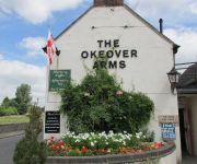
The Okeover Arms
The Izaak Walton Hotel
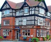
Station Hotel
The Dog and Partridge Country Inn
TRAVELODGE ASHBOURNE
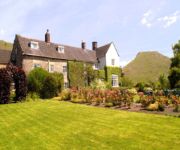
CALLOW HALL COUNTRY HOUSE HOTE
Videos from this area
These are videos related to the place based on their proximity to this place.
City of Exeter Pipes and Drums - Ashbourne 2014
The City of Exeter Pipes & Drums competing at the Ashbourne Highland Gathering in Grade 4.
Ashbourne video - Peak District Village series
Visit website: http://www.peakdistrict-nationalpark.com -New 2011 HD video of the elegant market town of Ashbourne in south Derbyshire on the edge of the Peak District - for more Peak District...
Cycling The Tissington Trail - Callow Top to Ashbourne Tunnel
An excellent cycle path. A quick journey from Callow Top Caravan Park to Ashbourne through the Ashbourne Tunnel, with the church bells ringing.
Royal Shrovetide Football 2015 (15/15)
The Royal Shrovetide Football 2015 from 'turn up' to sundown. Filmed on the first day of the match, Shrove Tuesday. PS: Please excuse this raw, unstabilised GoPro footage. A shorter, properly...
Ashbourne Shrovetide Football, Tues 4th Mar 2014. Pt 2 of 7
This absolutely mad game of football with hundreds of players and goals 3 miles apart took place today. Hope you like my video. This is one of many parts Feel free to embed or link to this...
Tissington Trail
Part of the National Cycle Route. 13 miles from Ashbourne to Parsley Hay across beautiful countryside. Just 20 minutes from The Laurels B&B.
Ashbourne Royal Shrovetide Football 2014 - Play crosses down onto Ashbourne's Sports Fields.
The regular Football (Soccer) & Rugby goal post pale into insignificance when Ashbourne's Shrovetide Football takes to the fields!!
Callow Top Camping
LOL I DUNNO © Rachel Prince - All Rights Reserved - No unauthorized use, copying, editing, distribution or sale of this video is permitted.
Ashbourne Shrovetide Football, Weds 5th Mar 2014. Pt 7 of 9
This absolutely mad game of football with hundreds of players and goals 3 miles apart took place today. Hope you like my video. This is one of many parts Feel free to embed or link to this...
Videos provided by Youtube are under the copyright of their owners.
Attractions and noteworthy things
Distances are based on the centre of the city/town and sightseeing location. This list contains brief abstracts about monuments, holiday activities, national parcs, museums, organisations and more from the area as well as interesting facts about the region itself. Where available, you'll find the corresponding homepage. Otherwise the related wikipedia article.
Ashbourne, Derbyshire
Ashbourne is one of the market towns in the Derbyshire Dales, England. It has a population of 7,302. It contains many historical buildings and many independent shops, and is famous for its historic annual Shrovetide football match. Due to its proximity to the southern edge of the Peak District and being the closest town to the popular area of Dovedale, the town is known as both 'The Gateway to Dovedale' and the 'Gateway to the Peak District'.
St Oswald's Church, Ashbourne
St Oswald's Church is a Church of England parish church located in Ashbourne, in the county of Derbyshire, England.
Okeover Hall
Okeover Hall is a privately owned Grade II* listed country house in Staffordshire. It is the family seat of the Okeover family, who have been in residence since the reign of William Rufus. The house lies at the border of Staffordshire and Derbyshire, which lies on the far side of the small River Dove. The Hall is not open to the public.
Ashbourne railway station
Ashbourne railway station formerly served the town of Ashbourne in Derbyshire The original station was opened in 1852 by the North Staffordshire Railway on its branch from Rocester on its Churnet Valley Line.
A515 road
The A515 is a primary route in England. It runs 48 miles (77 km) from Lichfield, Staffordshire to Buxton, Derbyshire.
Ashbourne Hall
Ashbourne Hall is a Manor house originally built by the Cockayne family in the 13th century in Ashbourne, Derbyshire. The present Hall is part of a largely demolished, Georgian styled Hall build during the 18th century.
Darley Moor Airfield
Darley Moor Airfield in Ashbourne, England, is operated by Airways Airsports providing training in almost every type of leisure flying. The World War II runway has also been transformed into Darley Moor Racetrack which is used for motorbike and cycle racing The airfield is in 'G' airspace. Proximity to East Midlands Airport places the ceiling at 4000 ft AMSL before restrictions apply.
Clifton, Derbyshire
Clifton is a village in the Derbyshire Dales district of Derbyshire, England. The village is situated about 1.2 miles (2 km) south west of Ashbourne, and is close to the border with Staffordshire.


