Safety Score: 3,0 of 5.0 based on data from 9 authorites. Meaning we advice caution when travelling to United Kingdom.
Travel warnings are updated daily. Source: Travel Warning United Kingdom. Last Update: 2024-04-27 08:23:39
Discover Smarden
Smarden in Kent (England) with it's 614 citizens is a town in United Kingdom about 43 mi (or 69 km) south-east of London, the country's capital city.
Current time in Smarden is now 05:34 AM (Sunday). The local timezone is named Europe / London with an UTC offset of one hour. We know of 12 airports near Smarden, of which 5 are larger airports. The closest airport in United Kingdom is Rochester Airport in a distance of 16 mi (or 26 km), North-West. Besides the airports, there are other travel options available (check left side).
There are several Unesco world heritage sites nearby. The closest heritage site in United Kingdom is Canterbury Cathedral, St Augustine's Abbey, and St Martin's Church in a distance of 19 mi (or 31 km), North-East. Also, if you like playing golf, there are a few options in driving distance. Looking for a place to stay? we compiled a list of available hotels close to the map centre further down the page.
When in this area, you might want to pay a visit to some of the following locations: Ashford, Maidstone, Boxley, Yalding and Rochester. To further explore this place, just scroll down and browse the available info.
Local weather forecast
Todays Local Weather Conditions & Forecast: 10°C / 49 °F
| Morning Temperature | 9°C / 48 °F |
| Evening Temperature | 6°C / 42 °F |
| Night Temperature | 4°C / 40 °F |
| Chance of rainfall | 1% |
| Air Humidity | 78% |
| Air Pressure | 1004 hPa |
| Wind Speed | Strong breeze with 20 km/h (12 mph) from North-East |
| Cloud Conditions | Broken clouds, covering 84% of sky |
| General Conditions | Light rain |
Monday, 29th of April 2024
12°C (53 °F)
7°C (44 °F)
Scattered clouds, moderate breeze.
Tuesday, 30th of April 2024
14°C (57 °F)
9°C (48 °F)
Light rain, moderate breeze, overcast clouds.
Wednesday, 1st of May 2024
17°C (63 °F)
11°C (52 °F)
Overcast clouds, gentle breeze.
Hotels and Places to Stay
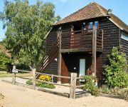
Elvey Farm
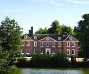
Chilston Park
Headcorn Lodge Weald of Kent Golf Course
Videos from this area
These are videos related to the place based on their proximity to this place.
Elvey Farm TV: Episode 5
The sun is out and the sounds of Jazz Sunday are heard across the Farm; another busy day for the staff!
Elvey Farm TV: Episode 3
Pluckley, Kent: the wedding season begins at Elvey Farm - but will the first ceremony begin on time?
SUPERCAR POKER NIGHT - www.poker-vision.co.uk
A Promotional Video made for the Supercar Poker Night, on behalf of Poker Vision and Design Hospitality. Poker Vision is a London based poker and fun casino events company that specialises...
racoon is mauled by alligator LOL :-)
my most random vid yet. Basically I only did it to test my digital camera's video. enjoy!
Trains at Pluckley 27/09/14 Including 34046 Braunton
A few trains seen at Pluckley station near Ashford in Kent on the afternoon of Saturday 27th September 2014. All trains seen are Southeastern Bombardier Class 375 Electrostar units with the...
Recurrency jump after 13 year layoff @ Skydive Headcorn
Good to get back in the air :-) Practice pulls and a couple of turns on this one....an awesome cloud jump!
Circuits - 01-03-2013 - G-BCXE Robin DR400-108 Headcorn
Circuits in a Robin DR400-108 (G-BCXE) at Headcorn. Shot using the NFlightcam +2 and edited using Dashware to include telemetry data.
Videos provided by Youtube are under the copyright of their owners.
Attractions and noteworthy things
Distances are based on the centre of the city/town and sightseeing location. This list contains brief abstracts about monuments, holiday activities, national parcs, museums, organisations and more from the area as well as interesting facts about the region itself. Where available, you'll find the corresponding homepage. Otherwise the related wikipedia article.
Kent
Kent /ˈkɛnt/ is a county in South East England, and one of the home counties. The ceremonial county boundaries of Kent include the shire county of Kent and the unitary borough of Medway. Kent has a nominal border with France halfway through the Channel Tunnel, as well as a defined boundary with Essex in the middle of the Thames Estuary. The county also borders Greater London to the North West near the towns of Swanley and Dartford, Surrey near Westerham and East Sussex near Tunbridge Wells.
RAF Headcorn
RAF Headcorn was a World War II airfield in Kent, England. The airfield was located approximately 2 miles east-northeast of Headcorn; about 38 miles southeast of London Opened in 1943, Headcorn was a prototype for the temporary Advanced Landing Ground airfields to be built in France after D-Day, when the need for advanced landing fields became urgent as the Allied forces moved east across France and Germany. It was used by the Royal Air Force and the United States Army Air Forces.
RAF High Halden
RAF High Halden is a former Royal Air Force Advanced Landing Ground in Kent, England. The airfield is located approximately 8 miles west-southwest of Ashford; about 50 miles southeast of London. Opened in 1944, Ashford was a prototype for the type of temporary Advanced Landing Ground type airfield which would be built in France after D-Day, when the need advanced landing fields would become urgent as the Allied forces moved east across France and Germany.
Biddenden railway station
Biddenden was a railway station on the Kent and East Sussex Railway which closed in 1954. As of 2012 some building remnants and parts of the platforms are still clearly visible about 50 metres to the west of the A274. Preceding station Disused railways Following station Frittenden Road British RailSouthern Region High Halden Road
Chart Hills Golf Club
Chart Hills Golf Club is a private golf club in Biddenden, Kent in England. It is owned by Leaderboard Golf along with 4 other golfing venues in the South East including The Oxfordshire Golf Club near Oxford, Sandford Springs Golf Club near Basingstoke and Newbury, Dale Hill Golf Club in Wadhurst East Sussex and The Leaderboard Golf Centre in Reading.


