Safety Score: 3,0 of 5.0 based on data from 9 authorites. Meaning we advice caution when travelling to United Kingdom.
Travel warnings are updated daily. Source: Travel Warning United Kingdom. Last Update: 2024-04-28 08:22:10
Discover Egerton
Egerton in Kent (England) is a place in United Kingdom about 43 mi (or 69 km) south-east of London, the country's capital city.
Current time in Egerton is now 12:15 PM (Sunday). The local timezone is named Europe / London with an UTC offset of one hour. We know of 11 airports near Egerton, of which 5 are larger airports. The closest airport in United Kingdom is Rochester Airport in a distance of 15 mi (or 24 km), North-West. Besides the airports, there are other travel options available (check left side).
There are several Unesco world heritage sites nearby. The closest heritage site in United Kingdom is Canterbury Cathedral, St Augustine's Abbey, and St Martin's Church in a distance of 16 mi (or 27 km), East. Also, if you like playing golf, there are a few options in driving distance. We encountered 1 points of interest in the vicinity of this place. If you need a hotel, we compiled a list of available hotels close to the map centre further down the page.
While being here, you might want to pay a visit to some of the following locations: Ashford, Boxley, Maidstone, Upper Stoke and Rochester. To further explore this place, just scroll down and browse the available info.
Local weather forecast
Todays Local Weather Conditions & Forecast: 10°C / 49 °F
| Morning Temperature | 9°C / 48 °F |
| Evening Temperature | 6°C / 42 °F |
| Night Temperature | 4°C / 40 °F |
| Chance of rainfall | 1% |
| Air Humidity | 78% |
| Air Pressure | 1004 hPa |
| Wind Speed | Strong breeze with 20 km/h (12 mph) from North-East |
| Cloud Conditions | Broken clouds, covering 84% of sky |
| General Conditions | Light rain |
Monday, 29th of April 2024
12°C (53 °F)
7°C (44 °F)
Scattered clouds, moderate breeze.
Tuesday, 30th of April 2024
14°C (57 °F)
9°C (48 °F)
Light rain, moderate breeze, overcast clouds.
Wednesday, 1st of May 2024
17°C (63 °F)
11°C (52 °F)
Overcast clouds, gentle breeze.
Hotels and Places to Stay
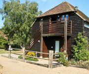
Elvey Farm
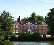
Chilston Park
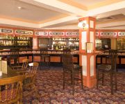
Mercure Maidstone Great Danes Hotel
Roebuck Inn Relaxinnz
Videos from this area
These are videos related to the place based on their proximity to this place.
Howling Basset - Kent Wedding Photography at Chilston Park Hotel
Eduina and Matthew held their wedding reception at the wonderful Chilston Park Hotel near Lenham in Kent. http://www.howlingbasset.com.
Seven Champions Molly Dancers - Birds-a-Building
The Seven Champions perform "Birds-a-Building" at The White Horse in Sandway, Kent on Boxing Day, 2010.
Seven Champions Moly Dancers - Inertia
The Seven Champions perform "Inertia" at The White Horse at Sandway near Lenham in Kent on Boxing Day 2010.
Seven Champions Molly Dancers - Russells
The Seven Champions perform "Russells" at The White Horse in Sandway, Kent on Boxing Day, 2010.
Seven Champions Molly Dancers - 3-4-5-6
The Seven Champions perform "3-4-5-6" at The White Horse in Sandway, Kent on Boxing Day, 2010.
60009 passes Lenham - 06/10/08
EWS 60009 passes Lenham working 6O57 Acton Yard-Hothfield loaded stone train on 06/10/08.
37612 and 37608 pass Lenham on 1Q14 - 22/08
37612 and 37608 pass Lenham working 1Q14 Selhurst - Dudding Hill Jn SERCO on 22/08/08.
Hever Castle - Kent, England, United Kingdom
http://tripwow.tripadvisor.com/tripwow/ta-00a0-7726-b243?ytv2=1 - Created at TripWow by TravelPod Attractions (a TripAdvisor™ company) Hever Castle Kent Read more at: http://www.travelpod.com...
Videos provided by Youtube are under the copyright of their owners.
Attractions and noteworthy things
Distances are based on the centre of the city/town and sightseeing location. This list contains brief abstracts about monuments, holiday activities, national parcs, museums, organisations and more from the area as well as interesting facts about the region itself. Where available, you'll find the corresponding homepage. Otherwise the related wikipedia article.
Kent
Kent /ˈkɛnt/ is a county in South East England, and one of the home counties. The ceremonial county boundaries of Kent include the shire county of Kent and the unitary borough of Medway. Kent has a nominal border with France halfway through the Channel Tunnel, as well as a defined boundary with Essex in the middle of the Thames Estuary. The county also borders Greater London to the North West near the towns of Swanley and Dartford, Surrey near Westerham and East Sussex near Tunbridge Wells.
Rivers of Kent
There are four rivers draining the county of Kent, England.
Pluckley railway station
Pluckley railway station serves Pluckley in Kent, and is located approximately 1.2 miles south of the village. The station, and all trains serving it, are operated by Southeastern. The ticket office is manned only during part of the day; at other times a PERTIS 'permit to travel' machine, located outside the station building on the 'down' side, suffices. The station opened with this section of the South Eastern Main Line on 1 December 1842.
Lenham railway station
Lenham railway station serves Lenham in Kent, England. The station, and all trains serving it, is operated by Southeastern. The ticket office is manned only during part of the day; at other times a PERTIS 'permit to travel' machine, located outside the station building on the 'down' side, suffices. A new footbridge replaced the life-expired concrete footbridge spanning the tracks here, completed in early 2010.
Lenham Heath
Lenham Heath is a hamlet in Kent situated on the southern edge of the North Downs, halfway between Maidstone and Ashford. grid reference TQ910500. The road through Lenham Heath runs parallel, and close to High Speed 1 and the M20 motorway. The Stour Valley Walk passes through the community.
RAF Headcorn
RAF Headcorn was a World War II airfield in Kent, England. The airfield was located approximately 2 miles east-northeast of Headcorn; about 38 miles southeast of London Opened in 1943, Headcorn was a prototype for the temporary Advanced Landing Ground airfields to be built in France after D-Day, when the need for advanced landing fields became urgent as the Allied forces moved east across France and Germany. It was used by the Royal Air Force and the United States Army Air Forces.
Stour watermills
Man has used the River Stour for centuries as a source of power. Many different processes were performed by the use of water power:- Corn milling, fulling, paper making and electricity generation. Many of the mills survive today as house conversions, with two of them still working commercially.
St Mary's Church, Lenham
St Mary's is a parish church in Lenham, Kent begun in the 12th century with additions in the next three centuries. It is a Grade I listed building.


