Safety Score: 3,0 of 5.0 based on data from 9 authorites. Meaning we advice caution when travelling to United Kingdom.
Travel warnings are updated daily. Source: Travel Warning United Kingdom. Last Update: 2024-04-26 08:02:42
Discover Little Chart
Little Chart in Kent (England) is a city in United Kingdom about 45 mi (or 73 km) south-east of London, the country's capital city.
Local time in Little Chart is now 01:06 PM (Friday). The local timezone is named Europe / London with an UTC offset of one hour. We know of 11 airports in the vicinity of Little Chart, of which 5 are larger airports. The closest airport in United Kingdom is Lydd Airport in a distance of 17 mi (or 27 km), South-East. Besides the airports, there are other travel options available (check left side).
There are several Unesco world heritage sites nearby. The closest heritage site in United Kingdom is Canterbury Cathedral, St Augustine's Abbey, and St Martin's Church in a distance of 15 mi (or 24 km), North-East. Also, if you like golfing, there are a few options in driving distance. Looking for a place to stay? we compiled a list of available hotels close to the map centre further down the page.
When in this area, you might want to pay a visit to some of the following locations: Ashford, Boxley, Maidstone, Upper Stoke and Rochester. To further explore this place, just scroll down and browse the available info.
Local weather forecast
Todays Local Weather Conditions & Forecast: 9°C / 48 °F
| Morning Temperature | 4°C / 40 °F |
| Evening Temperature | 9°C / 48 °F |
| Night Temperature | 6°C / 43 °F |
| Chance of rainfall | 0% |
| Air Humidity | 66% |
| Air Pressure | 1004 hPa |
| Wind Speed | Gentle Breeze with 7 km/h (4 mph) from West |
| Cloud Conditions | Overcast clouds, covering 95% of sky |
| General Conditions | Light rain |
Saturday, 27th of April 2024
12°C (53 °F)
10°C (49 °F)
Moderate rain, moderate breeze, overcast clouds.
Sunday, 28th of April 2024
11°C (51 °F)
9°C (48 °F)
Light rain, fresh breeze, overcast clouds.
Monday, 29th of April 2024
13°C (56 °F)
6°C (42 °F)
Light rain, gentle breeze, few clouds.
Hotels and Places to Stay
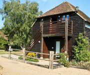
Elvey Farm
Chilston Park
ASHFORD INTERNATIONAL-QHOTELS
Holiday Inn ASHFORD - NORTH A20
Ashford North
Videos from this area
These are videos related to the place based on their proximity to this place.
Hever Castle - Kent, England, United Kingdom
http://tripwow.tripadvisor.com/tripwow/ta-00a0-7726-b243?ytv2=1 - Created at TripWow by TravelPod Attractions (a TripAdvisor™ company) Hever Castle Kent Read more at: http://www.travelpod.com...
Elvey Farm TV: Episode 5
The sun is out and the sounds of Jazz Sunday are heard across the Farm; another busy day for the staff!
Elvey Farm TV: Episode 3
Pluckley, Kent: the wedding season begins at Elvey Farm - but will the first ceremony begin on time?
Charing Circular, 21/8/13
Continuing with the 'Lost Landscapes Heritage Trails' on the North Downs Way area, this one combines two walks of 5.8 and 7.5 miles around Charing. This was one of the worst walks this walker...
Trains at Pluckley 27/09/14 Including 34046 Braunton
A few trains seen at Pluckley station near Ashford in Kent on the afternoon of Saturday 27th September 2014. All trains seen are Southeastern Bombardier Class 375 Electrostar units with the...
kmfm Frightday Night 2009 - The Screaming Woods in Pluckley
kmfm Frightday Night 2009 - The Screaming Woods in Pluckley, see what happened when we ventured into the screaming woods in Pluckley, Kent. Find out more at http://www.frightdaynight.co.uk.
kmfm Frightday Night 2009 - The Black Horse Inn kitchen in Pluckley, Kent
kmfm Frightday Night 2009 - The black horse Inn in Pluckley, see what happened when we ventured into the kitchen of the most haunted pub in the UK. Find out more at http://www.frightdaynight.co.uk.
Pluckley Screaming Woods, Kent real ghost voice EVP
Pluckley Screaming Woods, Kent. Real ghost voice EVP recorded during the ghost hunt on 28th July 2012. This is in response to a guests question.
Pluckley Screaming Woods real ghost voice
Pluckley Screaming Woods real ghost voice EVP. This was recorded during the ghost hunt on 6th October at Pluckley, Kent. You hear a guest ask their question and then the response.
Videos provided by Youtube are under the copyright of their owners.
Attractions and noteworthy things
Distances are based on the centre of the city/town and sightseeing location. This list contains brief abstracts about monuments, holiday activities, national parcs, museums, organisations and more from the area as well as interesting facts about the region itself. Where available, you'll find the corresponding homepage. Otherwise the related wikipedia article.
Pluckley railway station
Pluckley railway station serves Pluckley in Kent, and is located approximately 1.2 miles south of the village. The station, and all trains serving it, are operated by Southeastern. The ticket office is manned only during part of the day; at other times a PERTIS 'permit to travel' machine, located outside the station building on the 'down' side, suffices. The station opened with this section of the South Eastern Main Line on 1 December 1842.
Charing railway station
Charing railway station serves Charing in Kent, England. The station, and all trains serving it, is operated by Southeastern. The ticket office is manned only during part of the day; at other times a PERTIS 'permit to travel' machine, located outside the station building on the 'down' side, suffices. The next station eastwards (towards Ashford) used to be Hothfield, however it was closed in 1959, although it remained a 'request' stop for railway staff throughout the 1960s.
Archbishop's Palace, Charing
Archbishop's Palace, Charing an important heritage site first mentioned in the Domesday Book as land held by the Archbishop of Canterbury at 'Meddestane', was redeveloped as a palace in 1348. This was one of a string of medieval palaces at Charing, Otford and Croydon, serving the archbishops travelling between Canterbury and London. The Archbishops' registers indicate that a palace at Charing was in regular use from the time of Archbishop Peckham (1279–1292).
Charing Windmill
Charing Windmill is a Grade II listed house converted smock mill on Charing Hill in Kent in southeast England. It is sometimes known as Field Mill, but that name was also used by a watermill in Charing.
St Andrew's Church, Farnham
St Andrew's Church is an Anglican Parish church in the centre of Farnham, Surrey. It is a Grade II listed building and surviving parts of the structure date back to the Middle Ages. It in the archdeaconry of Surrey, in the Diocese of Guildford. The churchyard contains the grave of William Cobbett and there is a memorial to Augustus Toplady.


