Safety Score: 3,0 of 5.0 based on data from 9 authorites. Meaning we advice caution when travelling to United Kingdom.
Travel warnings are updated daily. Source: Travel Warning United Kingdom. Last Update: 2024-04-26 08:02:42
Delve into Low Street
Low Street in Borough of Thurrock (England) is located in United Kingdom about 23 mi (or 37 km) east of London, the country's capital town.
Current time in Low Street is now 04:26 AM (Saturday). The local timezone is named Europe / London with an UTC offset of one hour. We know of 8 airports close to Low Street, of which 5 are larger airports. The closest airport in United Kingdom is Rochester Airport in a distance of 9 mi (or 15 km), South-East. Besides the airports, there are other travel options available (check left side).
There are several Unesco world heritage sites nearby. The closest heritage site in United Kingdom is Royal Botanic Gardens, Kew in a distance of 5 mi (or 7 km), West. Also, if you like playing golf, there are some options within driving distance. We encountered 1 points of interest near this location. If you need a hotel, we compiled a list of available hotels close to the map centre further down the page.
While being here, you might want to pay a visit to some of the following locations: Grays, Cuxton, Cooling, Halling and Rochester. To further explore this place, just scroll down and browse the available info.
Local weather forecast
Todays Local Weather Conditions & Forecast: 8°C / 47 °F
| Morning Temperature | 6°C / 43 °F |
| Evening Temperature | 11°C / 52 °F |
| Night Temperature | 10°C / 49 °F |
| Chance of rainfall | 5% |
| Air Humidity | 94% |
| Air Pressure | 1003 hPa |
| Wind Speed | Gentle Breeze with 8 km/h (5 mph) from South-West |
| Cloud Conditions | Overcast clouds, covering 100% of sky |
| General Conditions | Moderate rain |
Sunday, 28th of April 2024
12°C (53 °F)
8°C (47 °F)
Light rain, moderate breeze, overcast clouds.
Monday, 29th of April 2024
14°C (58 °F)
8°C (47 °F)
Light rain, moderate breeze, broken clouds.
Tuesday, 30th of April 2024
17°C (63 °F)
11°C (52 °F)
Light rain, gentle breeze, overcast clouds.
Hotels and Places to Stay
Jessamine House
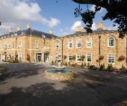
Orsett Hall
The Clarendon Royal Hotel
Best Western Manor
Inn on the Lake
Gravesend Central
Gravesend (A2/Singlewell)
Videos from this area
These are videos related to the place based on their proximity to this place.
Mr P's Classic Amusements 13-07-13
Day trip over to Mr P's in Gravesend, mecca to us classic Fruit / Slot machines fans http://www.mrpsclassicamusements.co.uk/
Tilbury Ferry.MOD
Long before the Dartford Tunnel was built, if you wanted to cross the river Thames to the east of London, you had to use the Tilbury Ferry. It was operated by British Railways from Tilbury,...
Tilbury Fort, Essex - Firing A BIG GUN Across The River Thames!
Tilbury Fort, Essex - firing a BIG GUN across the River Thames!
Down By The River Thames, Ferry Crossing, Between Tilbury ESSEX Gravesend KENT
Just another fantastic day out with Ivy, and we decided to goto South Weald Country park. What a wonderful place, full of good memories for me. Was nice to show Ivy some of my old areas I used...
Near Gravesend to Higham on 465007
The journey from just to the east of Gravesend to Higham aboard 465007 working 2L40, the 13:39 Southeastern service from London Charing Cross to Gillingham (Kent) on Wednesday 5th March 2014.
Saving Gravesend's Waterway Heritage - By Bernard Snell
Achievements by developers alongside restored canals in other parts of the country serve as examples of what might be accomplished in Gravesend on the Thames and Medway Canal. Video prduced.
Videos provided by Youtube are under the copyright of their owners.
Attractions and noteworthy things
Distances are based on the centre of the city/town and sightseeing location. This list contains brief abstracts about monuments, holiday activities, national parcs, museums, organisations and more from the area as well as interesting facts about the region itself. Where available, you'll find the corresponding homepage. Otherwise the related wikipedia article.
Thurrock
Thurrock is a unitary authority with borough status in the English ceremonial county of Essex. It is part of the London commuter belt and an area of regeneration within the Thames Gateway redevelopment zone. The local authority is Thurrock Council.
Tilbury Fort
Tilbury Fort is on the north, Essex, bank of the River Thames in England and was built to defend London from attack from the sea, particularly during the Spanish Armada and the Anglo-Dutch Wars. The site is now cared for by English Heritage and opened to the public.
East Tilbury railway station
East Tilbury railway station is a railway station located in the village of East Tilbury in the borough and unitary authority of Thurrock in the East of England. It was opened on 7 September 1936 as a halt on the London, Tilbury and Southend Railway. It was intended to serve workers at the Bata Shoe company and the company paid for the construction of the platforms. Initially, trains only stopped in the rush hour. The halt was given station status in January 1949.
Mucking
Mucking is a hamlet and former Church of England parish adjoining the Thames estuary in southern Essex, England. It is located approximately 2 miles south of the town of Stanford le Hope in what is now Thurrock unitary authority.
Low Street railway station
Low Street Station was a station on the London, Tilbury & Southend line. The station opened in 1861, at a level crossing. It served the small villages of West and East Tilbury. The station closed in 1967.
Denton Halt railway station
Denton Halt was a halt between Milton Road Halt and Milton Range Halt on the Hundred of Hoo Railway. It opened on July 1906 and closed on 4 December 1961. The halt was about 1¼ miles from Gravesend Central.
Bill Meroy Creek
Bill Meroy Creek is a small waterway flowing into the Thames to the east of Tilbury Fort in West Tilbury which from 1851 marked the eastern boundary of the area in which duty had to be paid on coal entering London.
Bata shoe factory (East Tilbury)
The Bata shoe factory in East Tilbury is what remains of an industrial estate in Essex which produced shoes for over 70 years. Founded in 1932 by Tomáš Baťa, the factory was "one of the most important planned landscapes in the East of England" in the 20th Century. The factory closed in 2005.


