Safety Score: 3,0 of 5.0 based on data from 9 authorites. Meaning we advice caution when travelling to United Kingdom.
Travel warnings are updated daily. Source: Travel Warning United Kingdom. Last Update: 2024-05-07 07:59:51
Delve into Luddesdown
Luddesdown in Kent (England) is located in United Kingdom about 24 mi (or 39 km) east of London, the country's capital town.
Current time in Luddesdown is now 04:46 AM (Wednesday). The local timezone is named Europe / London with an UTC offset of one hour. We know of 10 airports close to Luddesdown, of which 5 are larger airports. The closest airport in United Kingdom is Rochester Airport in a distance of 5 mi (or 8 km), East. Besides the airports, there are other travel options available (check left side).
There are several Unesco world heritage sites nearby. The closest heritage site in United Kingdom is Royal Botanic Gardens, Kew in a distance of 9 mi (or 14 km), North-West. Also, if you like playing golf, there are some options within driving distance. We encountered 1 points of interest near this location. If you need a hotel, we compiled a list of available hotels close to the map centre further down the page.
While being here, you might want to pay a visit to some of the following locations: Halling, Cuxton, Rochester, Grays and Yalding. To further explore this place, just scroll down and browse the available info.
Local weather forecast
Todays Local Weather Conditions & Forecast: 16°C / 60 °F
| Morning Temperature | 7°C / 45 °F |
| Evening Temperature | 17°C / 63 °F |
| Night Temperature | 10°C / 50 °F |
| Chance of rainfall | 0% |
| Air Humidity | 66% |
| Air Pressure | 1029 hPa |
| Wind Speed | Light breeze with 4 km/h (2 mph) from West |
| Cloud Conditions | Broken clouds, covering 72% of sky |
| General Conditions | Broken clouds |
Thursday, 9th of May 2024
18°C (65 °F)
12°C (54 °F)
Broken clouds, light breeze.
Friday, 10th of May 2024
18°C (64 °F)
12°C (54 °F)
Overcast clouds, light breeze.
Saturday, 11th of May 2024
19°C (67 °F)
12°C (53 °F)
Scattered clouds, gentle breeze.
Hotels and Places to Stay
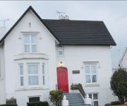
Jessamine House
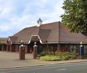
Best Western Manor
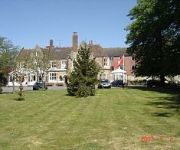
Inn on the Lake
The Clarendon Royal Hotel
Larkfield Priory
Holiday Inn MAIDSTONE - SEVENOAKS
Sevenoaks / Maidstone
Gravesend (A2/Singlewell)
Gravesend Central
Videos from this area
These are videos related to the place based on their proximity to this place.
The End of an Era - Rochester BlowDown
The demolition of the cement plant chimney Rochester Road, Halling on Sunday, September 19th. Filmed on behalf of Armoury Demolition and Watermark PR.
Alula flying at the Holly Hill slope Easter 2009
An Alula flying on the Holly Hill slope, near to Snodland in Kent. The video was shot on Good Friday 2009. As you can see from the video, it was an almost pe...
William Attenborough
Will transforms in to David Attenborough for a few seconds as he unleashes his dedly knowledge of everything plant like at the side of the motorway... plus a typically English speed limit sign...
Gravesend mmes open day 2012
A trip around a couple of laps of the Gravesend model and maring engineering society track at their 2012 open day. the trip is behind my 5 inch gauge Enterprise.
377213 & 377501 Pass Sole Street
After Working 1S03 16:22 Bedford - Gillingham 377213 & 377501 Pass Sole Street Working 5K94 18+34 Gillingham - Grosvenor Road Carriage Sidings Via London Victoria and Pass 377203 & 377206 ...
377203 & 377206 Pass Sole Street
50th Video--------------- 377203 & 377206 Pass Sole Street After Working 1S06 17:00 Bedford - Gillingham, Working 5K22 19+33 Gillingham - London Victoria 377206 Caused...
Stealth At Thorpe Park
Here is Me, Sarah, Emma and Kate messing around and testing the chairs on Stealth at Thorpe Park, UK Honors for this video #79 - Top Favourites (Today) - Travel & Events #46 - Top Rated...
DFDS Seaways- Onboard our ships
Enjoy the onboard experience when you cross the Channel to Dunkirk (France) with DFDS Seaways. Premium travel for less.
Reactions
On the 22nd October the street photographer Nick Turpin is going on an adventure around Europe. Each new step in his journey will be decided by the public clicking on his latest photograph,...
Videos provided by Youtube are under the copyright of their owners.
Attractions and noteworthy things
Distances are based on the centre of the city/town and sightseeing location. This list contains brief abstracts about monuments, holiday activities, national parcs, museums, organisations and more from the area as well as interesting facts about the region itself. Where available, you'll find the corresponding homepage. Otherwise the related wikipedia article.
Gravesham
Gravesham is a local government district and borough in North West Kent, England. It has borders with Thurrock across the River Thames to the north; the former city of Rochester and Medway to the east; the borough of Tonbridge and Malling (to the south); and the boroughs of Sevenoaks and Dartford to the west. Its council is based at the Civic Centre in Gravesend, and the borough shares similar borders with the Gravesham constituency.
Sole Street railway station
Sole Street railway station is on the Chatham Main Line, and serves the village of Sole Street in north Kent, England. Train services are provided by Southeastern. Sole Street station is 27 miles south east of London Victoria. The ticket office, on the 'up' side, is situated in the substantial station building.
Cobham Hall
Cobham Hall is an independent day and boarding school for girls in Cobham, Kent. The school is housed in a Tudor era manor, which is now Grade I listed. It is a Round Square school and a member of the Girls' Schools Association.
Upper Bush
Upper Bush is a hamlet in the parish of Cuxton,in the unitary authority of Medway, in Kent, England. The hamlet has only a few houses, including two Grade II listed buildings; Barrow Hill House and High Birch The North Downs Way long distance path leads through the village, between Cuxton and Upper Halling.
Cobham Park (cricket ground)
Cobham Park near Cobham, Kent and located within the grounds of the Cobham Park estate, was used as a cricket venue for a single first-class match between pre-county club Kent and pre-county club Hampshire. In use until at least 1879, the final recorded match on the ground saw Cobham played the Royal Engineers.
Meopham air disaster
The Meopham Air Disaster occurred on 21 July 1930 when a Junkers F.13ge from Le Touquet to Croydon with two crew and four passengers crashed near Meopham, Kent, with the loss of all on board. The report of the inquiry into the accident were made public, the first time in the United Kingdom that an accident report had been published.
Jeskyns
Jeskyns is near Cobham, in Kent, England. A former farm, now large open-space recreational area with areas being developed as new wildlife habitats. {{#invoke:Coordinates|coord}}{{#coordinates:51.4038|0.3872|region:GB|||||| |primary |name= }} Jeskyns is located in KentJeskyns Jeskyns shown within Kent
Camer Park Country Park
Camer Country Park is in Meopham, in Kent, England. A former estate landscape, with grassland and woodland. Camer Park Country Park Camer Park Country ParkCamer Park Country ParkCoordinates {{#invoke:Coordinates|coord}}{{#coordinates:51.3776|0.3689|region:GB|||||| |primary |name= }}Area 40 acresCreated 1971 (1971)Operated by Kent County Council,Open All Year, 7 days a week, dawn until duskWebsite {{#invoke:URL|url|1=http://www. kent. gov.


