Safety Score: 3,0 of 5.0 based on data from 9 authorites. Meaning we advice caution when travelling to Germany.
Travel warnings are updated daily. Source: Travel Warning Germany. Last Update: 2024-04-25 08:17:04
Explore Unterwürschnitz
Unterwürschnitz in Saxony is a city in Germany about 127 mi (or 204 km) south of Berlin, the country's capital.
Local time in Unterwürschnitz is now 06:15 AM (Friday). The local timezone is named Europe / Berlin with an UTC offset of 2 hours. We know of 9 airports in the vicinity of Unterwürschnitz, of which 5 are larger airports. The closest airport in Germany is Dresden Airport in a distance of 30 mi (or 48 km), North. Besides the airports, there are other travel options available (check left side).
There are several Unesco world heritage sites nearby. The closest heritage site in Germany is Dresden Elbe Valley in a distance of 24 mi (or 39 km), North. We found 2 points of interest in the vicinity of this place. If you need a place to sleep, we compiled a list of available hotels close to the map centre further down the page.
Depending on your travel schedule, you might want to pay a visit to some of the following locations: Schmiedeberg, Rechenberg-Bienenmuehle, Kreischa, Deutschneudorf and Dorfchemnitz. To further explore this place, just scroll down and browse the available info.
Local weather forecast
Todays Local Weather Conditions & Forecast: 11°C / 53 °F
| Morning Temperature | 1°C / 34 °F |
| Evening Temperature | 11°C / 52 °F |
| Night Temperature | 8°C / 46 °F |
| Chance of rainfall | 0% |
| Air Humidity | 53% |
| Air Pressure | 1008 hPa |
| Wind Speed | Gentle Breeze with 7 km/h (4 mph) from North-East |
| Cloud Conditions | Scattered clouds, covering 35% of sky |
| General Conditions | Scattered clouds |
Saturday, 27th of April 2024
15°C (59 °F)
8°C (47 °F)
Scattered clouds, gentle breeze.
Sunday, 28th of April 2024
17°C (63 °F)
11°C (52 °F)
Scattered clouds, gentle breeze.
Monday, 29th of April 2024
20°C (67 °F)
13°C (56 °F)
Scattered clouds, light breeze.
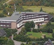
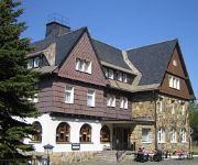
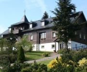
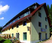
Hotels and Places to Stay
Lugsteinhof
Wettin Landhotel
Zum Silberstollen
Rothmanns Waldhotel am Aschergraben
AHORN Waldhotel Altenberg (ex. Stephanshöhe)
Landhotel Altes Zollhaus
Videos from this area
These are videos related to the place based on their proximity to this place.
Jezírka v Háji předělaný na golfák
Takhle to dopadá když zbohatlíkum nestačí malí golfoví hřiště nedaleko a zaberou nám jedinečný jezírko, celí ho překopou, vozej si tam prdele na kriplkárách a hrajou pojebanej...
Den s motorovými vozy řady M 152.0 na trati č. 135 Most - Moldava v Krušných horách
Dlouho jsem se chystal se podívat na trať číslo 135 Most - Moldava v Krušných horách. Jezdí zde moje oblíbená řada motorových vozů.Videa jsou natočena v úseku Hrob - Dubí -...
Velikonoční zábava 7.4.2012.wmv
video z tradiční velikonoční zábavy, kterou pořádal Sbor dobrovolných hasičů v Košťanech.
Videos provided by Youtube are under the copyright of their owners.
Attractions and noteworthy things
Distances are based on the centre of the city/town and sightseeing location. This list contains brief abstracts about monuments, holiday activities, national parcs, museums, organisations and more from the area as well as interesting facts about the region itself. Where available, you'll find the corresponding homepage. Otherwise the related wikipedia article.
Georgenfelder Hochmoor
The Georgenfelder Hochmoor is a raised bog (Hochmoor) in the German Ore Mountains of central Europe, not far from Zinnwald-Georgenfeld. It is part of a larger bog or moor complex, that lies to the south, mainly on the far side of the Germany's national border in Czechia and which, since time immemorial, has been known simply as "The Lake" (Die See). The Georgenfelder Hochmoor is one of the oldest nature reserves in Saxony.


