Safety Score: 3,0 of 5.0 based on data from 9 authorites. Meaning we advice caution when travelling to United Kingdom.
Travel warnings are updated daily. Source: Travel Warning United Kingdom. Last Update: 2024-04-25 08:17:04
Discover Dunvant
Dunvant in City and County of Swansea (Wales) is a city in United Kingdom about 168 mi (or 270 km) west of London, the country's capital city.
Local time in Dunvant is now 07:25 AM (Friday). The local timezone is named Europe / London with an UTC offset of one hour. We know of 10 airports in the vicinity of Dunvant, of which 5 are larger airports. The closest airport in United Kingdom is Swansea Airport in a distance of 2 mi (or 3 km), South-West. Besides the airports, there are other travel options available (check left side).
There are several Unesco world heritage sites nearby. The closest heritage site in United Kingdom is Blaenavon Industrial Landscape in a distance of 49 mi (or 79 km), East. Also, if you like golfing, there are a few options in driving distance. Looking for a place to stay? we compiled a list of available hotels close to the map centre further down the page.
When in this area, you might want to pay a visit to some of the following locations: Bishopston, Pennard, Swansea, Landore and Morriston. To further explore this place, just scroll down and browse the available info.
Local weather forecast
Todays Local Weather Conditions & Forecast: 9°C / 49 °F
| Morning Temperature | 6°C / 42 °F |
| Evening Temperature | 9°C / 49 °F |
| Night Temperature | 7°C / 45 °F |
| Chance of rainfall | 0% |
| Air Humidity | 63% |
| Air Pressure | 1003 hPa |
| Wind Speed | Gentle Breeze with 7 km/h (5 mph) from West |
| Cloud Conditions | Overcast clouds, covering 100% of sky |
| General Conditions | Overcast clouds |
Saturday, 27th of April 2024
5°C (42 °F)
4°C (40 °F)
Light rain, moderate breeze, overcast clouds.
Sunday, 28th of April 2024
12°C (53 °F)
7°C (44 °F)
Light rain, moderate breeze, broken clouds.
Monday, 29th of April 2024
12°C (54 °F)
9°C (49 °F)
Light rain, moderate breeze, broken clouds.
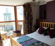
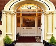
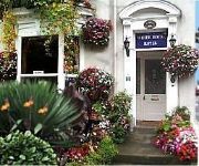
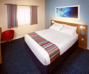
Hotels and Places to Stay
Cafe Valance Bar & Rooms
The Gower Hotel
Alexander Hotel
White House Hotel
Llwyn Hall Country House
TRAVELODGE SWANSEA M4
Videos from this area
These are videos related to the place based on their proximity to this place.
Rugby Report
Regional rugby side the Ospreys visited Bishopston Comprehensive School, and we caught up with some of their stars for BBC School Report. We had the chance to watch their open training session...
Swansea Skies - Timelapse
Gower 11/04/2014 All footage Copyright Air Marshall. No reproduction in whole or part without permission.
Activity centres in Gower
There are three activity centres in Gower, close to beautiful beaches and fantastic as a base for groups wishing to do outdoor activities.
easyfundraising Case Study: Swansea City Supporters Trust
We provide a FREE fundraising service where you can raise funds for any charity, trust, school, club, good cause or community group you support simply by going shopping. Choose from over 1500...
Cardiff & Swansea Wedding Photographer
http://www.chrisbarroccu.co.uk. 51, Pleasent Street, Morriston Swansea SA6 6HH Christopher Barroccu is a professional wedding photographer based in Swansea, ...
Clyne At Night
New to GoPro videos, I've only managed to ride out twice with the camera, once in the wet and once in the dark. The wet ride was a blurry dull XC ride so the the Night ride trumped it despite...
Videos provided by Youtube are under the copyright of their owners.
Attractions and noteworthy things
Distances are based on the centre of the city/town and sightseeing location. This list contains brief abstracts about monuments, holiday activities, national parcs, museums, organisations and more from the area as well as interesting facts about the region itself. Where available, you'll find the corresponding homepage. Otherwise the related wikipedia article.
Dunvant
Dunvant is a suburban district in the City and County of Swansea, Wales, and falls within the Dunvant ward. It is situated in a valley some 4.5 miles west of Swansea city centre.
Killay, Swansea
Killay is the name of a suburb and local government community in Swansea, Wales. Killay has its own community council. The village is set high above sea level, about 3.5 miles west of Swansea city centre. The north of the area is mainly residential and is deemed a relatively affluent area of Swansea. The south of the area consists of an unpopulated common, which is used for grazing and forms part of Gower Area of Outstanding Natural Beauty.
Killay South
Killay South (Welsh: Cilâ - De) is an electoral ward in the City and County of Swansea, Wales. The ward is mainly rural and consists of some or all of the following areas: Dunvant, Ilston, Killay, Sketty and Upper Killay in the parliamentary constituency of Swansea West. It is bounded by the wards of Dunvant and Killay North to the north; Sketty to the east; Mayals to the south; and Fairwood to the west. For the 2012 local council elections, the turnout for Killay south was 43.73%.
Killay North
Killay North (Welsh: Cilâ - Gogledd) is an electoral ward in the City and County of Swansea, Wales which consists of some or all of the following areas: Killay, Olchfa and Waunarlwydd, in the parliamentary constituency of Swansea West. The village of Killay is located mainly in this ward, set high above sea level, about 3.5 miles west of Swansea city centre. Killay North is bounded by Gowerton and Cockett to the north; Sketty to the east; Killay South to the south and Dunvant to the west.
Gowerton railway station
Gowerton railway station (originally Gower Road and later Gowerton North) serves the village of Gowerton, Wales. It is located at street level at the end of Station Road in Gowerton. Since it is unmanned, tickets need to be bought in advance or on the train. Gowerton is served approximately every two hours by Arriva Trains Wales services heading westbound towards Llanelli, (where they continue to either West Wales or to Shrewsbury via the Heart of Wales Line; and eastbound towards Swansea.
Ysgol Gyfun Gŵyr
Ysgol Gyfun Gŵyr is a Welsh language medium secondary school in Gowerton, Swansea, Wales, with approximately 800 pupils as of 2006. However, GCSE Science lessons are also held in English. It was established in 1984.
Gowerton (electoral ward)
Gowerton is the name of an electoral ward, a community in the county of Swansea, Wales, UK. It is named after Gowerton village which falls within the ward. The electoral ward consists of some or all of the following areas: Gowerton, Penclawdd, Waunarlwydd, in the parliamentary constituency of Gower.
Dunvant (electoral ward)
Dunvant is an electoral ward coterminous with a community of the same name in the City and County of Swansea, Wales, UK. The community does not have a community council. It is named after the village of Dunvant which lies within the ward. The electoral ward consists of some or all of the following areas, Derlwyn, Dunvant, Killay, in the parliamentary constituency of Swansea West.


