Safety Score: 3,0 of 5.0 based on data from 9 authorites. Meaning we advice caution when travelling to United Kingdom.
Travel warnings are updated daily. Source: Travel Warning United Kingdom. Last Update: 2024-04-23 08:18:23
Delve into Pen-clawdd
Pen-clawdd in City and County of Swansea (Wales) with it's 1,935 habitants is located in United Kingdom about 171 mi (or 275 km) west of London, the country's capital town.
Current time in Pen-clawdd is now 04:00 PM (Tuesday). The local timezone is named Europe / London with an UTC offset of one hour. We know of 10 airports close to Pen-clawdd, of which 5 are larger airports. The closest airport in United Kingdom is Swansea Airport in a distance of 3 mi (or 4 km), South-East. Besides the airports, there are other travel options available (check left side).
There are several Unesco world heritage sites nearby. The closest heritage site in United Kingdom is Blaenavon Industrial Landscape in a distance of 52 mi (or 83 km), East. Also, if you like playing golf, there are some options within driving distance. If you need a hotel, we compiled a list of available hotels close to the map centre further down the page.
While being here, you might want to pay a visit to some of the following locations: Pennard, Bishopston, Swansea, Landore and Morriston. To further explore this place, just scroll down and browse the available info.
Local weather forecast
Todays Local Weather Conditions & Forecast: 9°C / 48 °F
| Morning Temperature | 8°C / 47 °F |
| Evening Temperature | 10°C / 49 °F |
| Night Temperature | 6°C / 43 °F |
| Chance of rainfall | 0% |
| Air Humidity | 85% |
| Air Pressure | 1025 hPa |
| Wind Speed | Gentle Breeze with 6 km/h (4 mph) from South-East |
| Cloud Conditions | Overcast clouds, covering 91% of sky |
| General Conditions | Light rain |
Wednesday, 24th of April 2024
11°C (52 °F)
6°C (42 °F)
Broken clouds, gentle breeze.
Thursday, 25th of April 2024
11°C (52 °F)
7°C (45 °F)
Light rain, gentle breeze, overcast clouds.
Friday, 26th of April 2024
10°C (50 °F)
9°C (48 °F)
Light rain, moderate breeze, overcast clouds.
Hotels and Places to Stay
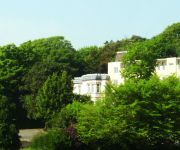
Stradey Park
Llwyn Hall Country House
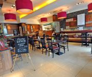
The Gower Hotel
Vista Hotel
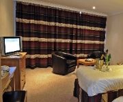
Best Western Diplomat Hotel & Spa
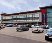
TRAVELODGE LLANELLI CENTRAL
Llanelli Central East
Llanelli Central West
Videos from this area
These are videos related to the place based on their proximity to this place.
Swansea Skies - Timelapse
Gower 11/04/2014 All footage Copyright Air Marshall. No reproduction in whole or part without permission.
Start of Llanelli Waterside Half Marathon 2013
Start of Llanelli Waterside Half Marathon 2013! 9am 03.03.2013.
2 year old Welsh kid Gangnam style brilliant
Levi Williams 2 year old from llanelli on holiday going for it big gangnam style ***** 5 Stars.
Festival of the tides 2010 - Raft race part 1/3
The annual Festival of the Tides held in Penclawdd, Gower. This video is part 1/3 of the annual raft race held at the festival.
Videos provided by Youtube are under the copyright of their owners.
Attractions and noteworthy things
Distances are based on the centre of the city/town and sightseeing location. This list contains brief abstracts about monuments, holiday activities, national parcs, museums, organisations and more from the area as well as interesting facts about the region itself. Where available, you'll find the corresponding homepage. Otherwise the related wikipedia article.
Lower Loughor
Lower Loughor is an electoral ward in the City and County of Swansea, Wales. The ward covers the western part of the town of Loughor in the parliamentary constituency of Gower. It is bounded by the wards of Gowerton to the west; the Loughor estuary to the north and Upper Loughor to the east. Lower Loughour consists of an area of salt marsh south of the A484 road and a suburban settlement north of the A484.
Bynea railway station
Bynea railway station serves the village of Bynea near Llanelli, West Wales. Bynea station is situated close to the Millennium Coastal Park and is a convenient stop for cyclists and hikers to the coastal area. All trains serving the station are operated by Arriva Trains Wales.
River Loughor
The River Loughor in Carmarthenshire, Wales has its source at an underground lake at the Black Mountain and emerges at the surface from Llygad Llwchwr which translates from the Welsh as "eye of the Loughor". It flows past settlements like Ammanford and Hendy in Carmarthenshire and Pontarddulais in Swansea. The river divides Carmarthenshire from Swansea for much of its course and it separates Hendy from Pontarddulais at the point where the river becomes tidal.
Loughor railway viaduct
The Loughor railway viaduct is a railway viaduct carrying the West Wales Line across the River Loughor. The structure sits adjacent to the Loughor road bridge. It is a Grade II listed structure.
Loughor bridge
The Loughor bridge is a road bridge crossing over the River Loughor, providing a convenient link between much of western Swansea and Llanelli, west Wales. The bridge is part of the A484 road. The road bridge is adjacent to the Loughor railway viaduct. A permanent bridge linking Loughor and Llanelli was first constructed in 1923.
Leucarum
Leucarum was a coastal auxiliary fort in the Roman province of Britannia. Its remains are located beneath the town of Loughor in the Welsh city of Swansea. The Romans built a rectangular or trapezoidal fort at the mouth of the River Loughor in the late 1st century to house a regiment of Roman auxiliary troops. Stone defences were added to the earthen ditch and rampart by 110 and the fort was occupied until the middle or end of that century.
Penclawdd (electoral ward)
Penclawdd is the name of an electoral ward in the City and County of Swansea, Wales, UK. It is named after the village of Penclawdd, which falls within the ward. The electoral ward consists of some or all of the following areas: Blue Anchor, Penclawdd, Llanmorlais, Crofty and Wernffrwd in the parliamentary constituency of Gower. The ward is mainly rural and is fairly sparsely populated.
Bynea
Bynea is a village close to the River Loughor in Carmarthenshire, Wales. This was an agricultural area until the turn of the twentieth century, when it became heavily industralised with coal mines and steelworks. Bynea runs into the village of Llwynhendy, and between the two there are four places of worship, and a number of pubs. Terry Davies, the rugby union player, is from this area.


