Safety Score: 3,0 of 5.0 based on data from 9 authorites. Meaning we advice caution when travelling to United Kingdom.
Travel warnings are updated daily. Source: Travel Warning United Kingdom. Last Update: 2024-04-28 08:22:10
Delve into Wolvey
Wolvey in Warwickshire (England) with it's 845 habitants is located in United Kingdom about 86 mi (or 138 km) north-west of London, the country's capital town.
Current time in Wolvey is now 01:30 AM (Monday). The local timezone is named Europe / London with an UTC offset of one hour. We know of 10 airports close to Wolvey, of which 5 are larger airports. The closest airport in United Kingdom is Coventry Airport in a distance of 9 mi (or 15 km), South-West. Besides the airports, there are other travel options available (check left side).
There are several Unesco world heritage sites nearby. The closest heritage site in United Kingdom is Derwent Valley Mills in a distance of 52 mi (or 83 km), North-East. Also, if you like playing golf, there are some options within driving distance. If you need a hotel, we compiled a list of available hotels close to the map centre further down the page.
While being here, you might want to pay a visit to some of the following locations: Coventry, Keresley, Glenfield, Meriden and Leicester. To further explore this place, just scroll down and browse the available info.
Local weather forecast
Todays Local Weather Conditions & Forecast: 12°C / 54 °F
| Morning Temperature | 4°C / 39 °F |
| Evening Temperature | 11°C / 51 °F |
| Night Temperature | 9°C / 48 °F |
| Chance of rainfall | 1% |
| Air Humidity | 73% |
| Air Pressure | 1013 hPa |
| Wind Speed | Fresh Breeze with 15 km/h (10 mph) from North |
| Cloud Conditions | Broken clouds, covering 82% of sky |
| General Conditions | Light rain |
Tuesday, 30th of April 2024
15°C (59 °F)
8°C (47 °F)
Light rain, fresh breeze, broken clouds.
Wednesday, 1st of May 2024
16°C (60 °F)
11°C (51 °F)
Light rain, gentle breeze, overcast clouds.
Thursday, 2nd of May 2024
11°C (51 °F)
9°C (49 °F)
Heavy intensity rain, gentle breeze, overcast clouds.
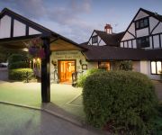
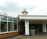
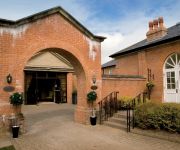
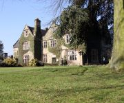
Hotels and Places to Stay
Sketchley Grange Hotel and Spa
Jurys Inn Hickley Island
Macdonald Ansty Hall
Coombe Abbey
DoubleTree by Hilton Coventry
JCT.2 Holiday Inn COVENTRY M6
Best Western Weston Hall
TRAVELODGE NUNEATON
TRAVELODGE COVENTRY BINLEY
Hinckley
Videos from this area
These are videos related to the place based on their proximity to this place.
Hail Storm from beginning to end ( Burbage Hinckley / Leicester, UK - June 2012)
This is a video of the hail storm we experienced in Burbage, Hinckley. I captured the full storm as I began recording just before the storm began. My grey Nissan 350z sustained £5500 worth...
Hail Storm In Burbage, Hinckley
Sudden hailstorm in Burbage, Hinckley, Leicestershire caused damage to cars, roof's sheds and gardens this afternoon. Both cars dented on most panels and one car had windscreen cracked in...
Hail Storm In Burbage, Hinckley
Sudden hailstorm in Burbage, Hinckley, Leicestershire caused damage to cars, roof's sheds and gardens this afternoon. Both cars dented on most panels and one car had windscreen cracked in...
Driving through heavy snow southbound on the M69
I was driving southbound on the M69 from Leicester back to Coventry when suddenly there was a stretch of heavy snowfall.
Pro-Vue Interactive Projector - PVI2600
The new Pro-Vue Interactive provides a whole new dimension to interactive teaching and presentation; all the benefits of an interactive whiteboard... without the whiteboard! The Pro-Vue...
Cadeby 'Final Fling' Light Railway
A tribute to a Light Railway in the Leicestershire village of Cadeby. Built by the late Rev Teddy Boston.
Bramcote - Open and PC Horse Trials on 5/6 May 2012
BRAMCOTE-HORSE TRIALS - MAY BANK HOLIDAY -2 DAYS-- RUN BY ATHERSTONE HUNT BRANCH of the PONY CLUB---WITH "OPEN" "ALL COMERS" SECTIONS AT LEVELS 2 TO 5. Links to ...
How to protect your car seat from dirt and damp
Protect your car seat with this dirt-proof, waterproof car seat cover from MicksGarage. The Dirty Harry Slip-on Single Seat Protector is a seat protector suitable for all vehicles. It's...
Videos provided by Youtube are under the copyright of their owners.
Attractions and noteworthy things
Distances are based on the centre of the city/town and sightseeing location. This list contains brief abstracts about monuments, holiday activities, national parcs, museums, organisations and more from the area as well as interesting facts about the region itself. Where available, you'll find the corresponding homepage. Otherwise the related wikipedia article.
M69 motorway
The M69 is a 15.7-mile dual three lane dual carriageway motorway in Leicestershire and Warwickshire, England. It runs between junction 21 of the M1 near Leicester and junction 2 of the M6 near Coventry. It opened in 1977.
Stretton Baskerville
Stretton Baskerville is a deserted medieval village and civil parish in the English county of Warwickshire. It shares a parish council with the nearby parish of Burton Hastings. Stretton means "settlement on a Roman Road" (from the Old English stræt and tun). In this case the road is Watling Street.
Burton Hastings
Burton Hastings and Stretton Baskerville is a village in Warwickshire. It lies about four miles south-east of Nuneaton and is named after the Hastings family who held the manor until 1529. Burton Hastings is often used by commuters who work in nearby towns. The Church of St Botolph lies at the centre of the village. The current population of the village is around 250. There are 92 houses in the village, on five streets all of which branch off from Hinckley Road.
List of United Kingdom locations: Bur-Bz
RAF Bramcote
RAF Bramcote is a Royal Air Force station located 4 miles south-east of Nuneaton, Warwickshire, England during the Second World War. It later became HMS Gamecock and then Gamecock Barracks.
Britannia Fields
The Britannia Fields are a public open space at grid reference SP440919 in Britannia Road, Burbage, Leicestershire. The Fields land was once part of the ancient three field system which operated in Burbage during Medieval times. The hedge row at the western hedge of the field represented one boundary and is one of the oldest hedges in Burbage at least 600 years. By 1838 on the tithe map of the village, number 651, the land was owned by Joseph Freeman, who gave his name to Freeman’s lane.
Ansty Hall
Ansty Hall is a 17th century country house, situated at Ansty, near Rugby, Warwickshire, which is occupied as an hotel operated by Macdonald Hotels Ltd. It is a Grade II* listed building. The Manor of Ansty was owned by the Stanhope family from 1406. It was sold in 1506 to the Earl of Shrewsbury who donated it to the Dean of St George's, Windsor and was let out on lease until 1659 when it was purchased by Richard Tayler.
Shilton railway station
Shilton railway station was a railway station serving Shilton in the English county of Warwickshire. on the Trent Valley Line of the LNWR. It was situated where Church Road crosses the line. The booking office was built on the bridge, with steps down to the two island platforms. Initially there were two running lines when the station opened in 1847. A third up line was added between Bulkington and Rugby in 1871, for which an extra arch was built for the bridge.


