Safety Score: 3,0 of 5.0 based on data from 9 authorites. Meaning we advice caution when travelling to United Kingdom.
Travel warnings are updated daily. Source: Travel Warning United Kingdom. Last Update: 2024-05-10 08:04:54
Explore Bedworth
Bedworth in Warwickshire (England) with it's 29,981 inhabitants is a city in United Kingdom about 88 mi (or 142 km) north-west of London, the country's capital.
Local time in Bedworth is now 04:20 AM (Saturday). The local timezone is named Europe / London with an UTC offset of one hour. We know of 9 airports in the vicinity of Bedworth, of which 5 are larger airports. The closest airport in United Kingdom is Coventry Airport in a distance of 8 mi (or 12 km), South. Besides the airports, there are other travel options available (check left side).
There are several Unesco world heritage sites nearby. The closest heritage site in United Kingdom is Derwent Valley Mills in a distance of 55 mi (or 89 km), North-East. Also, if you like golfing, there are multiple options in driving distance. If you need a place to sleep, we compiled a list of available hotels close to the map centre further down the page.
Depending on your travel schedule, you might want to pay a visit to some of the following locations: Keresley, Coventry, Meriden, Berkswell and Warwick. To further explore this place, just scroll down and browse the available info.
Local weather forecast
Todays Local Weather Conditions & Forecast: 19°C / 66 °F
| Morning Temperature | 11°C / 52 °F |
| Evening Temperature | 17°C / 63 °F |
| Night Temperature | 12°C / 54 °F |
| Chance of rainfall | 0% |
| Air Humidity | 71% |
| Air Pressure | 1021 hPa |
| Wind Speed | Gentle Breeze with 7 km/h (4 mph) from North-West |
| Cloud Conditions | Overcast clouds, covering 96% of sky |
| General Conditions | Light rain |
Sunday, 12th of May 2024
20°C (68 °F)
14°C (58 °F)
Moderate rain, gentle breeze, broken clouds.
Monday, 13th of May 2024
16°C (61 °F)
11°C (52 °F)
Light rain, moderate breeze, broken clouds.
Tuesday, 14th of May 2024
13°C (55 °F)
10°C (50 °F)
Light rain, fresh breeze, overcast clouds.
Hotels and Places to Stay
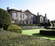
Coombe Abbey
DoubleTree by Hilton at the Ricoh Arena - Coventry
DoubleTree by Hilton Coventry
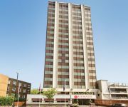
Ramada Hotel and Suites Coventry The Butts Earlsdon
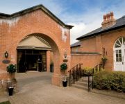
Macdonald Ansty Hall
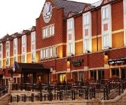
VILLAGE COVENTRY
Novotel Coventry M6/J3
JCT.2 Holiday Inn COVENTRY M6
DAYS HOTEL COVENTRY
The Beechwood
Videos from this area
These are videos related to the place based on their proximity to this place.
Wilson's Lane to Ricoh Arena Journey - Original Footage (Low Quality)
The footage I caputred for my 212MC module coursework at Coventry University. Showing the journey I take on matchdays from the car park on Wilson's Lane to t...
M6 Island from A444 Nuneaton to Coventry - Evolve Driving Lesson
http://www.evolvedriving.co.uk How to drive around the M6 Island when travelling from on the A444 from Nuneaton and exiting to Coventry City Centre - Evolve Driving Lesson. For Driving Lessons...
Snow angel?
After a larger than normal fall of snow in Warwickshire, Amanda Amaral demonstrates a technique for creating a "snow angel".
Bedworth, Warwickshire
A short tourism video about Bedworth in Warwickshire. Bedworth sits to the north of Coventry and was once a busy mining town. The town centre has undergone much regeneration over the...
Bedworth United 5-3 Slough Town
Bedworth United all but ended Slough's faint title hopes as they ran out winners in an eight goal thriller at the Oval. Bedworth took a two goal lead through Piggon and Bates but were pegged...
Videos provided by Youtube are under the copyright of their owners.
Attractions and noteworthy things
Distances are based on the centre of the city/town and sightseeing location. This list contains brief abstracts about monuments, holiday activities, national parcs, museums, organisations and more from the area as well as interesting facts about the region itself. Where available, you'll find the corresponding homepage. Otherwise the related wikipedia article.
Oxford Canal
The Oxford Canal is a 78-mile-long narrow canal in central England linking Oxford with Coventry via Banbury and Rugby. It connects with the River Thames at Oxford, to the Grand Union Canal at the villages of Braunston and Napton-on-the-Hill, and to the Coventry Canal at Hawkesbury Junction in Bedworth just north of Coventry.
Nuneaton (UK Parliament constituency)
Nuneaton is a constituency represented in the House of Commons of the UK Parliament since 2010 by Marcus Jones, a Conservative.
Bedworth railway station
Bedworth railway station serves the town of Bedworth in Warwickshire, England. It is on the Coventry to Nuneaton Line 6.25 miles north of Coventry railway station. It is the only intermediate station on the line. The station, and all trains serving it, are operated by London Midland.
Bermuda, Warwickshire
Bermuda is a suburb of Nuneaton in the English county of Warwickshire. Bermuda was originally a small pit village built in 1893 to house workers for the Griff Colliery Company's new mine, "Griff Clara". The village initially consisted of ninety miners' houses, a working men's club, and a mission hall. The new construction replaced the former workers' housing, known as "the Old Row". Bermuda was named for local landowner Edward Newdegate, a former Governor of Bermuda.
Longford, Coventry
Longford is a ward in the north of Coventry, West Midlands, England. It is covered by the Coventry North East constituency and bounded by the wards of Holbrooks, Henley, Upper Stoke and Foleshill.
Griff, Warwickshire
Griff is a hamlet in the English county of Warwickshire. Griff is located on the A444 road between the towns of Nuneaton and Bedworth and is administered as part of Nuneaton and Bedworth district. Formerly a coal mining area there is evidence that coal was obtained from Griff from as early as the twelfth century. Nowadays Griff Quarry is a major enterprise producing around 260,000 tonnes of material annually. Mary Ann Evans was brought up at Griff House, now a hotel.
Hawkesbury Junction
Hawkesbury Junction or Sutton Stop is a canal junction at the northern limit of the Oxford Canal where it meets the Coventry Canal, near Hawkesbury Village, Warwickshire, on the West Midlands county border, England. The alternative name, Sutton Stop, arises from the name of a family which provided several lock keepers there in the nineteenth century.
Bermuda Park railway station
Bermuda railway station is a proposed railway station in Nuneaton, Warwickshire, England. The station would serve the Bermuda Park Industrial Estate, on the Coventry to Nuneaton Line between the existing stations at Nuneaton and Bedworth. Funding for the new station was approved in December 2011. A planning application for the station was submitted to Warwickshire County Council in June 2012.


