Safety Score: 3,0 of 5.0 based on data from 9 authorites. Meaning we advice caution when travelling to United Kingdom.
Travel warnings are updated daily. Source: Travel Warning United Kingdom. Last Update: 2024-04-28 08:22:10
Delve into Sambourne
Sambourne in Warwickshire (England) is located in United Kingdom about 92 mi (or 148 km) north-west of London, the country's capital town.
Current time in Sambourne is now 11:10 PM (Sunday). The local timezone is named Europe / London with an UTC offset of one hour. We know of 9 airports close to Sambourne, of which 5 are larger airports. The closest airport in United Kingdom is Birmingham International Airport in a distance of 15 mi (or 25 km), North-East. Besides the airports, there are other travel options available (check left side).
There are several Unesco world heritage sites nearby. The closest heritage site in United Kingdom is Blaenavon Industrial Landscape in a distance of 54 mi (or 87 km), South-West. Also, if you like playing golf, there are some options within driving distance. We encountered 1 points of interest near this location. If you need a hotel, we compiled a list of available hotels close to the map centre further down the page.
While being here, you might want to pay a visit to some of the following locations: Tidbury Green, Dickens Heath, Cheswick Green, Solihull and Birmingham. To further explore this place, just scroll down and browse the available info.
Local weather forecast
Todays Local Weather Conditions & Forecast: 10°C / 51 °F
| Morning Temperature | 4°C / 39 °F |
| Evening Temperature | 10°C / 49 °F |
| Night Temperature | 3°C / 38 °F |
| Chance of rainfall | 20% |
| Air Humidity | 68% |
| Air Pressure | 1005 hPa |
| Wind Speed | Moderate breeze with 10 km/h (6 mph) from South-East |
| Cloud Conditions | Overcast clouds, covering 100% of sky |
| General Conditions | Moderate rain |
Monday, 29th of April 2024
12°C (54 °F)
10°C (50 °F)
Light rain, fresh breeze, overcast clouds.
Tuesday, 30th of April 2024
15°C (59 °F)
9°C (48 °F)
Light rain, fresh breeze, clear sky.
Wednesday, 1st of May 2024
14°C (58 °F)
9°C (48 °F)
Light rain, gentle breeze, overcast clouds.
Hotels and Places to Stay
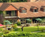
Golf and Country Club Abbey Hotel
Kings Court Hotel
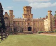
Studley Castle
Redditch West (A448)
Holiday Inn Express BIRMINGHAM - REDDITCH
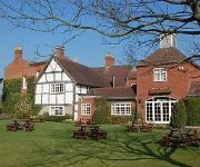
The Bulls Head Inn
Avonhill B&B
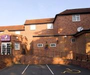
TRAVELODGE STRATFORD ALCESTER
Redditch North (A441)
Videos from this area
These are videos related to the place based on their proximity to this place.
DJI F550 Flying Over The Redditch BMX Track
Flying a DJI F550 with a GoPro hero 3 around the Redditch BMX track.
Wot 4 Foam-e with Paintballing Smoke Grenades! - Ipsley Redditch
In very windy conditions in Redditch UK we were testing out these smoke grenades - http://www.store.justpaintball.co.uk/... Good value, loads of smoke but only last just over a minute on the...
Redditch race school 24/10/2010
Quick lap of Redditch (surprise) on a cold winter October day with patchy damp roads after a quick blast to Henley in Arden. Camera is a Drift x170, mounted on left leg with a strap. Need...
AGS: Blind Date
Alcester Grammar Sixth Form put on Blind Date to raise money for Myton Hospice and the British Heart Foundation. £310 was raised in total - thank you to the Tech Managers, Charity Reps and...
Laser Scan of Minerva Mill, Alcester
Laser scan of Minerva Mill, Registered office of Grantham Coates Surveys Ltd.
Studley Church and Castle mission.
Video from X-ite flying wing (Zagi clone). APM 2.6 steering. Mobius ActionCam filming. Brief views of River Arrow, Studley Church, and Studley Castle.
Landys Pink Fitness Rave! Sept 26th 2014.
Monthly themed fitness raves at Studley Village Hall, Warks! Please see www.fitnesswithlandy.co.uk for more information.
Model plane 13km flight to Arrow Valley Lake
Zagi-like model plane with Mobius ActionCam and Arduplane APM2.6 autopilot. Flies from Spernall to Arrow Valley Lake following River Arrow, then returns to Studley. 13km flight.
View of driving down the A448 turning left onto the A435 Alcester Rd. and speed camera
This video shows the drivers eye view when driving down the A448 (The Slough/Bromsgrove Rd) turning left onto the A435 (Alcester Rd.) towards Studley where the speed limit changes from 40MPH...
Videos provided by Youtube are under the copyright of their owners.
Attractions and noteworthy things
Distances are based on the centre of the city/town and sightseeing location. This list contains brief abstracts about monuments, holiday activities, national parcs, museums, organisations and more from the area as well as interesting facts about the region itself. Where available, you'll find the corresponding homepage. Otherwise the related wikipedia article.
Redditch (UK Parliament constituency)
Redditch is a constituency in East Worcestershire and in the south of the West Midlands (region) represented in the House of Commons of the UK Parliament since 2010 by Karen Lumley, a Conservative.
Coughton Court
Coughton Court is an English Tudor country house, situated on the main road between Studley and Alcester in Warwickshire. It is a Grade I listed building. The house has a long crenelated façade directly facing the main road, at the centre of which is the Tudor Gatehouse, dating from 1530, this has hexagonal turrets and oriel windows in the English Renaissance style.
Studley F.C
Studley Football Club is a football club based in Studley, near Redditch, Warwickshire, England. They play in the Midland Football Alliance which is the 9th tier in the overall English football league system.
Studley College
Studley Horticultural & Agricultural College for Women was a horticultural and agricultural college for women in Warwickshire, England which operated from 1898 until 1969.
Ridgeway Middle School
Ridgeway Middle School is a middle school with academy status located in Redditch, Worcestershire, England. There are currently 470 pupils on roll, in the age range 9-13. A March 2007 Ofsted inspection accorded the school a Grade 3 (satisfactory).
Ipsley Court
Ipsley Court was a 16th century country house, much altered in the 18th and 20th centuries, situated at Ipsley, once Warwickshire, now since 1931, Worcestershire. It currently comprises two disconnected wings, both Grade II listed buildings. which are in commercial use. The Manor of Ipsley was held by the Huband family from Norman times. The house, originally comprising a central block and two wings to the north and south, was built for Sir John Huband Kt in the 16th century.
St Leonard's Church, Spernall
St Leonard's Church, Spernall, is a redundant church in Spernall, Warwickshire, England. It has been designated by English Heritage as a Grade II* listed building, and is under the care of the Friends of Friendless Churches.
Cookhill Priory
Cookhill Priory was a Cistercian nunnery in Worcestershire, England. It was founded by Isabel de Mauduit in 1260. It is now a Grade II* listed building.


