Safety Score: 3,0 of 5.0 based on data from 9 authorites. Meaning we advice caution when travelling to United Kingdom.
Travel warnings are updated daily. Source: Travel Warning United Kingdom. Last Update: 2024-05-19 08:11:23
Explore Cathiron
The district Cathiron of Rugby in Warwickshire (England) is located in United Kingdom about 80 mi north-west of London, the country's capital.
If you need a place to sleep, we compiled a list of available hotels close to the map centre further down the page.
Depending on your travel schedule, you might want to pay a visit to some of the following locations: Coventry, Keresley, Glenfield, Warwick and Leicester. To further explore this place, just scroll down and browse the available info.
Local weather forecast
Todays Local Weather Conditions & Forecast: 19°C / 65 °F
| Morning Temperature | 9°C / 49 °F |
| Evening Temperature | 17°C / 62 °F |
| Night Temperature | 9°C / 48 °F |
| Chance of rainfall | 0% |
| Air Humidity | 69% |
| Air Pressure | 1016 hPa |
| Wind Speed | Gentle Breeze with 8 km/h (5 mph) from South-West |
| Cloud Conditions | Clear sky, covering 1% of sky |
| General Conditions | Sky is clear |
Monday, 20th of May 2024
17°C (63 °F)
7°C (45 °F)
Scattered clouds, moderate breeze.
Tuesday, 21st of May 2024
17°C (62 °F)
12°C (54 °F)
Light rain, gentle breeze, overcast clouds.
Wednesday, 22nd of May 2024
13°C (55 °F)
12°C (54 °F)
Light rain, gentle breeze, overcast clouds.
Hotels and Places to Stay
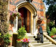
Brownsover Hall
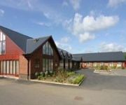
Draycote Hotel and Golf Course
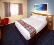
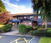
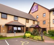
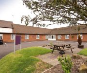
TRAVELODGE RUGBY CENTRAL
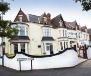
The Grosvenor
TRAVELODGE RUGBY DUNCHURCH
Rugby Hotel
Rugby North (M6 Jct1)
Rugby North (Newbold)
Coventry East (Ansty)
Videos from this area
These are videos related to the place based on their proximity to this place.
www.rugbyworld.com Warm Up Drills
www.rugbyworld.com video demonstrating key warm up drills for Rugby. A proper warm up is imperative before any kind of physical activity in order to: •Increase the body's core temperature...
Rugby St Andrews Under 17 Kangaroo Court 2011
This is the Kangaroo Court from the Rugby St Andrews RFC Under 17;s Tour to France in 2011. Just a look into the behind the scenes of a Lads Rugby Tour!!
Judah's Journey: Study 5 - 'Tribe of Judah, Sons of their father' - Bryan Styles
The Christadelphian Video Channel Judah's Journey: Study 5 - 'Tribe of Judah, Sons of their father' - Bryan Styles Welcome to our channel run by the Christadelphians Worldwide to help promote...
Kent Prophecy Day- Register to watch using the KeytotheBible App.. see description
Kent Prophecy Day 2015 Saturday, 21 March 2015, God Willing Commencing at 3.30pm East Malling Village Hall, New Road, East Malling, Kent ME19 6DD Theme: Israel & the nations in the Purpose...
Promised Land Youth Conference Studies: We Be Well Able To Overcome Joshua & Hatzor
Promised Land Youth Conference Studies: We Be Well Able To Overcome Joshua & Hatzor http://promisedlandyouthconference.com/ God willing, a Youth Conference study tour of the Promised Land...
Promised Land Youth Conference Studies: Study 4 'Jerusalem - the Daughter of Zion'
http://promisedlandyouthconference.com/ God willing, a Youth Conference study tour of the Promised Land is being organized for two weeks in the late spring of 2015. This conference is a study...
The Location of Sodom & Gomorrah Revealed Dr Steven Collins, D Min , PhD
The Christadelphian Video Channel An Introduction t the work that Dr.Steven Collins is doing at the archaeological site at Tall el-Hammam, in the country of Jordan. Our Good friend Stan Isbell...
Scania truck driving sim (Episode 2): Drifting wood on the floods of rock!
The Vox showing us how its done! (opinions vary) Back in Scania on the dangerous roads, battling against all odds, yet dispute the fact you cant die or really fail on any of them, reaching...
Ukraine Peace Deal in Great Danger. The 'Angry' Russian Bear
Other Channels we recommend https://www.youtube.com/BibleProphecyHD https://www.youtube.com/RugbyChristadelphian Ukraine Peace Deal in Great Danger. The Christadelphian Video Channel ...
Moscow caught watching Israel from Syrian border
The Christadelphian Video Channel Moscow caught watching Israel from Syrian border Welcome to our channel run by the Christadelphians Worldwide to help promote the understanding of God's ...
Videos provided by Youtube are under the copyright of their owners.
Attractions and noteworthy things
Distances are based on the centre of the city/town and sightseeing location. This list contains brief abstracts about monuments, holiday activities, national parcs, museums, organisations and more from the area as well as interesting facts about the region itself. Where available, you'll find the corresponding homepage. Otherwise the related wikipedia article.
Borough of Rugby
The Borough of Rugby is a local government district with borough status in eastern Warwickshire, England. The borough comprises the town of Rugby where the council has its headquarters, and the rural areas surrounding the town. The borough has a population of just over 91,000. Of these, over 60,000 live in the town of Rugby, with the remainder living in the rural areas surrounding the town.
A45 road
The A45 is a major road in England. It runs east from Birmingham past the National Exhibition Centre and the M42, then bypasses Coventry and Rugby, where it briefly merges with the M45 until it continues to Daventry. It then heads to Northampton and Wellingborough before running north of Rushden and Higham Ferrers and terminating at its junction with the A14 road in Thrapston. Prior to the construction of the M6 motorway it was the main route from the Midlands to Ipswich and to the Haven ports.
107.1 Rugby FM
Rugby FM is an Independent Local Radio station in Warwickshire owned by Quidem Ltd and operated as part of its Midlands division. The station follows the 'great music, local news' format of its sister stations (branded as Touch Radio) in the area, but has retained its launch name. From 2002 until 2008 it operated from studios on Spring Street in the heart of the town centre.
Rugby Art Gallery and Museum
The Rugby Art Gallery and Museum is a combined art gallery and museum located in central Rugby, Warwickshire, in England. The purpose built building housing it which was opened in 2000 also contains the town's library. The art gallery hosts a nationally recognised temporary exhibition from the "Rugby collection of 20th century and contemporary British art", which includes prints from artists such as Stanley Spencer, Bridget Riley, L. S. Lowry and Lucian Freud.
Webb Ellis Rugby Football Museum
The Webb Ellis Rugby Football Museum is a rugby football museum in the town centre of Rugby in Warwickshire, near Rugby School. It takes its name from William Webb Ellis who is credited with inventing the game of Rugby football. The museum, (previously known as the James Gilbert Rugby Football Museum) opened in the 1980, and is housed in the building where the shoe and boot maker James Gilbert,, first made rugby balls in 1842. On its premises (see image) it is identified as The Rugby Museum.
Rugby Rural District
The Rugby Rural District was a former rural district in Warwickshire, England. The district covered the rural areas surrounding the town of Rugby, where the district council was based, but did not include Rugby itself which was administered separately. The district was created in 1894. In 1932 its boundaries were significantly altered.
Cosford, Warwickshire
Cosford is a tiny village and civil parish in the Rugby borough of Warwickshire, located a few miles north of Rugby. According the 2001 census it has a population of 11 and a more recent estimate by Rugby Borough Council puts it at 13. It should not be confused with Cosford, Shropshire, the home of RAF Cosford.
New Bilton
New Bilton is a place in Rugby, Warwickshire, in England. It is a suburb of Rugby, situated to the west of the town centre. The nearby village of Bilton has also been absorbed into Rugby. New Bilton comprises mostly Victorian terraced housing. Some modern housing has been built on the former GEC site to the rear of Avenue Road up to the limestone quarries of Cemex.
Monks Kirby Rural District
The Monks Kirby Rural District was a rural district of Warwickshire between 1894 and 1932, based on the part of the Lutterworth Rural Sanitary District which was in Warwickshire. Its council was based in the village of Monks Kirby.
Bretford
Bretford is a small hamlet in Warwickshire, England. It is part of the parish of Brandon and Bretford. Bretford lies at a junction between the A428 road (Coventry-Rugby) and the old Fosse Way. The name of the village comes from the old ford crossing point over the River Avon which runs just south of the village. The original Roman line of the Fosse Way was diverted to the west in the Middle Ages to its present crossing point.
Clock Towers Shopping Centre
The Clock Towers Shopping Centre is a shopping precinct in the town centre of Rugby, Warwickshire, England, managed by EFM Facilities Ltd. The precinct includes clothes stores, game shops and thrift stores.
Rugby (UK Parliament constituency)
Rugby is a constituency represented in the House of Commons of the UK Parliament since its 2010 recreation by Mark Pawsey, a Conservative.
Easenhall
Easenhall is a small village and parish in Warwickshire, England, three miles north-west of the town of Rugby and a mile south of the M6 motorway. According to the United Kingdom Census 2001 the parish had a population of 231 in 96 houses.
Little Lawford
Little Lawford is a hamlet to the north of Long Lawford and west of Rugby in Warwickshire, England. Consisting of 5 dwellings plus numerous other buildings used for commercial or farming business, Little Lawford has a population of 12 people.
Overslade
Overslade is a political ward, as well as a general neighbourhood in the central south part of the town of Rugby, Warwickshire. According to the United Kingdom Census 2001, the ward's population was 5,606. The parish church is dedicated to Saint Matthew and the local secondary school is Harris School. There are several parks in the neighbourhood, the largest being the long, thin, Overslade Park which is 4.2 acres in area.
Brownsover Hall
Brownsover Hall is a 19th century mansion house in the old village of Brownsover, Rugby, Warwickshire which has been converted for use as a hotel. It is a Grade II listed building.
Caldecott Park
Caldecott Park is an urban park located in the centre of Rugby, England. Most of the land was purchased by the Rugby Urban District Council in 1903 from Thomas Caldecott, the last lord of the manor. There was additional land purchased to the north of the original park in 1911, bringing the park to its current size of 10.6 acres . In other respects though the park has changed a lot. There used to be an ornamental lake in the centre of the park, but that was filled in 1922.
Bilton Hall
Bilton Hall is a 17th century mansion house at Bilton, near Rugby, Warwickshire which has been converted into residential apartments. It is a Grade I listed building. It was once the home of the poet and essayist Joseph Addison and of the sporting writer Charles James Apperley.
Brinklow railway station
Brinklow railway station was a railway station almost midway between Brinklow and Stretton-Under-Fosse in the English county of Warwickshire, opened in 1847 on the Trent Valley Line. Until 1870 it was known as Stretton or possibly Streeton It was also described as Brinklow for Stretton Under Fosse in some timetables. Although line opened in September 1847, full services including those from Brinklow did not begin until the 1st. December of that year.
Rugby Western Relief Road
The Rugby Western Relief Road (RWRR) is a 3.7-mile single carriageway road which is on the outskirts of Rugby, Warwickshire, England. The £36.6 million scheme includes a £17.08 million contribution from the Department for Transport and was expected to be completed by the end of 2009 but the date was put back by a year, eventually opening in September 2010. There was also much speculation that the project went well over budget. Due to its route it can be considered in many ways to be a bypass.
Benn Hall
The Benn Hall is a conference, seminar, exhibition and party venue located in Rugby, Warwickshire, England. The hall, along with the town hall which is located next to it, was opened on 5 July 1961 by Queen Elizabeth, the Queen Mother. It is named after George Charles Benn who in his will of 1895 left £6,000 to the local council to construct a building that would be useful to the town. The first of these buildings was opened in 1900 but has now been demolished.
Street Ashton
Street Ashton is a hamlet in the Rugby district of Warwickshire, England.
St Michael and All Angels Church, Brownsover
St Michael and All Angels Church, Brownsover, is a redundant Anglican church in the former village of Brownsover, which is now a suburb of the town of Rugby, Warwickshire, England. It has been designated by English Heritage as a Grade II* listed building, and is under the care of the Churches Conservation Trust.
The Crescent School, Bilton
The Crescent School is an Independent Preparatory Coeducational Day School for pupils aged 3 – 11+ in Bilton, Rugby, Warwickshire, England. Originally founded in 1948 (having informally started in 1946) as a school for the children of Rugby School masters, it was housed in Rugby School buildings.
RAF Church Lawford
RAF Church Lawford is a former Royal Air Force station located 1.5 mi south of Church Lawford, Warwickshire, England, 3.0 miles south-west of Rugby, Warwickshire. The airfield opened in April 1941 and was used by the RAF for pilot training until it closed in 1955.


