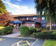
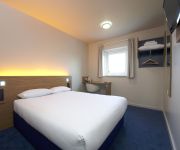
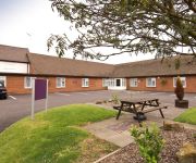
Safety Score: 3,0 of 5.0 based on data from 9 authorites. Meaning we advice caution when travelling to United Kingdom.
Travel warnings are updated daily. Source: Travel Warning United Kingdom. Last Update: 2024-04-23 08:18:23
Discover Stretton-on-Dunsmore
Stretton-on-Dunsmore in Warwickshire (England) is a city in United Kingdom about 80 mi (or 128 km) north-west of London, the country's capital city.
Local time in Stretton-on-Dunsmore is now 02:30 AM (Wednesday). The local timezone is named Europe / London with an UTC offset of one hour. We know of 9 airports in the vicinity of Stretton-on-Dunsmore, of which 5 are larger airports. The closest airport in United Kingdom is Coventry Airport in a distance of 4 mi (or 6 km), West. Besides the airports, there are other travel options available (check left side).
There are several Unesco world heritage sites nearby. The closest heritage site in United Kingdom is Blenheim Palace in a distance of 48 mi (or 77 km), South-East. Also, if you like golfing, there are a few options in driving distance. Looking for a place to stay? we compiled a list of available hotels close to the map centre further down the page.
When in this area, you might want to pay a visit to some of the following locations: Coventry, Keresley, Warwick, Berkswell and Meriden. To further explore this place, just scroll down and browse the available info.
Local weather forecast
Todays Local Weather Conditions & Forecast: 9°C / 49 °F
| Morning Temperature | 5°C / 40 °F |
| Evening Temperature | 8°C / 46 °F |
| Night Temperature | 2°C / 35 °F |
| Chance of rainfall | 0% |
| Air Humidity | 56% |
| Air Pressure | 1017 hPa |
| Wind Speed | Gentle Breeze with 8 km/h (5 mph) from South-West |
| Cloud Conditions | Broken clouds, covering 69% of sky |
| General Conditions | Broken clouds |
Thursday, 25th of April 2024
10°C (51 °F)
7°C (45 °F)
Light rain, gentle breeze, overcast clouds.
Friday, 26th of April 2024
8°C (46 °F)
8°C (46 °F)
Overcast clouds, gentle breeze.
Saturday, 27th of April 2024
14°C (57 °F)
9°C (48 °F)
Light rain, fresh breeze, overcast clouds.
Hotels and Places to Stay
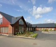
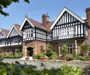
Mercure Brandon Hall Hotel and Spa Warwickshire
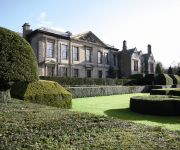
Coombe Abbey
Citrus Hotel Coventry South By Compass Hospitality
Draycote Hotel and Golf Course
Chace Coventry
JCT.2 Holiday Inn COVENTRY M6
Coventry (Binley/A46)
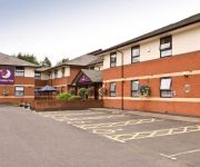
TRAVELODGE RUGBY DUNCHURCH
TRAVELODGE COVENTRY BINLEY
Coventry East (Ansty)
Videos from this area
These are videos related to the place based on their proximity to this place.
Coombe Abbey Country Park Coventry
A collection of some of my photos taken at Coombe over the last few years. I am lucky enough to have this on my doorstep and visit frequently, so see it as it changes throughout the seasons....
Introduction to Five Acre Community Farm
Five Acre Community Farm is a Community Supported Agriculture farm, founded in January 2012. We are based at Garden Organic, at Ryton between Coventry and Rugby. For more information go...
A Drive through Birdingbury
A Drive through Birdingbury. Plus a country lane. And, bonus, a little bit of Leamington Hastings. http://southamnews.org.
Tawney Mining Bees - 2014-03 - tewbirds @ Brandon Marsh
Male [small], and Female Tawny Mining Bees, at work, outside the entrance to the Jon Baldwin Hide. recorded at Brandon Marsh Nature Reserve. The Tawny Mining Bee is a common, spring-flying,...
Badgers at Brandon Marsh Nature Reserve - 28/09/2012 to 01-10/2012
Badgers at Brandon Marsh Nature Reserve - 28/09/2012 to 01-10/2012.
Videos provided by Youtube are under the copyright of their owners.
Attractions and noteworthy things
Distances are based on the centre of the city/town and sightseeing location. This list contains brief abstracts about monuments, holiday activities, national parcs, museums, organisations and more from the area as well as interesting facts about the region itself. Where available, you'll find the corresponding homepage. Otherwise the related wikipedia article.
River Itchen, Warwickshire
The River Itchen flows through east Warwickshire in England. It is a small river, about 12 miles long, and its general course is from south to north. The River Itchen rises near Wormleighton at grid reference SP 447 541 and flows into a broad valley to the northeast of a range of ironstone hills which border Warwickshire and Northamptonshire.
Brandon and Bretford
Brandon and Bretford is a civil parish in the Rugby borough of Warwickshire, England. As the name suggests it contains the two villages of Brandon and Bretford. Of the two, Brandon is the largest. The villages are located within 1½ miles of each other, along the A428 road. In the 2001 census the parish had a population of 588.
Knightlow
Knightlow was a hundred of the county of Warwickshire in England. It covered the eastern part of the county, including Coventry, Bedworth, Rugby, and Leamington.
Brandon Castle
Brandon Castle was sited overlooking the River Avon between the virtually adjacent villages of Brandon and Wolston in Warwickshire which in turn lie between the towns of Rugby and Coventry. It was originally a 12th century earthwork motte and bailey fortress founded by Geoffrey de Clinton. Around 1226 the de Verdon family founded the stone castle consisting of the keep and a large outer enclosure.
Eathorpe
to Eathorpe Hall]] Eathorpe is a small village five miles east of Leamington Spa, in the English county of Warwickshire. It is in its own parish, in the electoral ward of Cubbington. It is very close to the B4455, which follows the line of the Roman Fosse Way, and the River Leam. According to the 2001 census, the parish had a population of 113. Although the village is small it has an excellent village hall, built in 2006.
Brandon Marsh
Brandon Marsh is an SSSI (Site of Special Scientific Interest) and nature reserve in Warwickshire, England. It is situated adjacent to the River Avon, near the village of Brandon, a few miles east of Coventry. The reserve is also the headquarters of the Warwickshire Wildlife Trust. Formerly used for sand and gravel quarrying, the 92 hectare (228 acre) site is owned by French industrial company LaFarge Industries and is leased to the Trust.
Brandon and Wolston railway station
There was also a Brandon station on the NER which was renamed Brandon Colliery railway station Brandon and Wolston railway station was a railway station serving the villages of Brandon and Wolston in the English county of Warwickshire. The original Brandon station was built by the London and Birmingham Railway and was the only one between Coventry and Rugby. It was replaced by a new station nearby, Brandon and Wolston, in 1879.
Brandon Stadium
Brandon Stadium also known as Coventry Stadium, is located 6 miles east of Coventry in Brandon, Warwickshire, England. It is the home of the Coventry Bees motorcycle speedway team. It also hosts BriSCA F1 Stock Car Racing on the 1st Saturday of the month from April through to November. Since 1978 it has also hosted Greyhound racing, known as Coventry Greyhounds. Brandon Stadium's first speedway meeting took place on 29 September 1928.


