Safety Score: 3,0 of 5.0 based on data from 9 authorites. Meaning we advice caution when travelling to United Kingdom.
Travel warnings are updated daily. Source: Travel Warning United Kingdom. Last Update: 2024-04-20 08:25:34
Discover Binley
The district Binley of in Coventry (England) is a district in United Kingdom about 84 mi north-west of London, the country's capital city.
Looking for a place to stay? we compiled a list of available hotels close to the map centre further down the page.
When in this area, you might want to pay a visit to some of the following locations: Coventry, Keresley, Warwick, Berkswell and Meriden. To further explore this place, just scroll down and browse the available info.
Local weather forecast
Todays Local Weather Conditions & Forecast: 9°C / 49 °F
| Morning Temperature | 1°C / 34 °F |
| Evening Temperature | 9°C / 48 °F |
| Night Temperature | 2°C / 36 °F |
| Chance of rainfall | 0% |
| Air Humidity | 57% |
| Air Pressure | 1030 hPa |
| Wind Speed | Moderate breeze with 9 km/h (6 mph) from South |
| Cloud Conditions | Scattered clouds, covering 45% of sky |
| General Conditions | Scattered clouds |
Sunday, 21st of April 2024
10°C (50 °F)
3°C (37 °F)
Overcast clouds, gentle breeze.
Monday, 22nd of April 2024
6°C (42 °F)
8°C (46 °F)
Light rain, light breeze, overcast clouds.
Tuesday, 23rd of April 2024
7°C (45 °F)
2°C (36 °F)
Light rain, moderate breeze, overcast clouds.
Hotels and Places to Stay
DoubleTree by Hilton at the Ricoh Arena - Coventry
DoubleTree by Hilton Coventry
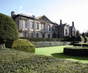
Coombe Abbey
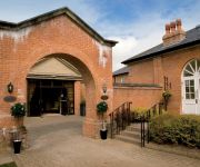
Mercure Brandon Hall Hotel and Spa Warwickshire
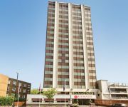
Ramada Hotel and Suites Coventry The Butts Earlsdon
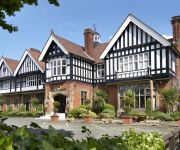
Macdonald Ansty Hall
Citrus Hotel Coventry South By Compass Hospitality
Chace Coventry
JCT.2 Holiday Inn COVENTRY M6
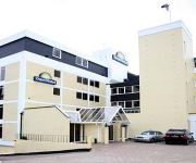
DAYS HOTEL COVENTRY
Videos from this area
These are videos related to the place based on their proximity to this place.
5 Gauge GWR Collett Goods 0-6-0 at the GEC Coventry MES
Our 5 inch gauge 0-6-0 collett goods Great Western locomotive pulling away up the hill on the GEC Coventry MES miniature railway.
The Redwoods of Coombe Abbey Country Park 2010
This is a short showing the Sequoia Dendron Redwoods at Coombe Abbey Country Park east of Coventry. Originally mananged by the Cistercian Monks.
Coombe Abbey Country Park Coventry
A collection of some of my photos taken at Coombe over the last few years. I am lucky enough to have this on my doorstep and visit frequently, so see it as it changes throughout the seasons....
Right Turn!
Watch the soldier on the right! A clip from the re-dedication of the Walsgrave War Memorial.
First daytime snow here in Coventry. We got our much later than other parts of the UK
This was the first time we witnessed snow fall during the day here in Coventry; unlike up north in Scotland where it had been snowing since late last year. This video was recorded at Sainsbury's...
Greetings from Stoke
Some images of Stoke in Coventry. Apart from the GEC factory at the end they all belong to Rob who runs the Historic Coventry website, so many thanks as usual to him for allowing me to use...
Tawney Mining Bees - 2014-03 - tewbirds @ Brandon Marsh
Male [small], and Female Tawny Mining Bees, at work, outside the entrance to the Jon Baldwin Hide. recorded at Brandon Marsh Nature Reserve. The Tawny Mining Bee is a common, spring-flying,...
Badgers at Brandon Marsh Nature Reserve - 28/09/2012 to 01-10/2012
Badgers at Brandon Marsh Nature Reserve - 28/09/2012 to 01-10/2012.
Videos provided by Youtube are under the copyright of their owners.
Attractions and noteworthy things
Distances are based on the centre of the city/town and sightseeing location. This list contains brief abstracts about monuments, holiday activities, national parcs, museums, organisations and more from the area as well as interesting facts about the region itself. Where available, you'll find the corresponding homepage. Otherwise the related wikipedia article.
Coombe Abbey
Coombe Abbey is a hotel which has been developed from an historic grade I listed building and former country house. It is located roughly midway between Coventry and Brinklow in the countryside of Warwickshire, England. The house's original grounds are now a country park known as Coombe Country Park and run by Coventry City Council.
Coventry North East (UK Parliament constituency)
Coventry North East is a constituency represented in the House of Commons of the UK Parliament since 1992 by Bob Ainsworth of the Labour Party.
Walsgrave
Walsgrave-on-Sowe is a village located about 3 miles north-east of Coventry, West Midlands in England. Although it now sees very little flooding, it was built on marsh lands. However, due to urban growth, it is now an outer suburb of Coventry, near to Ansty and Shilton.
Ball Hill
Ball Hill is an area within the Stoke district of Coventry, West Midlands, England. It is to the east of Coventry city centre. Walsgrave Road is the main street that runs through Ball Hill, which is a name that primarily defines the shopping area extending from the brow of the hill down to the junction with Clay Lane/ Brays Lane. The Walsgrave Road forms the main route out of Coventry's town centre towards Leicester and the north east.
Coventry Copsewood F.C
Coventry Copsewood F.C. are a football club based in Coventry, West Midlands, England. In 2005, they changed their name from Coventry Marconi to their present name. Currently they are members of the Midland Combination Premier Division.
Ernesford Grange
Ernesford Grange is a suburb of Coventry, West Midlands. It is in the southeast of the city and borders the Binley, Stoke Aldermoor and Willenhall areas. It is part of the Coventry South Constituency. It is served by four primary schools, the Ernesford Grange School & Community College, and Corpus Christi church. There is also a leisure centre with an 18 metre long swimming pool. Many of the streets are named after miners who worked in the coal pits, which used to cover most of the area.
Stoke Aldermoor
Stoke Aldermoor is a suburb in Coventry, West Midlands, England. An area of Stoke Aldermoor consisting of a small estate alongside the northeast of Pinley Fields is called Pinley. It is bordered by the river Sowe, and Coventry Canal.
Willenhall, Coventry
Willenhall is a suburb of Coventry in the West Midlands of England. Willenhall is in the south-east of the city adjacent to the suburbs of Binley, Ernesford Grange and Whitley. It covers the area bounded by the Rugby to Coventry railway line, the River Sowe and the city's boundary with Warwickshire. For general election purposes it is part of the Coventry South Constituency and for local elections it forms part of the Binley and Willenhall ward on Coventry City Council.
Foleshill
Foleshill is a suburb in the north of Coventry in the West Midlands of England. Longford. Courthouse Green and Rowley Green are to its north and Keresley is to its west.
University Hospital Coventry
University Hospital Coventry is a large National Health Service (NHS) hospital situated in the Walsgrave on Sowe area of Coventry, West Midlands, England, 4 miles from the city centre. It is part of the University Hospitals Coventry and Warwickshire NHS Trust, which also includes the Hospital of St. Cross that is situated in Rugby, Warwickshire.
Air Algérie Flight 702P
Air Algérie/Phoenix Flight 702P, ship name Oasis, registration 7T-VEE, was a Boeing 737 owned by Air Algérie and leased by Phoenix Aviation which crashed on 21 December 1994 near Coventry Airport, England. All five on board were killed.
Wyken
Wyken, a suburb of Coventry, England, is situated between the areas of Stoke and Walsgrave, three miles northeast of Coventry city centre. It is a fairly large ward spreading as far as the Binley area. The majority of the houses in Wyken are terraced houses. The original parish ran close to the River Sowe and was mainly flat except for Wyken Heath and Wyken Knob near Stoke Heath.
Binley, Coventry
Binley is a suburb in the east of Coventry, England. Binley evolved from a small mining village on the outskirts of Coventry to a large residential area composing private residences and council-owned properties. Binley colliery started producing coal in 1911 and was most productive during the 1950s, the entrance was on Willenhall Lane. It closed in 1963 and Herald Way industrial estate now occupies the site. Former pit worker cottages still remain along Willenhall Lane and St James Lane.
Brandon Marsh
Brandon Marsh is an SSSI (Site of Special Scientific Interest) and nature reserve in Warwickshire, England. It is situated adjacent to the River Avon, near the village of Brandon, a few miles east of Coventry. The reserve is also the headquarters of the Warwickshire Wildlife Trust. Formerly used for sand and gravel quarrying, the 92 hectare (228 acre) site is owned by French industrial company LaFarge Industries and is leased to the Trust.
Potters Green
Potters Green is a mainly residential suburb situated in the northeast of the city of Coventry, West Midlands, England. The longest road is Yewdale Crescent, while the road used by through traffic is Ringwood Highway, which provides a link between Woodway Lane, Wigston Road and Deedmore Road. It is not home to any leisure centres, but is close to the NDC's new one (opened March 2009).
The Alan Higgs Centre
The Alan Higgs Centre, opened in September 2004, is a leisure centre situated in about 80 acres grounds near to the River Sowe, on Allard Way in the southeast of Coventry, England. It was designed by RHWL architects, and built by Galiford Try plc at a cost of about 8 million pounds to their client and the current owner, the Alan Higgs Centre Trust. The funds were provided by the Alan Edward Higgs Charity. The Coventry City Football Club's Academy is based at The Alan Higgs Centre.
Henley Green
Henley Green is a former council estate in Coventry at grid reference SP366815 adjacent to Wood End, bordered by Deedmore Road, and about a mile from the area of Bell Green. Henley Green now consists of a mixture of private and social housing. The neighbourhood is part of the Henley ward. This housing estate was mostly built by Wimpey around 1955, the majority of properties were built out of no fines by a method of cast pouring.
Herald Way Marsh
Herald Way marsh is a 10.6 hectare (26.2 acre) biological and geological site of Special Scientific Interest in the West Midlands. The site was notified in 1988 under the Wildlife and Countryside Act 1981 and is currently managed by the Country Trust.
Toll Bar End
Toll Bar End is an area of Coventry that lies on the South East edge of the city. The main focal point of the area is the Toll Bar Island, where the A45, A46 and B4110 (London Road) converge. It is a main transport route out of the city and provides access to Coventry Airport and Middlemarch Business Park. Another area of interest is Gary C King museum that specialises in the Coventry motor industry as the demolished old Peugot Ryton plant lies close by along the A45.
Henley College, Coventry
Henley College Coventry was built 1964. It is located to north of Coventry city centre and is close to the M6 motorway in a sub area of Bell Green. Graduation ceremonies are held at Coventry Cathedral.
Ivor Preece Field
The Ivor Preece Field on Rugby Road, Binley Woods, Warwickshire is the home ground for Broadstreet RUFC designed by SR Davis architects with the sports ground designed by Peter Jones Associates, Quantity Surveyors Bucknall Austin, project managed by Falcon House Project Management. The first game played here was on 1 March 2001 with the official opening in August 2002. The official opening day saw world cup winning captain Martin Johnson open the club and grounds.
The Meriden Hospital
The Meriden Hospital is a private hospital run by BMI Healthcare. It is situated adjacent to University Hospital Coventry, Walsgrave, Coventry, England. Key features of the hospital include 52 patient bedrooms, 15 outpatient consulting rooms, 3 major operating theatres, endoscopy suite, radiology and physiotherapy departments. It undertakes a wide range of procedures from routine investigations to complex surgery.
Bulls Head Ground
Bulls Head Ground is a cricket ground in Coventry, West Midlands. The first recorded match on the ground was in 1848, when Coventry played an All-England Eleven. It hosted its first first-class match in 1903, which was between Warwickshire and the Gentlemen of Philadelphia. From 1909 to 1919, the ground played host to 12 first-class matches.
Toll Bar
Toll Bar is a village on the A19 road, in the Doncaster District, in the English county of South Yorkshire.
Caludon Castle
Caludon Castle is a Scheduled Ancient Monument and Grade I listed building in Coventry, in the West Midlands of England. A second moated site 190 metres to the south is a Scheduled Ancient Monument in its own right. The castle is now a ruin, and all that remains is a large fragment of sandstone wall. What remains of the estate is now an urban park, owned and run by Coventry City Council, but much of it was sold and developed into housing estates in the early 20th century.


