Safety Score: 3,0 of 5.0 based on data from 9 authorites. Meaning we advice caution when travelling to United Kingdom.
Travel warnings are updated daily. Source: Travel Warning United Kingdom. Last Update: 2024-05-05 08:24:42
Delve into Kites Hardwick
Kites Hardwick in Warwickshire (England) is a city located in United Kingdom about 75 mi (or 121 km) north-west of London, the country's capital town.
Current time in Kites Hardwick is now 10:07 PM (Sunday). The local timezone is named Europe / London with an UTC offset of one hour. We know of 10 airports closer to Kites Hardwick, of which 5 are larger airports. The closest airport in United Kingdom is Coventry Airport in a distance of 8 mi (or 13 km), North-West. Besides the airports, there are other travel options available (check left side).
There are several Unesco world heritage sites nearby. The closest heritage site in United Kingdom is Blenheim Palace in a distance of 43 mi (or 69 km), South-East. Also, if you like playing golf, there are some options within driving distance. In need of a room? We compiled a list of available hotels close to the map centre further down the page.
Since you are here already, you might want to pay a visit to some of the following locations: Coventry, Hanwell, Keresley, Warwick and Berkswell. To further explore this place, just scroll down and browse the available info.
Local weather forecast
Todays Local Weather Conditions & Forecast: 17°C / 63 °F
| Morning Temperature | 9°C / 48 °F |
| Evening Temperature | 14°C / 56 °F |
| Night Temperature | 10°C / 50 °F |
| Chance of rainfall | 1% |
| Air Humidity | 65% |
| Air Pressure | 1006 hPa |
| Wind Speed | Gentle Breeze with 7 km/h (4 mph) from North-West |
| Cloud Conditions | Broken clouds, covering 79% of sky |
| General Conditions | Light rain |
Monday, 6th of May 2024
16°C (60 °F)
9°C (48 °F)
Light rain, light breeze, overcast clouds.
Tuesday, 7th of May 2024
16°C (61 °F)
10°C (50 °F)
Light rain, light breeze, scattered clouds.
Wednesday, 8th of May 2024
14°C (57 °F)
12°C (53 °F)
Light rain, light breeze, overcast clouds.
Hotels and Places to Stay
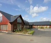
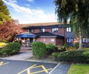
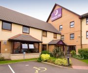
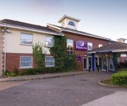
Draycote Hotel and Golf Course
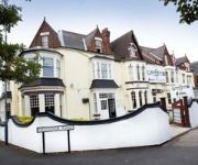
The Grosvenor
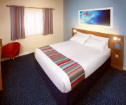
TRAVELODGE RUGBY CENTRAL
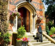
Brownsover Hall
TRAVELODGE RUGBY DUNCHURCH
Rugby Hotel
Rugby North (M6 Jct1)
Rugby North (Newbold)
Videos from this area
These are videos related to the place based on their proximity to this place.
Bilton Grange in the 1970s- part 1
During the 1950s, 60's and 70's, Joe Richardson (JBR), a master at Bilton Grange, took some home cine film of everyday life at the school, recording some special occasions as well. A few years...
Bilton Grange in the 1970s- part 3
During the 1950s, 60's and 70's, Joe Richardson (JBR), a master at Bilton Grange, took some home cine film of everyday life at the school, recording some special occasions as well. A few years...
01 Whitestone Lake Tombuttle's photos around Dunchurch, Canada (dunchurch ontario wifi access)
Preview of Tombuttle's blog at TravelPod. Read the full blog here: http://www.travelpod.com/travel-blog-entries/tombuttle/10/1241971140/tpod.html This blog preview was made by TravelPod...
Floating Cars and Garage Giltches! H1Z1 pt.4
Introducing the all-new hover-car! Each new model comes with a free backpack, regardless of how close you are to building your own! Also, Chris De Burgh.
iPad parts for iPad 2 Repair in Nottingham - Power button flex cable
http://www.thepersonalcomputerservice.co.uk - 0115 972 1120 Serving Nottingham Derby and Leicester with computer service for pc and mac. This is showing an iPad 2 power button flex cable...
Argentina v Belgium 2014 World Cup 05/07/2014 coupe de monde
Argentina v Belgium 2014 World Cup 05/07/2014 World Cup 2014 04/07/2014 coupe de monde Preview/Review/Prediction game rules: https://www.youtube.com/watch?v=N-57_TtUZL4 Want to be part ...
Napton St Lawrence Church
The church of ST. LAWRENCE stands on the summit of Napton Hill in the middle of a small churchyard to the north of the village. The church was built in the 12th century and probably consisted...
Napton and Chesterton Windmills
Canals and Windmills. For Chesterton Windmill fastforward to 3m 45s. A walk round Napton Locks on the Oxford Canal and Chesterton Windmill in Warwickshire. Close by is the Folly Inn for...
Calcutt to Wolfamcote and back
First attempt at creating a time lapse video with a (cheap) web cam mounted on the front of our narrowboat. The actual journey from Calcutt marina on the Grand Union near to Napton to the...
GU Canal - Birdingbury Wharf to Wigrams Turn (time lapse)
That's yer lot then. Trombone time. Finito Benito. The last leg of the trip around the Warwickshire Ring finds us back where we started, or back more or less where we started this series of...
Videos provided by Youtube are under the copyright of their owners.
Attractions and noteworthy things
Distances are based on the centre of the city/town and sightseeing location. This list contains brief abstracts about monuments, holiday activities, national parcs, museums, organisations and more from the area as well as interesting facts about the region itself. Where available, you'll find the corresponding homepage. Otherwise the related wikipedia article.
A45 road
The A45 is a major road in England. It runs east from Birmingham past the National Exhibition Centre and the M42, then bypasses Coventry and Rugby, where it briefly merges with the M45 until it continues to Daventry. It then heads to Northampton and Wellingborough before running north of Rushden and Higham Ferrers and terminating at its junction with the A14 road in Thrapston. Prior to the construction of the M6 motorway it was the main route from the Midlands to Ipswich and to the Haven ports.
Draycote Water
Draycote Water is a reservoir and country park near the village of Dunchurch, 3.75 miles south of Rugby in Warwickshire, England, owned and operated by Severn Trent Water. It supplies drinking water to Rugby, via Barby Storage Reservoir, and is named after the nearby hamlet of Draycote. The reservoir was created in the 1960s and was opened in January 1969 and is by far the largest expanse of water in Warwickshire.
Kites Hardwick
Kites Hardwick is a hamlet in east Warwickshire, England, in the Leam Valley ward of Rugby Borough and in the civil parish of Leamington Hastings The village straddles the A426 Rugby to Southam road two miles (3 km) south of Dunchurch. It lies in the valley of the River Leam which passes under the A426 at Thurlaston Bridge, just north of Kites Hardwick.
Bourton and Draycote
Bourton and Draycote is a civil parish in the Rugby borough of Warwickshire, England which consists of the villages of Bourton-on-Dunsmore and Draycote. Of these, Bourton is the larger. In the 2001 census the parish had a population of 231.
Hill, Warwickshire
Hill is a hamlet in the English county of Warwickshire. Administratively it is in the civil parish of Leamington Hastings that, in turn, forms part of the borough of Rugby. It lies between Leamington Hastings and the A426 road from Rugby to Southam.
Toft, Warwickshire
Toft is a hamlet in the county of Warwickshire, England, just south of Dunchurch village. To the west across Draycote Water (a modern reservoir) lies Thurlaston village. The hamlet is known to have existed in the early 17th century. It sits on a hill known as Toft Hill and can be found on UK Survey Maps. Toft is home to a herd of over two hundred alpacas. Toft Alpacas is based at Toft Manor, Toft Lane and is the base for 'Toft Alpaca', a luxury natural hand-knitted clothing range.
Flecknoe railway station
Flecknoe was a railway station that served the village of Flecknoe in Warwickshire, England, on the Weedon to Leamington Spa branch line. The station was built in a remote location in open countryside around 1.5 miles north-west of Flecknoe, it also served the small nearby hamlets of Sawbridge and Lower Shuckburgh, both within a couple of miles of the station.
Napton and Stockton railway station
Napton and Stockton railway station was a railway station on the London and North Western Railway branch line between Weedon and Leamington Spa. The station was built of wood and opened in 1 August 1895. It had two platforms, one having the main station facilities and the other being on a passing loop. The station was about 0.75 miles north of Stockton and 1 mile south of Broadwell. Napton was at least 2.5 miles away.


