Safety Score: 3,0 of 5.0 based on data from 9 authorites. Meaning we advice caution when travelling to United Kingdom.
Travel warnings are updated daily. Source: Travel Warning United Kingdom. Last Update: 2024-04-29 08:03:39
Touring Longdon
Longdon in Staffordshire (England) is a town located in United Kingdom about 112 mi (or 180 km) north-west of London, the country's capital place.
Time in Longdon is now 02:46 PM (Monday). The local timezone is named Europe / London with an UTC offset of one hour. We know of 9 airports nearby Longdon, of which 5 are larger airports. The closest airport in United Kingdom is Birmingham International Airport in a distance of 19 mi (or 31 km), South. Besides the airports, there are other travel options available (check left side).
There are several Unesco world heritage sites nearby. The closest heritage site in United Kingdom is Pontcysyllte Aqueduct and Canal in a distance of 46 mi (or 75 km), West. Also, if you like the game of golf, there are several options within driving distance. We collected 2 points of interest near this location. Need some hints on where to stay? We compiled a list of available hotels close to the map centre further down the page.
Being here already, you might want to pay a visit to some of the following locations: Walsall, Birmingham, Stafford, Oldbury and Wolverhampton. To further explore this place, just scroll down and browse the available info.
Local weather forecast
Todays Local Weather Conditions & Forecast: 11°C / 52 °F
| Morning Temperature | 6°C / 42 °F |
| Evening Temperature | 10°C / 51 °F |
| Night Temperature | 10°C / 50 °F |
| Chance of rainfall | 1% |
| Air Humidity | 78% |
| Air Pressure | 1012 hPa |
| Wind Speed | Fresh Breeze with 14 km/h (9 mph) from North |
| Cloud Conditions | Overcast clouds, covering 100% of sky |
| General Conditions | Light rain |
Tuesday, 30th of April 2024
15°C (59 °F)
10°C (51 °F)
Light rain, fresh breeze, scattered clouds.
Wednesday, 1st of May 2024
15°C (59 °F)
11°C (51 °F)
Light rain, gentle breeze, overcast clouds.
Thursday, 2nd of May 2024
10°C (51 °F)
9°C (48 °F)
Moderate rain, gentle breeze, overcast clouds.
Hotels and Places to Stay
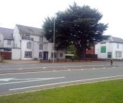
Cedar Tree Hotel
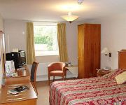
Cathedral Lodge
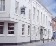
Best Western George
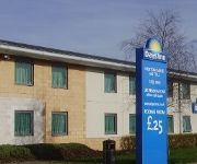
Days Inn Cannock
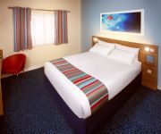
TRAVELODGE RUGELEY
Holiday Inn Express LICHFIELD
Rugeley
Lichfield City Centre
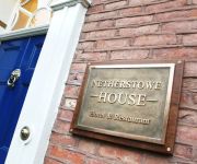
NETHERSTOWE HOUSE
Videos from this area
These are videos related to the place based on their proximity to this place.
The House of Funk at The Feathers in Lichfield
Note: Ok, so I know this isn't gaming related at all, so it kind of goes against the entire point of this channel, but I uploaded it anyway. I uploaded this to YouTube was because the file...
Tier on Tier Plantation Shutters in Lichfield
Tier on Tier Plantation Shutters fitted in Lichfield. These shutters are made from lightweight hardwood and then painted white. This lightweight beautiful timber optimises the performance of...
Lichfield Olympic Torch Relay 2012
30 pre-war British cars lead the Lichfield leg of the Olympic Torch Relay 2012.
Viva Livin Bootcamp Lichfield 500 likes
Viva Livin Bootcamp Lichfield would like to say a massive thank you to everyone who likes our page, this video was shot with no expense spared and is to say thank you to the winner of our prize...
Ansley at Windy Lichfield.MOV
Ansley & Gloryshears morris at windy Lichfield Cathedral Summer? 2012.
St Chads Volunteer Programme
The St Chads Volunteer programme enables young Christians from the linked dioceses of Lichfield, Mecklenberg, West Malaysia and Canada experience life and faith in another part of the world....
Rhythm of Life
Sung by the joint choirs and groups participating at M. Y. Inter-Theatre Companies event 'Inspired' at Lichfield Cathedral, 2013.
Action at Elmhurst Trent Valley
Elmhurst Trent valley is a fictitious station located between Lichfield and Rugeley Trent valley stations . Set in the mid 80's when sectorisation was starting to take a hold of British Rail...
LIVERPOOL CHAMPION 2012(Penalty Shootout 3-2 Carling Cup final 2012: Liverpool v Cardiff city)
แฟนหงส์แดงฉลองแชมป์คาร์ลิ่งคัพแชมป์แรกในปี2012 ถึงแม้จะเป็นถ้วยใบเล็ก...
Sarah & Matthew's Wedding 20150410
Highlights from the wedding disco for Sarah & Matthew McKirdy at The Village Urban Resort, Coventry on 10th April 2015.
Videos provided by Youtube are under the copyright of their owners.
Attractions and noteworthy things
Distances are based on the centre of the city/town and sightseeing location. This list contains brief abstracts about monuments, holiday activities, national parcs, museums, organisations and more from the area as well as interesting facts about the region itself. Where available, you'll find the corresponding homepage. Otherwise the related wikipedia article.
Beaudesert (house)
Beaudesert was an estate and stately home on the southern edge of Cannock Chase in Staffordshire. It was one of the family seats of the Paget family, the Marquesses of Anglesey. The estate was obtained by William Paget, 1st Baron Paget in 1546; the family's other main seat is at Plas Newydd. The estate was broken up by the 6th Marquess of Anglesey due to financial difficulties; as a result the furniture was sold off and the fabric of the hall and stables went to auction.
Edial Hall School
Edial Hall School was a school established in 1735 by Samuel Johnson at Edial, near Lichfield. Here, Johnson taught Latin and Greek to young gentlemen. the funds for the school were provided by his wife, "Tetty" Porter. It only had three pupils, one of whom was David Garrick, and it was only open for about a year, after which Johnson was forced to close it due to a lack of funds.
Prince's Park
Prince's Park is located in the Staffordshire town of Burntwood and is featured in the Guinness Book of Records for being the smallest park in the United Kingdom. It was created to commemorate the marriage of Albert Edward, Prince of Wales and Princess Alexandra of Denmark. There are three trees within its grounds named Faith, Hope and Charity.
Hill Ridware
Hill Ridware is a small village situated in the Lichfield district of Staffordshire, England. It is the largest settlement in the civil parish of Mavesyn Ridware. Facilities in the village include two public houses and the Henry Chadwick Primary School. There is also a village hall that hosts a variety of events. There is also a children's play park and field on the village hall grounds.
Maple Hayes
Maple Hayes is late 18th century manor house, now occupied by a special needs school, near Lichfield, Staffordshire. It is a Grade II listed building. In 1728 a farmhouse stood at Maple Hayes. When the owner William Jesson died in 1732 the estate was shared by his daughters. In 1786 his great nephew sold the estate to George Addams a wine merchant of Lichfield. Addams built a new manor house on the site in 1794.
Armitage Park
Armitage Park (which has recently reverted to an earlier name of Hawkesyard Hall) is a 19th century Grade II listed country house at Armitage near Rugeley, Staffordshire. The estate was purchased by Nathaniel Lister, following his marriage to Martha Fletcher a Lichfield heiress and he built the house in the Gothic Revival style about 1760. Josiah Spode IV, greatgrandson of Josiah Spode bought the estate in about 1840 and the house was much altered and extended.
Armitage railway station
Armitage railway station was a station on the Trent Valley Line, part of what is now known as the West Coast Main Line, and served the village of Armitage in the Midland county of Staffordshire, in England.
Church of St Nicholas, Mavesyn Ridware
The Church of St Nicholas is a Grade I listed parish church in the village of Mavesyn Ridware, Staffordshire, England. The church is situated at the eastern end of the village approximately 370 m north of the River Trent and just to the north of the Gatehouse of the former ancient Manor House. Although medieval in origin the church was partly demolished in 1782 leaving only the north aisle and west tower remaining from the older structure.


