Safety Score: 3,0 of 5.0 based on data from 9 authorites. Meaning we advice caution when travelling to United Kingdom.
Travel warnings are updated daily. Source: Travel Warning United Kingdom. Last Update: 2024-05-03 08:06:06
Discover Hamstall Ridware
Hamstall Ridware in Staffordshire (England) is a town in United Kingdom about 113 mi (or 183 km) north-west of London, the country's capital city.
Current time in Hamstall Ridware is now 08:49 PM (Friday). The local timezone is named Europe / London with an UTC offset of one hour. We know of 9 airports near Hamstall Ridware, of which 5 are larger airports. The closest airport in United Kingdom is Birmingham International Airport in a distance of 22 mi (or 36 km), South. Besides the airports, there are other travel options available (check left side).
There are several Unesco world heritage sites nearby. The closest heritage site in United Kingdom is Pontcysyllte Aqueduct and Canal in a distance of 47 mi (or 75 km), West. Also, if you like playing golf, there are a few options in driving distance. We discovered 2 points of interest in the vicinity of this place. Looking for a place to stay? we compiled a list of available hotels close to the map centre further down the page.
When in this area, you might want to pay a visit to some of the following locations: Walsall, Rodsley, Shirley, Netherseal and Stafford. To further explore this place, just scroll down and browse the available info.
Local weather forecast
Todays Local Weather Conditions & Forecast: 11°C / 52 °F
| Morning Temperature | 10°C / 49 °F |
| Evening Temperature | 10°C / 50 °F |
| Night Temperature | 9°C / 48 °F |
| Chance of rainfall | 7% |
| Air Humidity | 90% |
| Air Pressure | 1006 hPa |
| Wind Speed | Gentle Breeze with 9 km/h (5 mph) from East |
| Cloud Conditions | Overcast clouds, covering 100% of sky |
| General Conditions | Moderate rain |
Saturday, 4th of May 2024
15°C (59 °F)
9°C (49 °F)
Light rain, gentle breeze, broken clouds.
Sunday, 5th of May 2024
16°C (60 °F)
9°C (48 °F)
Light rain, gentle breeze, overcast clouds.
Monday, 6th of May 2024
14°C (58 °F)
9°C (47 °F)
Light rain, gentle breeze, broken clouds.
Hotels and Places to Stay
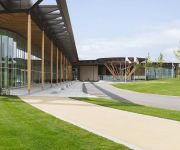
Hilton at St George's Park
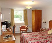
Cathedral Lodge
Wychnor Park Country Club by Diamond Resorts
Cedar Tree Hotel
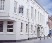
Best Western George
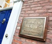
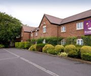
NETHERSTOWE HOUSE
Rugeley
Lichfield City Centre
Lichfield North East (A38)
Videos from this area
These are videos related to the place based on their proximity to this place.
Action at Elmhurst Trent Valley
Elmhurst Trent valley is a fictitious station located between Lichfield and Rugeley Trent valley stations . Set in the mid 80's when sectorisation was starting to take a hold of British Rail...
BforB Rugeley Spotlight - Andy Dick from Global Insolvency Solutions
Andy Dick from Global Insolvency Solutions presents his spotlight at Rugeley BforB, explaining how he helps to turn around the fortunes of struggling owner managed businesses.
BforB Rugeley; Spotlight Presentation: Jonathon Forrester
Jonathon Forrester from Pickerings Solicitors in Tamworth presents a talk about current issues in Employment Law.
Staffordshire Business Briefing - Moving Image Creations Ltd
Paul Woodcock from PJW Accounting Ltd interviews Anthony Green from Moving Image Creations Ltd about his exciting animation business venture.
The Nuts come out for New Year at Yoxall
The Nuts are a five piece band from Staffordshire. The dance floor fills when they play cover versions spanning several decades. Here they are at Yoxall for New Years eve celebrations.
Flying Scotsman Vintage Reliability Trial 2014
Fradley Junction, Staffordshire. Friday 4th April 2014 http://www.endurorally.com/pages/flying-scotsman-rally-2014.
Songkran Festival,2015,Kings Bromley,England
Songkran Festival at Wat Mahathat,Kings Bromley,April 19th,2015,near Burton on Trent,England.Market stalls,Thai New Year festivities,stills from performers.VIP guests.This event well attended...
timelapse T&M kings bromley to rugeley
Timelapse sequence of a cruise from south east of Bridge 54, King's Bromley Wharf to Bridge 64, Rugeley.
Lichfield Golf & Country Club Promotional Video
Lichfield Golf & Country Club Elmhurst Lichfield Staffordshire WS13 8HE Tel: 01543 417 333 http://www.lichfieldgolfandcountryclub.com.
Videos provided by Youtube are under the copyright of their owners.
Attractions and noteworthy things
Distances are based on the centre of the city/town and sightseeing location. This list contains brief abstracts about monuments, holiday activities, national parcs, museums, organisations and more from the area as well as interesting facts about the region itself. Where available, you'll find the corresponding homepage. Otherwise the related wikipedia article.
Hill Ridware
Hill Ridware is a small village situated in the Lichfield district of Staffordshire, England. It is the largest settlement in the civil parish of Mavesyn Ridware. Facilities in the village include two public houses and the Henry Chadwick Primary School. There is also a village hall that hosts a variety of events. There is also a children's play park and field on the village hall grounds.
Hoar Cross Hall
Hoar Cross Hall is a 19th century country mansion situated near the villages of Hoar Cross and Hamstall Ridware, Staffordshire which is operated as an hotel and health spa. It is a Grade II listed building. Hoar Cross was from the early 17th century the firstseat of the Ingram family whose principal residence was Temple Newsam, Yorkshire. In 1661 Henry Ingram was raised as Baron Ingram and Viscount of Irvine. On the death of the 9th Viscount in 1778 the Viscountcy became extinct .
Church of the Holy Angels, Hoar Cross
The Church of the Holy Angels is an Anglican church in Hoar Cross, Staffordshire, England. It is a Grade I listed building.
Armitage railway station
Armitage railway station was a station on the Trent Valley Line, part of what is now known as the West Coast Main Line, and served the village of Armitage in the Midland county of Staffordshire, in England.
Church of St Nicholas, Mavesyn Ridware
The Church of St Nicholas is a Grade I listed parish church in the village of Mavesyn Ridware, Staffordshire, England. The church is situated at the eastern end of the village approximately 370 m north of the River Trent and just to the north of the Gatehouse of the former ancient Manor House. Although medieval in origin the church was partly demolished in 1782 leaving only the north aisle and west tower remaining from the older structure.
Church of St Michael and All Angels, Hamstall Ridware
The Church of St Michael and All Angels is a parish church and Grade I listed building in the village of Hamstall Ridware, Staffordshire. The church is situated in a remote position to the north of the village accessed by a 250 m pathway through pasture land. The church is situated on a gentle slope 160 m west of the River Blithe. The church was founded in 1130—1150 but the majority of the present church was built of ashlar sandstone in the 14th and 15th centuries.


