Safety Score: 3,0 of 5.0 based on data from 9 authorites. Meaning we advice caution when travelling to United Kingdom.
Travel warnings are updated daily. Source: Travel Warning United Kingdom. Last Update: 2024-04-26 08:02:42
Delve into Shepperdine
Shepperdine in South Gloucestershire (England) is located in United Kingdom about 105 mi (or 169 km) west of London, the country's capital town.
Current time in Shepperdine is now 04:41 PM (Friday). The local timezone is named Europe / London with an UTC offset of one hour. We know of 10 airports close to Shepperdine, of which 5 are larger airports. The closest airport in United Kingdom is Bristol Filton Airport in a distance of 10 mi (or 16 km), South. Besides the airports, there are other travel options available (check left side).
There are several Unesco world heritage sites nearby. The closest heritage site in United Kingdom is Blaenavon Industrial Landscape in a distance of 17 mi (or 28 km), North-West. Also, if you like playing golf, there are some options within driving distance. We encountered 1 points of interest near this location. If you need a hotel, we compiled a list of available hotels close to the map centre further down the page.
While being here, you might want to pay a visit to some of the following locations: Hill, Aylburton, Thornbury, Alveston and Falfield. To further explore this place, just scroll down and browse the available info.
Local weather forecast
Todays Local Weather Conditions & Forecast: 11°C / 51 °F
| Morning Temperature | 3°C / 37 °F |
| Evening Temperature | 9°C / 49 °F |
| Night Temperature | 6°C / 43 °F |
| Chance of rainfall | 0% |
| Air Humidity | 61% |
| Air Pressure | 1003 hPa |
| Wind Speed | Gentle Breeze with 7 km/h (4 mph) from South-West |
| Cloud Conditions | Overcast clouds, covering 100% of sky |
| General Conditions | Overcast clouds |
Saturday, 27th of April 2024
6°C (43 °F)
5°C (42 °F)
Moderate rain, moderate breeze, overcast clouds.
Sunday, 28th of April 2024
5°C (41 °F)
4°C (39 °F)
Moderate rain, fresh breeze, overcast clouds.
Monday, 29th of April 2024
12°C (53 °F)
6°C (43 °F)
Light rain, moderate breeze, scattered clouds.
Hotels and Places to Stay
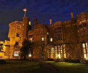
Thornbury Castle
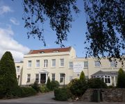
Alveston House
Bristol (Alveston)
TRAVELODGE BRISTOL SEVERN VIEW M48
Videos from this area
These are videos related to the place based on their proximity to this place.
Church Road, Thornbury - pedestrians in danger
In January 2010, South Gloucestershire Council removed two silver birches in Thornbury High Street, claiming that the roots were damaging the pavement and causing pedestrians to trip [although...
The Bonfire (with Guy) at Thornbury Round Table's Family Fireworks Fiesta
On Saturday, 7 November 2009, Thornbury Round Table held its Family Fireworks Fiesta in Mundy Playing Fields. This is the traditional bonfire with an effigy of Guy Fawkes on top. Guy Fawkes...
Fireworks - Fun at Mundy Playing Fields, Thornbury
An overview of the Family Fireworks Fiesta at Mundy Playing Fields, organised by the Thornbury Round Table. On Saturday, 7 November 2009, Thornbury Round Table held its Family Fireworks...
Heritage Open Days 2010 - St. Mary's Church Tower, Thornbury
On Saturday, 11 September 2010, in the afternoon, the church tower of St. Mary the Virgin, Thornbury was open to the public, as part of the Heritage Open Days programme arranged by English...
Wedding at Thornbury Castle 25/8/14
Heres a small wedding firework display we performed at Thornbury Castle on Bank Holiday Monday. Such a beautiful site for fireworks and wedding receptions. Congratulations again to the bride...
Meteors over Thornbury
The Perseids meteor shower was at its peak on the evening of Thursday, 12 August 2010, and there was a new moon to assist viewing. This is what your trusted reporter picked up. Soundtrack...
Clapper bridges in Thornbury
Clapper bridges are simple stone bridges, the most rudimentary being a single stone slab spanning a stream. Soundtrack Louise Morrissey - The Old Rustic Bridge by the Mill stone clapper...
Pollarded willows in the wind - Streamside Walk, Thornbury
Wind in the willows, Thornbury, Bristol BS35 View of the trees moving in the breeze on Saturday, 3 October 2009. These are pollarded willow trees. The Streamside Walk, considered a local...
Thornbury Carnival 2009 - Red Arrows (RAF display team)
The Red Arrows, the Royal Air Force Aerobatic Team, then led by Wing Commander Jase Hawker (ex pupil of Castle School, Thornbury), do a fly past, with vapour trails, over Mundy Playing Fields...
Thornbury's other castle
Hidden away, inside Thornbury's conservation area, there is a listed building, with a stone wall surrounding it and gothic turrets at the wall's corners. You won't see it, if you walk along...
Videos provided by Youtube are under the copyright of their owners.
Attractions and noteworthy things
Distances are based on the centre of the city/town and sightseeing location. This list contains brief abstracts about monuments, holiday activities, national parcs, museums, organisations and more from the area as well as interesting facts about the region itself. Where available, you'll find the corresponding homepage. Otherwise the related wikipedia article.
Morton, Gloucestershire
Morton, split into Upper and Lower Morton, are areas of farmland to the north east of Thornbury, in South Gloucestershire. There is a large farm shop in Upper Morton, while Lower Morton has a lot of cattle farms.
Oldbury-on-Severn
Oldbury-on-Severn is a small village near the mouth of the River Severn in South Gloucestershire. It is home to the nearby Oldbury nuclear power station, a Magnox power station which opened in 1967 and ceased operation on February 29th 2012. The area has been considered for nuclear 'new build' totalling some 3000MWe of capacity - either two or three PWRs.
Rockhampton, Gloucestershire
Rockhampton is a village in South Gloucestershire, England, to the north-east of Thornbury. It has a GL13 postal address, and used to get its mail via Berkeley. The South end of the village is more properly called Newton, and is in the Thornbury, Bristol postal area.
Cowhill, Gloucestershire
Cowhill is a small village south of Oldbury, South Gloucestershire, England. Its most prominent feature is the church, known as Cowhill church (St Arilda).
Shepperdine
Shepperdine is a hamlet on the northern edge of South Gloucestershire, England. It was formerly a popular place due to being located near the River Severn which at this point offers a walk with scenic views of the Severn Bridge a few miles away and the Oldbury power station. However, the new owners of the former pub ('The Windbound') no longer encourage parking there, and other parking provision in the narrow lanes around is very limited.
Hill, Gloucestershire
Hill is a village and civil parish in South Gloucestershire, England, midway between the towns of Thornbury in South Gloucestershire and Berkeley in Gloucestershire. The parish stretches from the banks of the River Severn to an outcrop of the Cotswold escarpment. At the 2001 census, it had a population of 114. Hill has four working farms.
Oldbury Naite
Oldbury Naite is a village in South Gloucestershire, England.
Alvington, Gloucestershire
Not to be confused with the village of Alvington, Somerset 50x40pxThis article needs additional citations for verification. Please help improve this article by adding citations to reliable sources. Unsourced material may be challenged and removed.


