Safety Score: 3,0 of 5.0 based on data from 9 authorites. Meaning we advice caution when travelling to United Kingdom.
Travel warnings are updated daily. Source: Travel Warning United Kingdom. Last Update: 2024-04-18 08:12:24
Delve into Lea
Lea in Herefordshire (England) is located in United Kingdom about 105 mi (or 169 km) west of London, the country's capital town.
Current time in Lea is now 06:14 AM (Friday). The local timezone is named Europe / London with an UTC offset of one hour. We know of 9 airports close to Lea, of which 5 are larger airports. The closest airport in United Kingdom is Gloucestershire Airport in a distance of 14 mi (or 23 km), East. Besides the airports, there are other travel options available (check left side).
There are several Unesco world heritage sites nearby. The closest heritage site in United Kingdom is Blaenavon Industrial Landscape in a distance of 20 mi (or 31 km), South-West. Also, if you like playing golf, there are some options within driving distance. If you need a hotel, we compiled a list of available hotels close to the map centre further down the page.
While being here, you might want to pay a visit to some of the following locations: Linton, Yatton, Walford, Brockhampton and Donnington. To further explore this place, just scroll down and browse the available info.
Local weather forecast
Todays Local Weather Conditions & Forecast: 11°C / 52 °F
| Morning Temperature | 8°C / 46 °F |
| Evening Temperature | 9°C / 48 °F |
| Night Temperature | 6°C / 42 °F |
| Chance of rainfall | 0% |
| Air Humidity | 66% |
| Air Pressure | 1019 hPa |
| Wind Speed | Fresh Breeze with 14 km/h (8 mph) from South-East |
| Cloud Conditions | Overcast clouds, covering 100% of sky |
| General Conditions | Light rain |
Saturday, 20th of April 2024
9°C (48 °F)
3°C (37 °F)
Few clouds, gentle breeze.
Sunday, 21st of April 2024
9°C (48 °F)
2°C (36 °F)
Broken clouds, moderate breeze.
Monday, 22nd of April 2024
9°C (48 °F)
5°C (40 °F)
Broken clouds, gentle breeze.
Hotels and Places to Stay
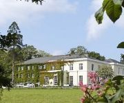
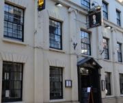
The Malt Shovel Inn
The Chase Classic British Hotel
King's Head
Ross-On-Wye
Videos from this area
These are videos related to the place based on their proximity to this place.
Luxury Holiday Cottages Ross-on-Wye Herefordshire Wharton Lodge
Wharton Lodge Cottages, luxury holiday cottages, Ross-on-Wye in the Wye Valley and Forest of Dean, Herefordshire / Gloucestershire border.
Ringing a quarter-peal at Ross-On-Wye
The start of a quarter peal of Grandsire Triples on the lovely bells at Ross, Herefordshire. The tenor is 20-1-4 in E flat and the bells were cast by Thomas Rudhall, with the 6th recast in...
Punch flight budget DBcam footage
Cheap "DBcam Hi-Resolution Micro Action Sports Video Camera" launched on 0 April 2014 from "Baconur" Ross-on-Wye, Herefordshire. Pretty good performance for the price. For more on this test...
SOTA - Ruardean Hill G/WB-021. 09/08/2012
SOTA activation of Ruardean Hill. Travel by bicycle from home. Round trip of 57 miles and 1040 metres ascent (and descent!) Rig is a MTR by Steve Webber, KD1JV. Antenna is EFHW on a 5 metre...
STORYTELLING COURSE- ASHA Centre 2014
"AND THEY LIVED HAPPILY EVER AFTER" This is an Action 3.1- EuroMed training course for youth leaders and youth workers from the EU and Mediterranean countries. It is the third storytelling...
[[ TRAILER ]] STORYTELLING COURSE- ASHA Centre 2014
link to their story: https://www.youtube.com/watch?v=5NeKcd4nMWg "AND THEY LIVED HAPPILY EVER AFTER" This is an Action 3.1- EuroMed training course for youth leaders and youth workers ...
Ruston Procter SD class Steam Tractor
Here is the first ever steaming of my new Ruston, I have had it 8 years in build, and steamed it today for the first time. I'm so pleased how it run, everything run to plan. Great friends...
Customer Video Review Testimonial at the FBI, Longhope, Glos
Customer Video Review Testimonial at the FBI, Longhope, Glos ON SAT 25TH OCT 2014.
Alan Keef Ltd Open Day 2014
Videos from the yearly open day at the Alan Keef Ltd workshop, in action of the very short demo line were: 1922 Kerr Stuart Wren Class No.4256 Peter Pan, from the Amerton Railway 1916 Motor...
Videos provided by Youtube are under the copyright of their owners.
Attractions and noteworthy things
Distances are based on the centre of the city/town and sightseeing location. This list contains brief abstracts about monuments, holiday activities, national parcs, museums, organisations and more from the area as well as interesting facts about the region itself. Where available, you'll find the corresponding homepage. Otherwise the related wikipedia article.
Weston under Penyard
Weston under Penyard is a small village in Herefordshire, England. It lies on the A40 road two miles east of Ross-on-Wye. The Penyard is a prominent hill. The parish church of St Lawrence has a tall 14th century west tower which had a spire until it was damaged by lightning in 1750. A methodist chapel was constructed during the early 19th century but was disused by 1964. The building was subsequently converted for use as private residence.
Abenhall
Abenhall is a small village in the English county of Gloucestershire, lying on the road between Mitcheldean and Flaxley in the Forest of Dean. The parish includes the settlement of Plump Hill, which is actually more populous than Abenhall itself, and was once part of the Hundred of St Briavels (known as Dene at the time of the Domesday book in 1086).
Mitcheldean
Mitcheldean is a small town in the east of the Forest of Dean, Gloucestershire, England.
Luxley
Luxley is a village in the southwest Midlands of England, on the border between Gloucestershire and Herefordshire near May Hill. Luxley is 12 km southeast of Ross-on-Wye and 18 km west of Gloucester. The name has a number of variations. Victorian maps show Luxtre while current place names include Luxtree Farm and Upper Laxtree.
Gorsley
Gorsley is an area in the southwest Midlands of England, on the border between Gloucestershire and Herefordshire. Gorsley itself is in Gloucestershire, forming part of the civil parish of Gorsley and Kilcot, but nearby Gorsley Common and Little Gorsley are both in Herefordshire. The Anglican church parish is combined with Cliffords Mesne. Gorsley is 7 km west of Newent, 11 km east of Ross-on-Wye and 21 km south of Ledbury.
Beavan's Hill
Beavan's Hill is a village in south east Herefordshire, England. The village is situated on the edge of Withymoor Wood, an area of ancient woodland, and on comparatively high ground forming the watershed between the rivers Wye and Severn. The village is near junction 3 of the M50, one of the first motorways built in Britain. The slip roads on the junction end in right angled turns which often surprise motorists used to the more gradual, modern junction designs.
Weston under Penyard Halt railway station
Weston under Penyard Halt railway station is a disused wood built railway station that served the village of Weston under Penyard in Herefordshire. Opened in 1929 to compete with local road transport it was located on the Great Western Railway line linking Ross-on-Wye and Gloucester. Nothing remains of the station.
Mitcheldean Road railway station
Mitcheldean Road railway station is a disused wood built railway station that served the town of Mitcheldean 1.5 miles to the south and the village of Lea in Herefordshire. Opened in 1855 with the line it was located on the Great Western Railway line linking Ross-on-Wye and Gloucester.


!['[[ TRAILER ]] STORYTELLING COURSE- ASHA Centre 2014' preview picture of video '[[ TRAILER ]] STORYTELLING COURSE- ASHA Centre 2014'](https://img.youtube.com/vi/eL0HF48zMWk/mqdefault.jpg)


