Safety Score: 3,0 of 5.0 based on data from 9 authorites. Meaning we advice caution when travelling to United Kingdom.
Travel warnings are updated daily. Source: Travel Warning United Kingdom. Last Update: 2024-05-01 08:01:32
Explore Brinsley
Brinsley in Nottinghamshire (England) is located in United Kingdom about 117 mi (or 188 km) north-west of London, the country's capital.
Local time in Brinsley is now 11:46 PM (Wednesday). The local timezone is named Europe / London with an UTC offset of one hour. We know of 10 airports in the wider vicinity of Brinsley, of which 5 are larger airports. The closest airport in United Kingdom is Nottingham Airport in a distance of 13 mi (or 20 km), South-East. Besides the airports, there are other travel options available (check left side).
There are several Unesco world heritage sites nearby. The closest heritage site in United Kingdom is Liverpool – Maritime Mercantile City in a distance of 29 mi (or 46 km), North-East. Also, if you like golfing, there are multiple options in driving distance. If you need a place to sleep, we compiled a list of available hotels close to the map centre further down the page.
Depending on your travel schedule, you might want to pay a visit to some of the following locations: Nottingham, Derby, Matlock, Wales and Todwick. To further explore this place, just scroll down and browse the available info.
Local weather forecast
Todays Local Weather Conditions & Forecast: 17°C / 62 °F
| Morning Temperature | 9°C / 48 °F |
| Evening Temperature | 16°C / 61 °F |
| Night Temperature | 10°C / 50 °F |
| Chance of rainfall | 3% |
| Air Humidity | 76% |
| Air Pressure | 1008 hPa |
| Wind Speed | Moderate breeze with 9 km/h (6 mph) from South |
| Cloud Conditions | Broken clouds, covering 63% of sky |
| General Conditions | Moderate rain |
Thursday, 2nd of May 2024
16°C (61 °F)
10°C (50 °F)
Light rain, moderate breeze, overcast clouds.
Friday, 3rd of May 2024
11°C (52 °F)
9°C (47 °F)
Moderate rain, moderate breeze, overcast clouds.
Saturday, 4th of May 2024
13°C (56 °F)
8°C (47 °F)
Light rain, moderate breeze, overcast clouds.
Hotels and Places to Stay
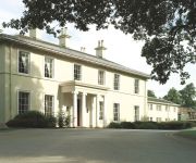
Eastwood Hall
mour
The Derbyshire PH Hotels
THE NOTTINGHAM BELFRY-QHOTELS
TRAVELODGE NOTTINGHAM TROWELL M1
TRAVELODGE ALFRETON
Independent (SPHC) THE DERBYSHIRE HOTEL
Mansfield
Ripley
Videos from this area
These are videos related to the place based on their proximity to this place.
Kawasaki VN 1500 C2 1997 My wife's 1st & Last ride on my bike
My wife wanted to have ago on my motorcycle before it was sold on eBay , as you hear she quite liked it. This video was taken on the grounds at MFN on the 10th September 2011.
Treasure Island Title Sequence
Title sequence filmed at Giltbrook Studios in HD with Creative Director Chris Brett. The materials were all sourced and purchased specifically for the sequence and the titles were hand carved...
Hilltop Eastwood Drive Thru 1
This car reversed off of the car park and ended up in my shop window 19/Nov/2010 13.30.
Midland General buses operating from Langley Mill Garage, Ilkeston and Heanor Market Places
Additional 1960's footage of Midland General buses operating from the Langley Mill garage in the 1960's locations include Heanor market place and Ilkeston market place. Also featured is some...
Blend Heanor Opening
The Blend Youth Project in Heanor is opened by Nigel Mills MP. Take a look round at the facilities.
Heanor iPad drawings - 12th February 2011
iPad Brushes field study test - Springtime for Heanor - year 5 The other week I entered the fifth year of this project-within-a-project, still learning how to deal with 'site', still learning...
The Big Lift
The Lifting of the Great northen Carriage out of the car park of the Stoneyford Lodge, Heanor, Derbyshire 1994 www.lner-svr-coachfund.org.uk.
Videos provided by Youtube are under the copyright of their owners.
Attractions and noteworthy things
Distances are based on the centre of the city/town and sightseeing location. This list contains brief abstracts about monuments, holiday activities, national parcs, museums, organisations and more from the area as well as interesting facts about the region itself. Where available, you'll find the corresponding homepage. Otherwise the related wikipedia article.
Ashfield
Ashfield is a local government district in western Nottinghamshire, England. According to the 2001 UK census, it has a population of 111,387. The district is mostly urban and contains parts of both the Nottingham Urban Area and the Mansfield Urban Area. The area has a tradition of coal mining. There are three towns in the district; the largest being Sutton-in-Ashfield.
Erewash Canal
The Erewash Canal is a broad canal in Derbyshire, England. It runs just under 12 miles and has 14 locks. The first lock at Langley Bridge is actually part of the Cromford Canal.
Langley Mill railway station
Langley Mill railway station (formerly Langley Mill and Eastwood) on the Erewash Valley Line serves the village of Langley Mill and the towns of Heanor in Derbyshire and Eastwood in Nottinghamshire, England. The station isBad rounding here{{#invoke:Math|precision_format| 19*1,000/1,609.344 | 1-1 }} miles (19 km) north of Nottingham. The station lies between Nottingham and Sheffield and is managed by East Midlands Trains.
A610 road
The A610 is an A-road in England, which runs from Nottingham to Ambergate, where it joins the A6.
Eastwood and Langley Mill railway station
Eastwood and Langley Mill railway station was a former railway station to serve the villages of Eastwood and Langley Mill . It was opened by the Great Northern Railway (Great Britain) on its Derbyshire Extension in 1875-6. It lay on the branch from Awsworth Junction, where it crossed the Giltbrook Viaduct, on the way to Pinxton. At the time it was in Nottinghamshire, but since recent boundary changes it would now be in Derbyshire.
D.H. Lawrence Heritage
D.H. Lawrence Heritage is a heritage attraction about the English writer, playwright and poet D. H. Lawrence. It consists of two sites which are in walking distance to each other: the D.H. Lawrence Birthplace Museum and Durban House Heritage Centre . D.H. Lawrence Heritage is situated in the writer's hometown Eastwood, Nottinghamshire and managed by Broxtowe Borough Council.
D.H. Lawrence Birthplace Museum
The D.H. Lawrence Birthplace Museum is a museum dedicated to the writer D.H. Lawrence situated in Eastwood, Nottinghamshire, near Nottingham. It is the house in which he was born in 1885 and one of the four houses the family occupied in Eastwood. Like its sister site Durban House Heritage Centre it belongs to D.H. Lawrence Heritage and is managed by Broxtowe Borough Council.
Durban House Heritage Centre
D. H. Lawrence Heritage Centre was formally known as the Durban House Heritage Centre and is the sister site of the D.H. Lawrence Birthplace Museum in Eastwood, near Nottingham. Both sites collectively go under the name of D.H. Lawrence Heritage. The D.H. Lawrence Heritage Centre contains an exhibition on the social history of Eastwood during the time that the writer lived there, including information on the educational system, mining, trams, retail along with D.H.


