Safety Score: 3,0 of 5.0 based on data from 9 authorites. Meaning we advice caution when travelling to United Kingdom.
Travel warnings are updated daily. Source: Travel Warning United Kingdom. Last Update: 2024-04-28 08:22:10
Touring Kimberley
Kimberley in Nottinghamshire (England) with it's 11,273 residents is a town located in United Kingdom about 113 mi (or 181 km) north-west of London, the country's capital place.
Time in Kimberley is now 04:24 AM (Monday). The local timezone is named Europe / London with an UTC offset of one hour. We know of 10 airports nearby Kimberley, of which 5 are larger airports. The closest airport in United Kingdom is Nottingham Airport in a distance of 9 mi (or 14 km), South-East. Besides the airports, there are other travel options available (check left side).
There are several Unesco world heritage sites nearby. The closest heritage site in United Kingdom is Liverpool – Maritime Mercantile City in a distance of 31 mi (or 50 km), North. Also, if you like the game of golf, there are several options within driving distance. Need some hints on where to stay? We compiled a list of available hotels close to the map centre further down the page.
Being here already, you might want to pay a visit to some of the following locations: Nottingham, Derby, Matlock, Glenfield and Wales. To further explore this place, just scroll down and browse the available info.
Local weather forecast
Todays Local Weather Conditions & Forecast: 13°C / 55 °F
| Morning Temperature | 5°C / 41 °F |
| Evening Temperature | 11°C / 51 °F |
| Night Temperature | 10°C / 51 °F |
| Chance of rainfall | 1% |
| Air Humidity | 78% |
| Air Pressure | 1011 hPa |
| Wind Speed | Fresh Breeze with 15 km/h (9 mph) from North |
| Cloud Conditions | Overcast clouds, covering 100% of sky |
| General Conditions | Light rain |
Tuesday, 30th of April 2024
14°C (58 °F)
9°C (48 °F)
Light rain, fresh breeze, broken clouds.
Wednesday, 1st of May 2024
15°C (59 °F)
12°C (53 °F)
Light rain, gentle breeze, overcast clouds.
Thursday, 2nd of May 2024
14°C (56 °F)
11°C (52 °F)
Light rain, moderate breeze, overcast clouds.
Hotels and Places to Stay
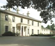
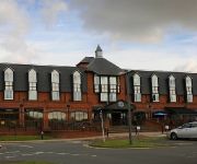
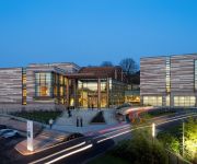
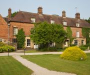
THE NOTTINGHAM BELFRY-QHOTELS
Eastwood Hall
DoubleTree by Hilton Nottingham - Gateway
VILLAGE NOTTINGHAM
mour
JCT.25 Holiday Inn DERBY - NOTTINGHAM M1
De Vere Venues The Orchard
Novotel Nottingham Derby
Risley Hall Hotel and Spa
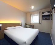
TRAVELODGE NOTTINGHAM TROWELL M1
Videos from this area
These are videos related to the place based on their proximity to this place.
Tour of Britain 2012 (Stage 2) through Ilkeston Derbyshire
Tour of Britain 2012 (Stage 2) through Ilkeston Derbyshire.
Duchess of Sutherland in the Erewash Valley, nr Ilkeston.
Duchess of Sutherland in the Erewash Valley, nr Ilkeston. Passes under Bennerley Viaduct .
Swancar Farm Country House - Your Wedding
http://www.timephotographic.co.uk - Follow the beautiful stories of three different couples as they tie the knot at Swancar Farm Country House All images copyright Time Photographic.
A Walk Through The Fair 2013
The 761st Charter Fair in Ilkeston town centre on Saturday 19th October 2013. It was on April 10th 1252 that King Henry III granted a charter to Hugh de Muskham that granted the lord of the...
Earl of Mount Edgcumbe
5043 Earl of Nount Edgcumbe passes under Bennerley Viaduct Ilkeston 25 April 2009, working The City of York charter.
Comfortably Numb performed by Ray Hatfield
"Comfortably Numb" performed by "Ray Hatfield" at "The Harrow" in Ilkeston, Derbyshire UK.
Graphics Gone Wrong - A Rude Awakening
A clip from a longer conversation about graphic logo design. See the full video or listen to audio at http://www.ilkestonwebdesign.com/dd1.
The Glamper Arch Cabin - Moving into place on the show site
We have now got a Glamper Cabin on display at our show site in Ilkeston. This is one of the Camping Cabin range of buildings we are targeting at camp site owners looking to add a luxurious...
Videos provided by Youtube are under the copyright of their owners.
Attractions and noteworthy things
Distances are based on the centre of the city/town and sightseeing location. This list contains brief abstracts about monuments, holiday activities, national parcs, museums, organisations and more from the area as well as interesting facts about the region itself. Where available, you'll find the corresponding homepage. Otherwise the related wikipedia article.
Edge Hill Light Railway
The Edge Hill Light Railway, one of Colonel Stephens' railways, was in Warwickshire, England. It was designed to carry iron ore from Edge Hill Quarries to Burton Dassett where a junction was made with the Stratford-upon-Avon and Midland Junction Railway. It was never officially opened, but began operating in 1922. In the middle of the line, there was a cable-worked Inclined Plane at 1 in 6 (16%).
Kimberley Town F.C
Kimberley Town Football Club was a football club based in Kimberley, Nottinghamshire, England. They joined the Midland League in 1971. They reached the Second Round of the FA Vase three times. In the summer of 2012 the club resigned from the Central Midlands League South Division and folded. Their last manager was ex-pro Paul Rawden.
Kimberley East railway station
Kimberley East Railway Station was a station serving the town of Kimberley in Nottinghamshire, England.
Awsworth railway station
Awsworth railway station was a former railway station in Awsworth, Nottinghamshire. It was opened by the Great Northern Railway on its Derbyshire and Staffordshire Extension in 1875-6.
Swingate, Nottinghamshire
Swingate is a small English village positioned in the centre of Kimberley and Babbington. It is a parish within Broxtowe Borough Council.
Kimberley West railway station
Kimberley West railway station was a station serving the town of Kimberley in Nottinghamshire, England. It was built in 1882 for the Midland Railways Basford to Bennerley Junction branch, at a cost of £2,495 15s 7d, designed by Charles Trubshaw who went on to become a major railway architect. It was designed according to the Arts and Crafts movement to resemble artisan cottages.
Watnall railway station
Watnall railway station was a station serving the village of Watnall in Nottinghamshire, England. The station, which closed in 1917, was at the eastern end of the railway cutting used to provide the Midland Railway with a route through to Kimberley. The cutting still exists although it is heavily overgrown. Remnants of the platform can be found beneath the undergrowth but the buildings are no longer in existence.
Giltbrook Viaduct
Giltbrook Viaduct was a railway viaduct built in the Erewash Valley between Awsworth and Giltbrook in Nottinghamshire. It was demolished in 1973 to make way for the A610 bypass.


