Safety Score: 3,0 of 5.0 based on data from 9 authorites. Meaning we advice caution when travelling to United Kingdom.
Travel warnings are updated daily. Source: Travel Warning United Kingdom. Last Update: 2024-04-24 08:14:40
Delve into Marr
Marr in Doncaster (England) with it's 138 habitants is a town located in United Kingdom about 148 mi (or 238 km) north of London, the country's capital town.
Time in Marr is now 03:26 AM (Thursday). The local timezone is named Europe / London with an UTC offset of one hour. We know of 10 airports closer to Marr, of which 5 are larger airports. The closest airport in United Kingdom is Robin Hood Doncaster Sheffield Airport in a distance of 10 mi (or 16 km), South-East. Besides the airports, there are other travel options available (check left side).
There are several Unesco world heritage sites nearby. The closest heritage site in United Kingdom is Liverpool – Maritime Mercantile City in a distance of 13 mi (or 21 km), South-East. Also, if you like the game of golf, there are some options within driving distance. In need of a room? We compiled a list of available hotels close to the map centre further down the page.
Since you are here already, you might want to pay a visit to some of the following locations: South Elmsall, North Elmsall, Doncaster, Upton and Norton. To further explore this place, just scroll down and browse the available info.
Local weather forecast
Todays Local Weather Conditions & Forecast: 9°C / 48 °F
| Morning Temperature | 6°C / 43 °F |
| Evening Temperature | 8°C / 46 °F |
| Night Temperature | 3°C / 37 °F |
| Chance of rainfall | 0% |
| Air Humidity | 57% |
| Air Pressure | 1003 hPa |
| Wind Speed | Gentle Breeze with 8 km/h (5 mph) from South |
| Cloud Conditions | Overcast clouds, covering 95% of sky |
| General Conditions | Light rain |
Friday, 26th of April 2024
10°C (49 °F)
4°C (39 °F)
Overcast clouds, gentle breeze.
Saturday, 27th of April 2024
8°C (47 °F)
7°C (44 °F)
Light rain, gentle breeze, overcast clouds.
Sunday, 28th of April 2024
11°C (53 °F)
9°C (49 °F)
Moderate rain, gentle breeze, overcast clouds.
Hotels and Places to Stay
JCT.36 Holiday Inn DONCASTER A1 (M)
Best Western Pastures
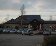
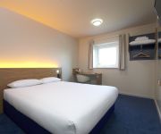
TRAVELODGE DONCASTER
Videos from this area
These are videos related to the place based on their proximity to this place.
Mexborough cooling towers tumble
Early 80s, early morning; the twin cooling towers of Mexborough Power Station are demolished. Video by Peter Lee using a b/w video recorder. Full story on www.mexboroughheritage.co.uk.
Mexborough Foodbank opening 28/11/2014
Food Aware CIC launched their Mexborough Foodbank on the 28th of November 2014, providing less fortunate people with food. Sean Gibbons, Managing Director, talks about the social enterprise...
Conisbrough-Edlington Tunnel URbex
Derelict 'ickle tunnel that runs between Edlington & Conisbrough, South Yorkshire, UK. Around 1290 yards long, Complete with a number of airshafts & brick-lined for part of the way- bare...
Father Bush Visits Conisbrough Castle
Father Bush, accompanied by Father Stephens and Bernard Moran, discovered his first castle in England and was so impressed with it, he thought it would be a grand idea to have a second collection...
Flash Flooding in Conisbrough (Time Lapse)
August 25 2012 - a little bit of rain quickly turns Station Road into Station River. Video taken on iPhone using time lapse at 1 shot per second. Within 10 minutes the water level has risen...
crazy richard batey riding steatly's new jump
ritch doing steetly new mad jump CRAZY conisbrough / doncaster.
Videos provided by Youtube are under the copyright of their owners.
Attractions and noteworthy things
Distances are based on the centre of the city/town and sightseeing location. This list contains brief abstracts about monuments, holiday activities, national parcs, museums, organisations and more from the area as well as interesting facts about the region itself. Where available, you'll find the corresponding homepage. Otherwise the related wikipedia article.
Brodsworth Hall
Brodsworth Hall, near Brodsworth, five miles north-west of Doncaster in South Yorkshire, is one of the most complete surviving examples of a Victorian country house in England. It is virtually unchanged since the 1860s. It was designed in the Italianate style by the London architect Philip Wilkinson, then 26 years old. He was commissioned for the grand residence by Charles Sabine Augustus Thellusson, who inherited the estate in 1859.
Brodsworth Colliery
Brodsworth Colliery was a colliery near Woodlands, South Yorkshire, England that operated from 1906, when the pit was sunk, to 1990. It was known for Woodlands, a high-quality model village constructed for its workers. The colliery was consistently amongst those that employed the most miners in Britain, employing around 2,800 workers throughout the 1980s. The pit site is soon to be redeveloped for housing.
Highfields, South Yorkshire
Highfields is a former coal mining village, located south of the model village of Woodlands, in the English county of South Yorkshire. It is part of the Metropolitan Borough of Doncaster. Although it does not currently have an air of prosperity, Highfields was built so that most houses either overlooked farmland or woodland (and an ornamental lake - Highfields Lake) or the greens in the centre of the village.
St James' Church, High Melton
St James' Church, High Melton, is a parish church in the Church of England in High Melton.
Pickburn
Pickburn is a hamlet in South Yorkshire, England, close to the village of Brodsworth and Brodsworth Hall. The hamlet appears to get its name from the small stream "Pick Burn" (or river Pick) which flows through it on its way to Highfields Lake, in the Woodlands wildlife park. At the time of Kirkby's Inquest, Pickburn was held by the Wasteneys and the Lyvets.
Doncaster Business School
Doncaster Business School is the international business school of Doncaster College, England. Established in 1992, as Dearne Valley Business School, the School offers postgraduate business degrees in management, including MBAs and professional qualifications as well as undergraduate teaching.
Marr, South Yorkshire
Marr is a village and civil parish in the Metropolitan Borough of Doncaster in South Yorkshire, England. It has a population of 138. It was in the historical county of the West Riding and is listed in the Domesday Book (Domesday Book 307d) complied in 1086 at the command of William the Conqueror at reference 307d. During feudal times, and even beyond, the manor was the basic administrative unit of the kingdom.
High Melton
High Melton is a village and civil parish in the Metropolitan Borough of Doncaster in South Yorkshire, England. It has a population of 339.


