Safety Score: 3,0 of 5.0 based on data from 9 authorites. Meaning we advice caution when travelling to United Kingdom.
Travel warnings are updated daily. Source: Travel Warning United Kingdom. Last Update: 2024-04-28 08:22:10
Discover Stanton Gate
Stanton Gate in Derbyshire (England) is a place in United Kingdom about 111 mi (or 179 km) north-west of London, the country's capital city.
Current time in Stanton Gate is now 01:14 AM (Monday). The local timezone is named Europe / London with an UTC offset of one hour. We know of 10 airports near Stanton Gate, of which 5 are larger airports. The closest airport in United Kingdom is East Midlands Airport in a distance of 8 mi (or 14 km), South. Besides the airports, there are other travel options available (check left side).
There are several Unesco world heritage sites nearby. The closest heritage site in United Kingdom is Derwent Valley Mills in a distance of 33 mi (or 52 km), East. Also, if you like playing golf, there are a few options in driving distance. If you need a hotel, we compiled a list of available hotels close to the map centre further down the page.
While being here, you might want to pay a visit to some of the following locations: Nottingham, Derby, Glenfield, Matlock and Leicester. To further explore this place, just scroll down and browse the available info.
Local weather forecast
Todays Local Weather Conditions & Forecast: 12°C / 54 °F
| Morning Temperature | 5°C / 40 °F |
| Evening Temperature | 11°C / 52 °F |
| Night Temperature | 10°C / 49 °F |
| Chance of rainfall | 1% |
| Air Humidity | 77% |
| Air Pressure | 1012 hPa |
| Wind Speed | Fresh Breeze with 14 km/h (9 mph) from North |
| Cloud Conditions | Broken clouds, covering 83% of sky |
| General Conditions | Light rain |
Tuesday, 30th of April 2024
16°C (60 °F)
9°C (48 °F)
Light rain, moderate breeze, scattered clouds.
Wednesday, 1st of May 2024
16°C (62 °F)
11°C (53 °F)
Light rain, gentle breeze, scattered clouds.
Thursday, 2nd of May 2024
12°C (54 °F)
10°C (51 °F)
Moderate rain, moderate breeze, overcast clouds.
Hotels and Places to Stay
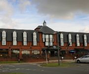
THE NOTTINGHAM BELFRY-QHOTELS
VILLAGE NOTTINGHAM
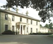
Eastwood Hall
JCT.25 Holiday Inn DERBY - NOTTINGHAM M1
Novotel Nottingham Derby
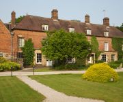
Risley Hall Hotel and Spa
De Vere Venues The Orchard
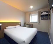
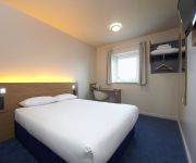
TRAVELODGE NOTTINGHAM TROWELL M1
TRAVELODGE NOTTINGHAM WOLLATON PARK
Nottingham West
Videos from this area
These are videos related to the place based on their proximity to this place.
Tour of Britain 2012 (Stage 2) through Ilkeston Derbyshire
Tour of Britain 2012 (Stage 2) through Ilkeston Derbyshire.
Swancar Farm Country House - Your Wedding
http://www.timephotographic.co.uk - Follow the beautiful stories of three different couples as they tie the knot at Swancar Farm Country House All images copyright Time Photographic.
A Walk Through The Fair 2013
The 761st Charter Fair in Ilkeston town centre on Saturday 19th October 2013. It was on April 10th 1252 that King Henry III granted a charter to Hugh de Muskham that granted the lord of the...
Comfortably Numb performed by Ray Hatfield
"Comfortably Numb" performed by "Ray Hatfield" at "The Harrow" in Ilkeston, Derbyshire UK.
Graphics Gone Wrong - A Rude Awakening
A clip from a longer conversation about graphic logo design. See the full video or listen to audio at http://www.ilkestonwebdesign.com/dd1.
Stapleford Town Council Meeting 05/09/2014
This Meeting has been rescheduled to enable the Town Council to consider adding a Standing Order in line with the legislation which allows Members of the Public to film/record Town council...
Malossi MHR 221cc Vespa PX 200 Rally 200 Cylinder Kit
http://www.scooter-center.com/product/1120002MHR60 Malossi comes with new MHR 221cc cylinder kit for Vespa PX 200 Blog EN: ...
Videos provided by Youtube are under the copyright of their owners.
Attractions and noteworthy things
Distances are based on the centre of the city/town and sightseeing location. This list contains brief abstracts about monuments, holiday activities, national parcs, museums, organisations and more from the area as well as interesting facts about the region itself. Where available, you'll find the corresponding homepage. Otherwise the related wikipedia article.
Broxtowe
Broxtowe is a local government district with borough status in Nottinghamshire, England, west of the City of Nottingham. It is part of the Greater Nottingham metropolitan area. Broxtowe's neighbour to the west is the borough of Erewash, which is in Derbyshire.
Nottingham Canal
The Nottingham Canal was a 23.6 kilometres long canal between Langley Mill in Derbyshire and Nottingham, England. It opened in 1796, and most of it was closed in 1937. The southern section is now part of the River Trent Navigation, and the northern section is a nature reserve.
Sandiacre Town F.C
Sandiacre Town Football Club is a football club based in Sandiacre, England. For the 2012–13 season, the club play in the Midlands Regional Alliance Premier Division.
British Cartographic Society
The British Cartographic Society (BCS) is an association of individuals and organisations dedicated to exploring and developing the world of maps. It is a registered charity. Membership includes mapping companies, publishers, designers, academics, researchers, map curators, individual cartographers, GIS specialists and ordinary members of the public with an interest in maps.
St. Helen's Church, Stapleford
St. Helen's Church Stapleford is a parish church in the Church of England in Stapleford, Nottinghamshire. The church is Grade II* listed by the Department for Culture, Media & Sport as it is a particularly significant building of more than local interest.
St. Luke's Church, Stapleford
St. Luke's Church Stapleford is a parish church in the Church of England in Stapleford, Nottinghamshire.
Erewash Museum
The Erewash Museum is a museum in the town of Ilkeston, Erewash, in Derbyshire, England. The building that houses the museum is named the Dalby House after one of the families who inhabited it, and has served as a school and a private dwelling. The museum opened in the 1980s, and focuses on the history of the Erewash area, with exhibits covering World War II, archaeology, and the Stanton Ironworks.
Ilkeston Junction and Cossall railway station
Ilkeston Junction and Cossall railway station was a railway station which served the town of Ilkeston in Derbyshire, England. It was opened in 1847 by the Midland Railway on the Erewash Valley Line at the junction of a short branch to the town itself. The station became known locally as Ilkeston Junction, and when first built it was literally in the middle of nowhere, with no road leading from it to either Cossall or Ilkeston.


