Safety Score: 3,0 of 5.0 based on data from 9 authorites. Meaning we advice caution when travelling to United Kingdom.
Travel warnings are updated daily. Source: Travel Warning United Kingdom. Last Update: 2024-04-19 08:03:45
Delve into Draycott
Draycott in Derbyshire (England) is located in United Kingdom about 109 mi (or 175 km) north-west of London, the country's capital town.
Current time in Draycott is now 05:08 PM (Friday). The local timezone is named Europe / London with an UTC offset of one hour. We know of 10 airports close to Draycott, of which 5 are larger airports. The closest airport in United Kingdom is East Midlands Airport in a distance of 5 mi (or 7 km), South. Besides the airports, there are other travel options available (check left side).
There are several Unesco world heritage sites nearby. The closest heritage site in United Kingdom is Derwent Valley Mills in a distance of 36 mi (or 58 km), East. Also, if you like playing golf, there are some options within driving distance. If you need a hotel, we compiled a list of available hotels close to the map centre further down the page.
While being here, you might want to pay a visit to some of the following locations: Derby, Nottingham, Glenfield, Netherseal and Matlock. To further explore this place, just scroll down and browse the available info.
Local weather forecast
Todays Local Weather Conditions & Forecast: 12°C / 54 °F
| Morning Temperature | 9°C / 48 °F |
| Evening Temperature | 7°C / 45 °F |
| Night Temperature | 3°C / 37 °F |
| Chance of rainfall | 0% |
| Air Humidity | 67% |
| Air Pressure | 1016 hPa |
| Wind Speed | Fresh Breeze with 15 km/h (9 mph) from South-East |
| Cloud Conditions | Scattered clouds, covering 43% of sky |
| General Conditions | Light rain |
Saturday, 20th of April 2024
10°C (50 °F)
2°C (36 °F)
Broken clouds, moderate breeze.
Sunday, 21st of April 2024
8°C (47 °F)
2°C (36 °F)
Overcast clouds, gentle breeze.
Monday, 22nd of April 2024
4°C (39 °F)
5°C (41 °F)
Light rain, light breeze, overcast clouds.
Hotels and Places to Stay
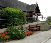
Morley Hayes
East Midlands Airport Radisson Blu Hotel
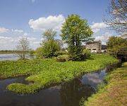
The Priest House on the River
Hilton East Midlands Airport
Best Western Premier East Midlands Airport Yew Lodge Hotel
Donington Park Farmhouse Hotel
Kegworth Hotel & Conference Centre
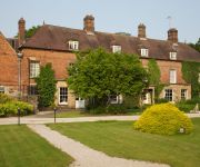
Risley Hall Hotel and Spa
Days Inn Donnington Welcome Break Service Area
Jurys Inn East Midlands Airport
Videos from this area
These are videos related to the place based on their proximity to this place.
Green Squeeze Question Time - Part One
This is the first of a two part video on the Green Squeeze Question Time event at which Erewash parliamentary candidates were invited to answer questions from the public on the regeneration...
LMS 46233 Duchess of Sutherland passes Borrowash 14.06.14
A poor vantage point but Severn Trent conspired to prevent access my chosen location and I had to make a very quick compromise. Still, she looks impressive for the few seconds that she took...
funny-man jumps into canal shardlow
crazy man jumps into canal for fifty pound to go to charity then he has to play in his ban in the same wet clothes for half an hour.recorded with my motorola razr v3i at the clock wharehouse...
AR.Drone 2.0 - With In Flight sound - Flying over Breaston Village Green - Recorded to USB .MP4
First Flights in open space. Day was fairly windy (As you can see by trees and flag flying) but the quad copter did well to fly. All the reasons for crashing were mine in the making! This is...
Children having fun in Plastic Bubble Balls - Playing and Walking on water !!
This is a yearly May Bank Holiday event that is held in the village of Breaston in Derbyshire. Come sun or rain this event is really worth a visit. Breaston has a large Village Green and this...
AR Drone 2.0 - With sound recorded from ground. 360 Flips / Barrel rolls. Flying over Village Green
Getting more used to flight in open space. The evening was breezy (As you can see by trees and flag flying) but the quad copter did well in flight. No crashes this time! The original video...
in HD - Parrot AR Drone 2.0 - All Unboxed. Assembling the two part battery charger. Part 2 of 2.
When you buy the AR Drone 2.0 - you will get within the box various countries power adapters. Here I show the UK adapter being fitted to the Battery Charger. Please check the Parrot web site...
Driving against oncoming traffic
Cavendish Bridge, Shardlow. Car decides to run the lights on a one way bridge system.
Videos provided by Youtube are under the copyright of their owners.
Attractions and noteworthy things
Distances are based on the centre of the city/town and sightseeing location. This list contains brief abstracts about monuments, holiday activities, national parcs, museums, organisations and more from the area as well as interesting facts about the region itself. Where available, you'll find the corresponding homepage. Otherwise the related wikipedia article.
Erewash
Erewash is a local government district and borough in eastern Derbyshire, England, to the east of Derby and the west of Nottingham. It contains the towns of Ilkeston, Long Eaton and Sandiacre and fourteen civil parishes. The borough was formed on 1 April 1974 by the merger of the Borough of Ilkeston, the Long Eaton urban district and part of South East Derbyshire Rural District.
Erewash (UK Parliament constituency)
Erewash (is a county constituency represented in the House of Commons of the U.K. Parliament.
Great Wilne
Great Wilne is a small village in Derbyshire, England on the border with Leicestershire. It is 7 miles south east of Derby. It is a village split from its church of St Chad's by the river. The church is at the very small hamlet of Church Wilne which can only be approached by a short walk via the bridge over the River Derwent, or by a fair car journey which necessitates travelling out of the county.
Draycott and Breaston railway station
For the station in Somerset, see Draycott railway station (Somerset). Draycott railway stationLocationPlace DraycottArea ErewashOperationsOriginal company Midland Counties RailwayPre-grouping Midland RailwayPost-grouping Midland Main LineBritish RailwaysHistory1852 Opened1966 ClosedDisused railway stations in the United Kingdom 32x28px UK Railways portal Draycott railway station was a station which served the village of Draycott, Derbyshire, England.
Risley Hall, Derbyshire
Risley Hall is an 11th century country house hotel and spa set in 17 acres of private landscaped grounds in the Derbyshire countryside, close to Junction 25 of the M1. It comprises 35 bedrooms and several function rooms. The building's main function is as a hotel and spa, but they also cater for weddings, which take place in the 16th century church-like Baronial Hall, crafted with high-rafted ceilings and mullion windows.
Derwent Mouth
Derwent Mouth is a location on the River Trent, which at that point forms the border between the English counties of Derbyshire and Leicestershire. It is both the confluence of the River Derwent with the River Trent, and the point at which the Trent and Mersey Canal joins the natural River Trent. Derwent Mouth is situated some 1-mile east of Shardlow, and 2 miles west of Trent Lock, where the navigable River Soar and Erewash Canal join the River Trent.
Western Mere Secondary School
Western Mere Secondary School was a school in Breaston, Derbyshire. Established in 1957, the school was located on Gregory Avenue until it was closed in 1990 and demolished in 1992. The area is now used a grazing area for horses, though the old school is still visible on the ground with the floors still visible. {{#invoke:Coordinates|coord}}{{#coordinates:52.898403|-1.326808|region:GB_type:landmark|||||| |primary |name= }}
Shardlow and Great Wilne
Shardlow and Great Wilne is a civil parish in the South Derbyshire district of the English county of Derbyshire. Shardlow and Great Wilne are the main settlements in the parish.


