Safety Score: 3,0 of 5.0 based on data from 9 authorites. Meaning we advice caution when travelling to United Kingdom.
Travel warnings are updated daily. Source: Travel Warning United Kingdom. Last Update: 2024-05-03 08:06:06
Explore Blackwell
Blackwell in Derbyshire (England) with it's 3,037 inhabitants is located in United Kingdom about 122 mi (or 197 km) north-west of London, the country's capital.
Local time in Blackwell is now 12:25 PM (Friday). The local timezone is named Europe / London with an UTC offset of one hour. We know of 10 airports in the wider vicinity of Blackwell, of which 5 are larger airports. The closest airport in United Kingdom is Nottingham Airport in a distance of 17 mi (or 28 km), South-East. Besides the airports, there are other travel options available (check left side).
There are several Unesco world heritage sites nearby. The closest heritage site in United Kingdom is Liverpool – Maritime Mercantile City in a distance of 24 mi (or 39 km), North-East. Also, if you like golfing, there are multiple options in driving distance. If you need a place to sleep, we compiled a list of available hotels close to the map centre further down the page.
Depending on your travel schedule, you might want to pay a visit to some of the following locations: Matlock, Wales, Derby, Nottingham and Todwick. To further explore this place, just scroll down and browse the available info.
Local weather forecast
Todays Local Weather Conditions & Forecast: 11°C / 52 °F
| Morning Temperature | 9°C / 48 °F |
| Evening Temperature | 10°C / 50 °F |
| Night Temperature | 9°C / 48 °F |
| Chance of rainfall | 1% |
| Air Humidity | 93% |
| Air Pressure | 1006 hPa |
| Wind Speed | Gentle Breeze with 8 km/h (5 mph) from North-East |
| Cloud Conditions | Overcast clouds, covering 100% of sky |
| General Conditions | Light rain |
Saturday, 4th of May 2024
12°C (54 °F)
9°C (49 °F)
Light rain, moderate breeze, overcast clouds.
Sunday, 5th of May 2024
15°C (60 °F)
10°C (50 °F)
Light rain, gentle breeze, overcast clouds.
Monday, 6th of May 2024
11°C (52 °F)
9°C (48 °F)
Light rain, gentle breeze, overcast clouds.
Hotels and Places to Stay
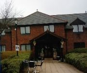
The Derbyshire PH Hotels
mour
Lumb Farm Country Club
Twin Oaks Hotel
The Robin Hood Inn
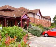
Days Inn Chesterfield Tibshelf
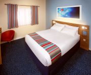
TRAVELODGE ALFRETON
Mansfield
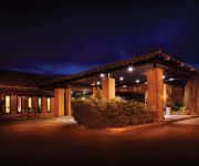
Independent (SPHC) THE DERBYSHIRE HOTEL
Ripley
Videos from this area
These are videos related to the place based on their proximity to this place.
Teversal Trail - Silverhill Wood Walk - 2009
Silverhill Wood 2 - 4 miles Walk - A network of trails based on former rail routes. Teversal, Sutton-in-Ashfield, Nottinghamshire.
Dom & Sky Walk Showjumping
Our first compition since i have had him excuse the slight mistake but he is young after all.
George on Doe Hill Country Park
How much energy has George got?! We had walked from Newton to Blackwell, down Gloves Ln, across to Doe Hill coming out at the end of Stonebroom, up to Holy C...
MTB Silverhill trail Blackwell to Pleasley 30-11-13 Time Lapsed
MTB Ride out on the phoenix greenways with my dog Jax, from Blackwell Derbyshire. 14.8 miles round trip.
Honda CB250 twin (Dream) 1978
Sorry about the wind noise. This is my wifes CB250T Dream. The bike has had very little use and is showing just 7900 miles. Now running great after having been laid up. Featured on www.westhouse...
BNI Synergy Launch Meeting - Visitor & Member Reactions
We interviewed some of the visitors to the BNI Synergy launch meeting, and also some of the members. Here is what they thought of the meeting! For further details about BNI Synergy visit http://ww...
Jonathan Clarke JCAD - BNI Synergy 60 Seconds
Filmed at the launch meeting of BNI Synergy at the Derbyshire Hotel. http://www.bnimidlands.co.uk/memberdetails.php?
Videos provided by Youtube are under the copyright of their owners.
Attractions and noteworthy things
Distances are based on the centre of the city/town and sightseeing location. This list contains brief abstracts about monuments, holiday activities, national parcs, museums, organisations and more from the area as well as interesting facts about the region itself. Where available, you'll find the corresponding homepage. Otherwise the related wikipedia article.
Alfreton railway station
Alfreton railway station serves the town of Alfreton in Derbyshire, England. The station is on the Erewash Valley Line 18+⁄4 miles north of Nottingham. As of late 2009 Alfreton is a Penalty fare station when travelling on East Midlands Trains services.
East Midlands Designer Outlet
The East Midlands Designer Outlet, run by the company McArthurGlen, is a shopping complex of 70 stores located at Pinxton, Derbyshire in the East Midlands, just off Junction 28 of the M1. 14 million people live within a 90 minute drive of the centre and 2.7 million shoppers visit each year. There is parking capacity for 1,200 vehicles. Brands represented in the outlet include Calvin Klein Jeans, Next Clearance, Marks & Spencer Outlet, Clarks, Bench, Jaeger, Mexx, adidas and Gap.
Tibshelf Town railway station
Tibshelf Town railway station is a disused station in the village of Tibshelf in Derbyshire. The station was opened on 2 January 1893 by the Manchester, Sheffield and Lincolnshire Railway (later part of the Great Central Railway and subsequently the LNER), on its line from Beighton in the outskirts of Sheffield to Annesley in Nottinghamshire, which later became part of the Great Central main line to London.
Miners Welfare Ground
The Miners Welfare Ground is a cricket ground in Blackwell, England that Derbyshire CCC used between 1909 and 1913. The ground hosted 7 first-class matches. Game Information: Game Statistics: first-class:
Pinxton South railway station
Pinxton South railway station was a former railway station that served Pinxton, Derbyshire; the station stie lies within the parish of Selston, Nottinghamshire. It was opened by the Great Northern Railway (Great Britain) as "Pinxton" on its Derbyshire Extension in 1875-6 In some timetables it was listed as "Pinxton for South Normanton". It was renamed "Pinxton South" in January 1954.
All Saints' Church, Huthwaite
All Saints' Church, Huthwaite is a parish church in the Church of England in Huthwaite, Nottinghamshire.
Silverhill, Nottinghamshire
Silverhill is a mine soil-heap hill in Nottinghamshire. It is on the site of the former Silverhill colliery and is 205m high. Strawberry Bank in Huthwaite is believed to be the highest natural point in the county at 203m. The link to Silverhill is in the wrong place on Google maps. It is shown as being on Newtonwood Lane in Huthwaite but should in fact be on Silverhill Lane in Teversal about a mile to the East.
Carnfield Hall
Carnfield Hall is a privately owned country house located at South Normanton, near Alfreton in Derbyshire, England. It is a Grade II* listed building. The estate includes around ninety acres of park and ancient woodland. The manor was anciently held by the Babington family of Dethick Manor but was sold in about 1502 to Hugh Revell, a younger brother of John Revell of Ogston Hall Documents relating to the Carnfield estate date from the early 14th century.


