Safety Score: 3,0 of 5.0 based on data from 9 authorites. Meaning we advice caution when travelling to United Kingdom.
Travel warnings are updated daily. Source: Travel Warning United Kingdom. Last Update: 2024-04-28 08:22:10
Delve into Riddings
Riddings in Derbyshire (England) is a town located in United Kingdom about 120 mi (or 193 km) north-west of London, the country's capital town.
Time in Riddings is now 11:42 PM (Sunday). The local timezone is named Europe / London with an UTC offset of one hour. We know of 9 airports closer to Riddings, of which 5 are larger airports. The closest airport in United Kingdom is Nottingham Airport in a distance of 16 mi (or 25 km), South-East. Besides the airports, there are other travel options available (check left side).
There are several Unesco world heritage sites nearby. The closest heritage site in United Kingdom is Liverpool – Maritime Mercantile City in a distance of 28 mi (or 45 km), North-East. Also, if you like the game of golf, there are some options within driving distance. In need of a room? We compiled a list of available hotels close to the map centre further down the page.
Since you are here already, you might want to pay a visit to some of the following locations: Derby, Matlock, Nottingham, Wales and Yeldersley. To further explore this place, just scroll down and browse the available info.
Local weather forecast
Todays Local Weather Conditions & Forecast: 6°C / 43 °F
| Morning Temperature | 5°C / 40 °F |
| Evening Temperature | 7°C / 45 °F |
| Night Temperature | 3°C / 38 °F |
| Chance of rainfall | 27% |
| Air Humidity | 93% |
| Air Pressure | 1001 hPa |
| Wind Speed | Moderate breeze with 11 km/h (7 mph) from East |
| Cloud Conditions | Overcast clouds, covering 100% of sky |
| General Conditions | Heavy intensity rain |
Monday, 29th of April 2024
11°C (52 °F)
9°C (49 °F)
Light rain, fresh breeze, overcast clouds.
Tuesday, 30th of April 2024
15°C (60 °F)
8°C (47 °F)
Light rain, fresh breeze, scattered clouds.
Wednesday, 1st of May 2024
16°C (61 °F)
11°C (52 °F)
Light rain, moderate breeze, broken clouds.
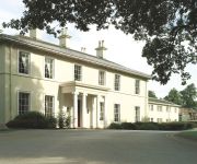
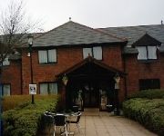
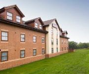
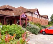
Hotels and Places to Stay
Lumb Farm Country Club
The Derbyshire PH Hotels
Eastwood Hall
The View at the White Horse Woolley Moor
TRAVELODGE ALFRETON
Days Inn Chesterfield Tibshelf
Ripley
Mansfield
Independent (SPHC) THE DERBYSHIRE HOTEL
Videos from this area
These are videos related to the place based on their proximity to this place.
Adventures of a local optician in Alfreton!
Michael from Stanley H Field Opticians shows how they are part of the vibrant local business community in Alfreton. SPECS network brings you probably the World's only video featuring an optician,...
Steven Hewitt goal vs Alfreton
Steven Hewitt knocks a third goal in for Burnley in a pre-season game with Alfreton, 28/07/12.
Joe Jackson goal vs Alfreton
Joe Jackson heads Burnley 2-0 in front in a pre-season game with Alfreton, 28/7/12.
46233 Duchess of Sutherland first run after overhaul
Duchess of Sutherland departs her shed in semi-green for a trip up the Midland Railway Butterley main line for the first time since her overhaul. Caught on camera whilst we were working on...
CQM - Case study - Lean and Continuous Improvement
CQM T&C and Thorntons staff talk about utilising the skills of the workforce to drive practical improvements at the Alfreton site, as part of an ongoing transformation of the operational element...
Charlotte Bryan Wins the David Nieper Fashion Academy Student Competition 2010
East Midlands today report on the winner of the David Nieper Fashion Academy Student Competition 2010 and the start of Charlotte Bryan's 6 month internship as an apprentice at the design rooms...
Videos provided by Youtube are under the copyright of their owners.
Attractions and noteworthy things
Distances are based on the centre of the city/town and sightseeing location. This list contains brief abstracts about monuments, holiday activities, national parcs, museums, organisations and more from the area as well as interesting facts about the region itself. Where available, you'll find the corresponding homepage. Otherwise the related wikipedia article.
Butterley Tunnel
Butterley Tunnel is a one and three quarter mile long canal tunnel on the Cromford Canal below Ripley, in Derbyshire, England, opened to traffic in 1794. Along with Butterley Works blast furnaces, part of the canal tunnel and its underground wharf were declared a scheduled monument in 2013.
Hayes Conference Centre
The Hayes Conference Centre is a group of buildings in Swanwick, UK which are used for conferences and other functions. The building which now houses the centre's reception was built in the 1850s as a private residence and named Swanwick Hayes. Since the early 1910 however it has taken up its current usage, apart from the Second World War years when it was a POW camp for German and Italian prisoners.
Leabrooks, Derbyshire
Leabrooks is a small urban locality in Derbyshire that merges with the village of Somercotes and the locality of Greenhill Lane. It is named after a stream, the Lee Brook, which formerly ran through it after rising on an area known as The Lees (off Sleetmoor Lane, originally known as Lee Moor Lane). It has a number of shops and businesses, a pub, a park and a cemetery.
North Street (stadium)
North Street also known as the Impact Arena is a football stadium in Alfreton, Derbyshire. It is the home of Alfreton Town F.C. who currently play in the Conference National. Capacity is 3,600 with 1,500 seats. Between 1986 and 1988, it was home to a rugby league team called Mansfield Marksman. It has two seated stands and one standing stand. The fourth side contains a bar and the changing rooms.
Golden Valley, Derbyshire
Golden Valley is a small Derbyshire hamlet in between the larger villages of Codnor, and Riddings, and also near Ironville and Codnor Park to the east. There also once was a road to Ripley, but this is now disused. It is most well known for being host of the now derelict Cromford Canal, being at the eastern portal of Butterley Tunnel, from there the canal merges into Codnor Park Reservoir, which has an unexploded German bomb from World War II marooned at the bottom.
Swanwick Junction railway station
Swanwick Junction railway station (pronounced "Swannick") is a heritage railway station situated on the former Ambergate to Pye Bridge Line which closed in 1968, but has been partially reopened by the Midland Railway - Butterley. Despite the station's name it is some distance from Swanwick. Previously, there was originally no station here (during BR/LMS days), only a junction with the Swanwick Colliery Branch Line.
Ambergate to Pye Bridge Line
The Ambergate to Pye Bridge Line is a partially disused, partially restored, and partially developed for other uses railway line in Derbyshire, England. It was a short east-west line linking the Midland Main Line with the Erewash Valley Line. The line was opened by the Midland Railway to freight on 1 February 1875, and to passenger trains on 1 May 1875. The Midland was grouped into the London, Midland and Scottish Railway (LMS) in 1923.
Pye Hill
Pye Hill is a hamlet in the Erewash Valley, Nottinghamshire, England. The B600 road runs east-west through it. It was once served by the Pye Hill and Somercotes railway station.


