Safety Score: 3,0 of 5.0 based on data from 9 authorites. Meaning we advice caution when travelling to United Kingdom.
Travel warnings are updated daily. Source: Travel Warning United Kingdom. Last Update: 2024-04-28 08:22:10
Discover Heage
Heage in Derbyshire (England) with it's 2,698 citizens is a city in United Kingdom about 120 mi (or 194 km) north-west of London, the country's capital city.
Local time in Heage is now 02:03 AM (Monday). The local timezone is named Europe / London with an UTC offset of one hour. We know of 9 airports in the vicinity of Heage, of which 5 are larger airports. The closest airport in United Kingdom is East Midlands Airport in a distance of 16 mi (or 26 km), South. Besides the airports, there are other travel options available (check left side).
There are several Unesco world heritage sites nearby. The closest heritage site in United Kingdom is Liverpool – Maritime Mercantile City in a distance of 31 mi (or 49 km), North-East. Also, if you like golfing, there are a few options in driving distance. Looking for a place to stay? we compiled a list of available hotels close to the map centre further down the page.
When in this area, you might want to pay a visit to some of the following locations: Derby, Matlock, Yeldersley, Bradley and Shirley. To further explore this place, just scroll down and browse the available info.
Local weather forecast
Todays Local Weather Conditions & Forecast: 12°C / 53 °F
| Morning Temperature | 5°C / 41 °F |
| Evening Temperature | 10°C / 50 °F |
| Night Temperature | 10°C / 50 °F |
| Chance of rainfall | 1% |
| Air Humidity | 80% |
| Air Pressure | 1011 hPa |
| Wind Speed | Fresh Breeze with 15 km/h (9 mph) from North |
| Cloud Conditions | Overcast clouds, covering 100% of sky |
| General Conditions | Light rain |
Tuesday, 30th of April 2024
14°C (57 °F)
9°C (49 °F)
Light rain, fresh breeze, scattered clouds.
Wednesday, 1st of May 2024
14°C (57 °F)
11°C (53 °F)
Light rain, moderate breeze, overcast clouds.
Thursday, 2nd of May 2024
13°C (56 °F)
11°C (51 °F)
Light rain, moderate breeze, overcast clouds.
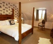
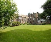
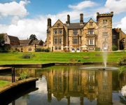
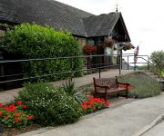
Hotels and Places to Stay
Lumb Farm Country Club
White Hart Inn
Makeney Hall Belper
Breadsall Priory Marriott Hotel & Country Club
Morley Hayes
TRAVELODGE ALFRETON
Ripley
Videos from this area
These are videos related to the place based on their proximity to this place.
Belper Churches Easter Flashmob 2015
Churches Together in Belper, as part of the Resurrection performance, did a surprise FlashMob in Belper's King Street. The choir sang Chris Tomlin's version of Amazing Grace, and then seguéd...
Cinema 101 - 008 - studio3cine Film School
This is one of the awesome short films which was created by the Year 8 students in Crew 2 at studio3cine's Cinema 101 workshop we conducted at Belper School in May 2014! Once finished, this...
love parks week installation 2014
love parks week is the last week of july and features activities and events across the uk. through corridor arts i was able to make the installation in belper parks. the installation was...
Derbyshire fire and rescue service Dennis Sabre on scene of Hoisery factory fire in Belper
FOOTAGE COURTESY OF MY DAD, also, this was recorded a long time ago-- © Copyright 2015 Gregoryemergencyvideos LIKE,COMMENT AND SUBSCRIBE! You can also like my facebook page at ...
Heage Windmill - EXCEL AWARDS FINALIST 2010
Heage Windmill is a delightful educational visitor attraction, a real working mill just up the road from Belper in Derbyshire. Watch the miller haul the grain up to the top of the windmill...
How Can A Poor Man Stand Such Times and Live
"How Can A Poor Man Stand Such Times and Live" (Blind Alfred Reed, 1929) Recorded live at The Queen's Head, Belper on 14th March 2015. Taropatch by tinguitar.com.
Chinese New Year 2015 Eye Dotting Lion Dance
Wednesday 18 February 2015 (Chinese New Year Eve) Year Of The Sheep Oriental Palace Restaurant Belper, Derbyshire Performed by: Ma Bo Lion Dance Group 孖寶醒獅團 For more information,...
46233 the yorkshire coronation 21/04/12
46233 on the pmr railtour to scarborough filmed passing through belper.
Call Of Duty Ghosts Loki gameplay walkthrough part 17
GHOSTS PLAYLIST HERE http://www.youtube.com/playlist?list=PLy5y2vlOmQv8oQJ4eFTEETlGqDqLmLgGs facebook http://www.facebook.com/manabovethemorgue SUBSCRIBE ...
Call Of Duty Ghosts - Safeguard rounds 10 - 20 - Stormfront CO-OP
GHOSTS PLAYLIST HERE http://www.youtube.com/playlist?list=PLy5y2vlOmQv8oQJ4eFTEETlGqDqLmLgGs Call of duty ghosts squads co op gameplay facebook ...
Videos provided by Youtube are under the copyright of their owners.
Attractions and noteworthy things
Distances are based on the centre of the city/town and sightseeing location. This list contains brief abstracts about monuments, holiday activities, national parcs, museums, organisations and more from the area as well as interesting facts about the region itself. Where available, you'll find the corresponding homepage. Otherwise the related wikipedia article.
Cromford Canal
The Cromford Canal ran 14.5 miles from Cromford to the Erewash Canal in Derbyshire, England with a branch to Pinxton. Built by William Jessop with the assistance of Benjamin Outram, its alignment included four tunnels and 14 locks. From Cromford it ran south following the 300-foot contour line along the east side of the valley of the Derwent to Ambergate, where it turned eastwards along the Amber valley.
Wingfield Manor
Wingfield Manor is a deserted (since the 1770s) and ruined manor house some 4 miles from the town of Alfreton in the English county of Derbyshire. There is a working farm that forms part of the old manor. It is now in the care of English Heritage, though only viewable through pre-booked guided tours one Saturday a month during the Summer.
Ambergate railway station
Ambergate railway station is a railway station owned by Network Rail and managed by East Midlands Trains (EMT) Train operating company (TOC). It serves the village of Ambergate in Derbyshire, England. The station is located on the Derwent Valley Line from Derby to Matlock, which diverges from the Midland Main Line just south of the station at Ambergate Junction. The full range of tickets for travel for any destination in the country are purchased from the guard on the train at no extra cost.
Toadmoor Tunnel
Toadmoor Tunnel (originally called Hag Wood Tunnel) was built at Ambergate as part of the North Midland Railway, which opened in 1840. 128 yards long, it was cut through an unstable hillside on a notoriously difficult line of route. George Stephenson designed it with an elliptical shape so that it had least diameter vertically with most strength at the sides. Braced with steel hoops at its southern end. Due to unplanned earth movements, it took 15 months to build, instead of the planned two.
Bull bridge accident
The Bull Bridge accident was a failure of a cast-iron bridge at Bullbridge, near Ambergate in Derbyshire on 26 September 1860. As a goods train was passing over the bridge at Bullbridge, the structure failed suddenly, causing the derailment of the majority of the wagons. There were no serious casualties, but it was a warning of the fundamental weakness of many such bridges on the British rail network.
The Elms, Derbyshire
The Elms is a housing estate built by the town council in the 1950s to provide social housing on the south-western edge of Ripley, Derbyshire, England. It took its name from The Elms farm whose land it was built on. The house, called The Elms, was converted into flats and the farm yard and outbuildings were used as a depot by the council until demolition around the 1970s when sheltered housing was built on the site.
Hammersmith railway station
Hammersmith railway station is a heritage railway station on the Midland Railway - Butterley in Derbyshire. There was no station at this point originally, being situated on the Ambergate to Pye Bridge Line. However, when the line was reopened, the A38 road prevented any further westward extension. Hammersmith is used as terminus with a run-around loop. Trains normally proceed from here eastwards without stopping at Butterley railway station which they left a few minutes previously.
Lower Hartshay
Lower Hartshay is a very small village in the Amber Valley District, in the English county of Derbyshire. It is on Hartshay Brook and near the A38 road. The nearest town is Ripley. There is the corresponding hamlet of Upper Hartshay just south.


