Safety Score: 3,0 of 5.0 based on data from 9 authorites. Meaning we advice caution when travelling to United Kingdom.
Travel warnings are updated daily. Source: Travel Warning United Kingdom. Last Update: 2024-04-28 08:22:10
Delve into Whatstandwell
Whatstandwell in Derbyshire (England) with it's 270 habitants is located in United Kingdom about 123 mi (or 199 km) north-west of London, the country's capital town.
Current time in Whatstandwell is now 05:14 PM (Sunday). The local timezone is named Europe / London with an UTC offset of one hour. We know of 8 airports close to Whatstandwell, of which 5 are larger airports. The closest airport in United Kingdom is East Midlands Airport in a distance of 19 mi (or 31 km), South-East. Besides the airports, there are other travel options available (check left side).
There are several Unesco world heritage sites nearby. The closest heritage site in United Kingdom is Liverpool – Maritime Mercantile City in a distance of 30 mi (or 49 km), North-East. Also, if you like playing golf, there are some options within driving distance. If you need a hotel, we compiled a list of available hotels close to the map centre further down the page.
While being here, you might want to pay a visit to some of the following locations: Matlock, Derby, Bradley, Yeldersley and Shirley. To further explore this place, just scroll down and browse the available info.
Local weather forecast
Todays Local Weather Conditions & Forecast: 9°C / 48 °F
| Morning Temperature | 4°C / 40 °F |
| Evening Temperature | 8°C / 47 °F |
| Night Temperature | 3°C / 38 °F |
| Chance of rainfall | 26% |
| Air Humidity | 77% |
| Air Pressure | 1004 hPa |
| Wind Speed | Moderate breeze with 12 km/h (8 mph) from East |
| Cloud Conditions | Overcast clouds, covering 100% of sky |
| General Conditions | Heavy intensity rain |
Monday, 29th of April 2024
12°C (53 °F)
10°C (50 °F)
Light rain, fresh breeze, overcast clouds.
Tuesday, 30th of April 2024
14°C (57 °F)
9°C (49 °F)
Light rain, fresh breeze, scattered clouds.
Wednesday, 1st of May 2024
14°C (57 °F)
11°C (53 °F)
Light rain, moderate breeze, overcast clouds.
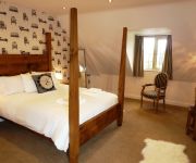
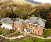
Hotels and Places to Stay
White Hart Inn
Alison House
New Bath Hotel
The View at the White Horse Woolley Moor
The Greyhound Hotel
The Duke of Wellington
Matlock
Videos from this area
These are videos related to the place based on their proximity to this place.
Chinese New Year 2015 Eye Dotting Lion Dance
Wednesday 18 February 2015 (Chinese New Year Eve) Year Of The Sheep Oriental Palace Restaurant Belper, Derbyshire Performed by: Ma Bo Lion Dance Group 孖寶醒獅團 For more information,...
caravan off home ammbergate hurt arms campsite
sat watching this caravaner doing his last checks before setting off home.? well i guess he was...this was filmed behind the hurt arms @ ammbergate derbyshire.
Derbyshire Mountain Biking
various decents from around crich chase, blackrocks and shining cliff woods in derbyshire. Track Deadmau5-Raise your weapon.
Crich Tramway Village & The National Tramway Museum, Crich, Derbyshire, England - 13th August, 2014
The National Tramway Museum, at Crich, in Derbyshire, England, is situated within Crich Tramway Village, a period village containing a pub, cafe, old-style sweetshop, including the tram depots....
Crich Tramway Village
A visit to the UK's National Tramway Museum. http://www.tramway.co.uk/ The trams for the day were both bow collector equipped Leeds cars. Blackpool 40 makes a brief appearance.
Crich Tramway Village. 1940s Weekend. Aug 2012
For all you 1940's war historians out there, this event is an absolute gem! People were dressed in period costume and were 'in-character'. It was just like stepping back in time. You were given...
Sheffield Horse Tram at Crich Tramway Village - 8th July 2013
On Monday 8th July 2013 Crich Tramway Village held the "50 Years of Trams" event, to mark the 50th anniversary of their first running of trams which were horse-drawn. Accordingly the event...
50 Years of Trams - Crich Tramway Village - 8th July 2013
Some of the sights to be seen at the "50 Years of Trams" event, held by Crich Tramway Village to commemorate the 50th anniversary of tram operation at the museum.
Trams at Crich Tramway Village
As a fan of electric transport, I've always enjoyed visiting Crich. It is located adjacent to a working quarry in Derbyshire, only about an hour away from where we were staying in Sherwood...
Videos provided by Youtube are under the copyright of their owners.
Attractions and noteworthy things
Distances are based on the centre of the city/town and sightseeing location. This list contains brief abstracts about monuments, holiday activities, national parcs, museums, organisations and more from the area as well as interesting facts about the region itself. Where available, you'll find the corresponding homepage. Otherwise the related wikipedia article.
Cromford Canal
The Cromford Canal ran 14.5 miles from Cromford to the Erewash Canal in Derbyshire, England with a branch to Pinxton. Built by William Jessop with the assistance of Benjamin Outram, its alignment included four tunnels and 14 locks. From Cromford it ran south following the 300-foot contour line along the east side of the valley of the Derwent to Ambergate, where it turned eastwards along the Amber valley.
National Tramway Museum
The National Tramway Museum, at Crich, in Derbyshire, England, is situated within Crich Tramway Village, a period village containing a pub, cafe, old-style sweetshop, including the tram depots. The village is also home to the Eagle Press, a small museum dedicated to Letterpress Printing including an 1859 Columbian printing press. The museum's collection of trams runs through the village setting.
Whatstandwell railway station
Whatstandwell railway station is a railway station owned by Network Rail and managed by East Midlands Trains (EMT) Train operating company (TOC). It serves the villages of Whatstandwell and Crich Carr in Derbyshire, England. The station is located on the Derwent Valley Line from Derby to Matlock. The full range of tickets for travel for any destination in the country are purchased from the guard on the train at no extra cost.
Ambergate railway station
Ambergate railway station is a railway station owned by Network Rail and managed by East Midlands Trains (EMT) Train operating company (TOC). It serves the village of Ambergate in Derbyshire, England. The station is located on the Derwent Valley Line from Derby to Matlock, which diverges from the Midland Main Line just south of the station at Ambergate Junction. The full range of tickets for travel for any destination in the country are purchased from the guard on the train at no extra cost.
Toadmoor Tunnel
Toadmoor Tunnel (originally called Hag Wood Tunnel) was built at Ambergate as part of the North Midland Railway, which opened in 1840. 128 yards long, it was cut through an unstable hillside on a notoriously difficult line of route. George Stephenson designed it with an elliptical shape so that it had least diameter vertically with most strength at the sides. Braced with steel hoops at its southern end. Due to unplanned earth movements, it took 15 months to build, instead of the planned two.
Shining Cliff Woods, Derbyshire
Shining Cliff Woods are on the west bank of the River Derwent near to Ambergate Derbyshire. In medieval times "Schymynde-cliffe" was one of the seven royal parks within Duffield Frith and, as such, belonged to Edmund Crouchback, Earl of Lancaster. It was an estate within the manor of Alderwasley and in 1284 was given to William Foun who was given the job of maintaining the boundaries between the Pendleton and Peatpits Brooks.
Crich Tramway Village
Crich Tramway Village is the recreated historic village that is the setting for the National Tramway Museum in Derbyshire. The village is set around a period street, with several re-built buildings from all over the country, including the facade of the former Assembly Rooms from Derby and the Red Lion Inn from Stoke-on-Trent. The village also includes a cafe, old-style sweetshop, and the museum's tram depots.
Coddington, Derbyshire
Coddington is a place in Derbyshire, England. It is part of the civil parish of Crich, and is ½ mile west of that village. According to Kelly's Directory of 1891 there were two farms at Coddington.


