Safety Score: 3,0 of 5.0 based on data from 9 authorites. Meaning we advice caution when travelling to United Kingdom.
Travel warnings are updated daily. Source: Travel Warning United Kingdom. Last Update: 2024-04-28 08:22:10
Touring Bonsall
Bonsall in Derbyshire (England) with it's 803 residents is a town located in United Kingdom about 127 mi (or 205 km) north-west of London, the country's capital place.
Time in Bonsall is now 06:19 PM (Sunday). The local timezone is named Europe / London with an UTC offset of one hour. We know of 8 airports nearby Bonsall, of which 5 are larger airports. The closest airport in United Kingdom is East Midlands Airport in a distance of 23 mi (or 37 km), South-East. Besides the airports, there are other travel options available (check left side).
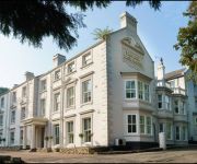
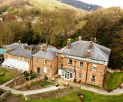
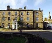
There are several Unesco world heritage sites nearby. The closest heritage site in United Kingdom is Liverpool – Maritime Mercantile City in a distance of 31 mi (or 50 km), North-East. Also, if you like the game of golf, there are several options within driving distance. We collected 1 points of interest near this location. Need some hints on where to stay? We compiled a list of available hotels close to the map centre further down the page.
Being here already, you might want to pay a visit to some of the following locations: Matlock, Bradley, Yeldersley, Shirley and Rodsley. To further explore this place, just scroll down and browse the available info.
Local weather forecast
Todays Local Weather Conditions & Forecast: 8°C / 47 °F
| Morning Temperature | 4°C / 39 °F |
| Evening Temperature | 9°C / 48 °F |
| Night Temperature | 4°C / 38 °F |
| Chance of rainfall | 23% |
| Air Humidity | 77% |
| Air Pressure | 1004 hPa |
| Wind Speed | Fresh Breeze with 13 km/h (8 mph) from East |
| Cloud Conditions | Overcast clouds, covering 100% of sky |
| General Conditions | Moderate rain |
Monday, 29th of April 2024
11°C (52 °F)
9°C (49 °F)
Light rain, fresh breeze, overcast clouds.
Tuesday, 30th of April 2024
14°C (57 °F)
10°C (49 °F)
Light rain, fresh breeze, scattered clouds.
Wednesday, 1st of May 2024
14°C (57 °F)
11°C (53 °F)
Light rain, moderate breeze, overcast clouds.
Hotels and Places to Stay
New Bath Hotel
Alison House
PEAK EDGE HOTEL
The Greyhound Hotel
The Duke of Wellington
The Rutland Arms Hotel
Matlock
Videos from this area
These are videos related to the place based on their proximity to this place.
ECC Gullivers Kingdom Matlock Bath 2014
The European Coaster Club trip to Gullivers Kingdom in Matlock Bath in May 2014.
Matlock Bath Derbyshire - Panasonic TZ5
A nice short visit to one of Derbyshire's hotspots - Panasonic TZ5.
Heights of Abraham - Matlock Bath
The Heights of Abraham cable car seen in Matlock Bath, Derbyshire from Dale Road (on the A6). River Derwent below - access via a footbridge. We didn't go to this attraction when we were in...
Kawasaki z750 Bennetts Road Show Matlock 7.4.13
A ride to Matlock on my Kawasaki z750 for the Bennetts Road Show and to see the Bennetts Babes ;)
Matlock Bath Pavilion Group Information Day Film
A short film showing the 100 year history of the Matlock Bath Grand Pavilion and our hopes for its future.
Matlock Raft Race Boxing Day 2011 - Catastrophic planning!
Matlock Raft Race Boxing Day 2011 - Catastrophic planning!
Lilly Pond at Matlock Bath
This Lilly pond is in Matlock Bath, it can be found on the way to the car park near the Fish Pond Pub. This was recorded on Saturday 9th August 2014.
Videos provided by Youtube are under the copyright of their owners.
Attractions and noteworthy things
Distances are based on the centre of the city/town and sightseeing location. This list contains brief abstracts about monuments, holiday activities, national parcs, museums, organisations and more from the area as well as interesting facts about the region itself. Where available, you'll find the corresponding homepage. Otherwise the related wikipedia article.
Derbyshire
Derbyshire is a county in the East Midlands of England. A substantial portion of the Peak District National Park lies within Derbyshire. The southern extremity of the Pennine range of hills extends into the north of the county. The county contains within its boundary of approximately 225 miles part of the National Forest.
Peak District Mining Museum
The Peak District Mining Museum is located at Matlock Bath, Derbyshire, England. The museum has a mockup of a lead mine in which children may safely experience and explore how the miners, and in particular how children, were used in this dangerous aspect of England's industrial past.
Heights of Abraham
The Heights of Abraham is a major tourist attraction in Matlock Bath, Derbyshire, England. It consists of a hilltop park on top of Masson Hill, accessed by a Gondola cable car from the village. Amongst the attractions in the park, which has been open since Victorian times, are cavern and mine tours. The cable car was opened in 1984 and is the first ever alpine cable car in Britain. The route is 568 metres long and climbs 169 metres .
Gulliver's Kingdom
Gulliver's Kingdom (also known as Gulliver's Matlock Bath) is an amusement park aimed at children aged 3 to 13 in the Derbyshire town of Matlock Bath, England. Founded in 1978 by Ray Phillips, it is still owned by the Phillips family and now has sister theme parks; Gulliver's World in Warrington and Gulliver's Land in Milton Keynes, which opened in 1989 and 1999 respectively.
Life in a Lens Museum of Photography & Old Times
The Life in a Lens Museum of Photography and Old Times is a museum in Matlock Bath, Derbyshire, England. Opened in 2001, the museum is dedicated to presenting the history of photography from 1839 to around the beginning of the digital age (2001). The museum is housed in five themed rooms in a renovated Victorian building, dating from 1861, on North Parade (above the Victorian Teashop).
Great Masson Cavern
The Great Masson Cavern, Derbyshire, England, is one of the two caves at the Heights of Abraham. It is notable for its lack of stalactites and stalagmites, as the cave is coated in a clay-like substance that inhibits deposition. However, it still has some rock formations such as "the Owl" and "the Rabbit". It was first opened to visitor viewing in Victorian times and had been mined for fluorspar prior to the opening to visitors.
Great Rutland Cavern
The Great Rutland Cavern is a small cave and one of the two at the Heights of Abraham, Matlock, Derbyshire. It consists of a narrow passage and a chamber leading in to the Nestus Grotto. Sometimes a face of sunlight can be seen through holes in the rock which is called the devils face. At the end of the tour there is a display on what it was like mining in the 19th century. It was first opened to the public in 1812 and was then known as 'Nestor mine'.
Snitterton Hall
Snitterton Hall is a privately owned late medieval manor house at South Darley, near Matlock, Derbyshire. It is a Grade I listed building. Anciently an independent manor within the large parish of Darley near Matlock, Snitterton held was held by a family of the same name whose emblem was a snipe (snite). It came to John Sacheverel of Morley upon his marriage to the de Snitterton heiress in the 14th century and a descendant was slain at the Battle of Bosworth Field in 1485.


