Safety Score: 3,0 of 5.0 based on data from 9 authorites. Meaning we advice caution when travelling to United Kingdom.
Travel warnings are updated daily. Source: Travel Warning United Kingdom. Last Update: 2024-05-07 07:59:51
Explore Redhill
The district Redhill of Arnold in Nottinghamshire (England) is located in United Kingdom about 112 mi north-west of London, the country's capital.
If you need a place to sleep, we compiled a list of available hotels close to the map centre further down the page.
Depending on your travel schedule, you might want to pay a visit to some of the following locations: Nottingham, Derby, Wales, Todwick and Glenfield. To further explore this place, just scroll down and browse the available info.
Local weather forecast
Todays Local Weather Conditions & Forecast: 14°C / 57 °F
| Morning Temperature | 10°C / 49 °F |
| Evening Temperature | 15°C / 58 °F |
| Night Temperature | 8°C / 47 °F |
| Chance of rainfall | 0% |
| Air Humidity | 82% |
| Air Pressure | 1024 hPa |
| Wind Speed | Gentle Breeze with 7 km/h (4 mph) from South |
| Cloud Conditions | Broken clouds, covering 73% of sky |
| General Conditions | Light rain |
Wednesday, 8th of May 2024
17°C (62 °F)
13°C (56 °F)
Light rain, light breeze, overcast clouds.
Thursday, 9th of May 2024
17°C (63 °F)
13°C (55 °F)
Light rain, light breeze, overcast clouds.
Friday, 10th of May 2024
19°C (66 °F)
14°C (56 °F)
Light rain, light breeze, overcast clouds.
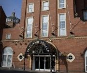
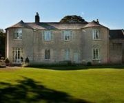
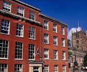
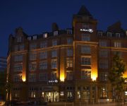
Hotels and Places to Stay
St James Hotel
ROOMZZZ NOTTINGHAM CITY
Cockliffe House
Park Plaza Nottingham
Lace Market
Hilton Nottingham
Crowne Plaza NOTTINGHAM
PREMIER SUITES Nottingham
Mercure Nottingham City Centre George Hotel
TRAVELODGE NOTTINGHAM CENTRAL
Videos from this area
These are videos related to the place based on their proximity to this place.
29 Seconds in Woodthorpe Park
29 Seconds in Woodthorpe Park, Nottingham! Well it was a little longer, loafing in the park on a summers day ....... but messing with timelapse.
MOT Test Arnold in order to get speedy qualified mot examination head over to MOT Test Arnold
http://www.promechgarage.co.uk/index.php Call 01159-203-090 Vehicles inside the UK which are three years of age and more, require to successfully pass an MOT exam (Ministry of Transport Test)....
MOT Test Arnold | MOT Test Center Arnold | MOT Test Arnold Nottingham | 01159 203 090
http://promechgarage.co.uk|http://www.promechgarage.co.uk|http://www.promechgarage.co.uk/index.php|http://promechgarage.co.uk/index.php} Here at the ProMech Garage we really pride ourselves...
Estate Agents In Arnold Nottingham - Estate Agents Arnold - 01158 - 82 83 84
http://www.moveandsave.co.uk - estate agents in arnold nottingham Thinking Of Selling Your Property ? Looking for estate agents in arnold nottingham , check out Move & Save, the "NO COMMISSION".
Arnot Hill Park, Arnold, Nottingham. Oct 2009
Here's a photo montage video I've created of Arnot Hill Park, Arnold, Nottingham. Locally, the park is referred to as Arnold Park. The quality on YouTube is low, download the original video:...
MOT Test Centre Arnold to get fast qualified mot test see MOT Test Centre Arnold
http://promechgarage.co.uk Call 01159-203-090 Motor vehicles throughout the UK that are three yrs old and more, require to pass an MOT assessment (Ministry of Transport Test). The MOT Assessment ...
Videos provided by Youtube are under the copyright of their owners.
Attractions and noteworthy things
Distances are based on the centre of the city/town and sightseeing location. This list contains brief abstracts about monuments, holiday activities, national parcs, museums, organisations and more from the area as well as interesting facts about the region itself. Where available, you'll find the corresponding homepage. Otherwise the related wikipedia article.
A614 road
The A614 is a main road in England running through the counties of Nottinghamshire, South Yorkshire and the East Riding of Yorkshire. Beginning at Redhill, near Calverton in Nottinghamshire at a roundabout with the A60, the road meets the A6097 at a junction which looks like a roundabout but actually is not, crosses the Robin Hood Way then passes Bilsthorpe. At Rufford there is a Center Parcs resort and Rufford Country Park.
Redhill, Nottinghamshire
Redhill is a small community forming part of the much larger town of Arnold in Nottinghamshire, England. It is about 4 miles north of the city of Nottingham in the borough of Gedling. The area is home to approximately two thousand people, many of whom are commuters
Arnold Town F.C
Arnold Town F.C. is a football club based in Arnold, Nottinghamshire, England. It was formed in 1989 following a merger between Arnold F.C. and Arnold Kingswell F.C. It reached the 5th round of the FA Vase in the season 2001–02 and again in 2005–06. The club plays in the Northern Counties East Football League Premier Division.
Gedling Miners Welfare F.C
Gedling Miners Welfare Football Club is a football club based in Gedling, near Arnold, Nottinghamshire, England. They currently play in the East Midlands Counties League.
Faza FM
Faza FM is a community radio station in the United Kingdom. The station broadcasts on 97.1 FM in Nottingham.
Dawn FM
Dawn FM is a Muslim Community radio station, broadcasting from The Bobbersmill Community Centre, Nottingham. The station broadcasts to Nottingham and surrounding areas on 107.6FM, and also worldwide on www. radiodawn. com
Calverton Miners' Welfare F.C
Calverton Miners' Welfare F.C. is an association football club in Calverton, near Nottingham, Nottinghamshire. As of the 2012–13 season, the club is a member of the Central Midlands League South Division.
Nottingham City Hospital
Nottingham City Hospital is a large hospital located in Nottingham, England. With Queen's Medical Centre, it forms the Nottingham University Hospitals NHS Trust. The City Hospital is the older of Nottingham's two hospitals, founded in 1903. It occupies a large 90-acre site on the ring road to the North of the city centre.
Arnold Hill Academy
Arnold Hill Academy (formerly Arnold Hill Comprehensive School) is a mixed state school in the county of Nottinghamshire in the East Midlands. It teaches children from 11 to 18 - Years 7-13. It is located in Arnold but it serves children from various nearby areas including Killisick, Daybrook, Woodthorpe, Mapperley, Carlton, Sherwood and many other area's of the County. It is split into two sites ("Main School" and "Lower School") and has around 1800 pupils and over 100 teachers.
Daybrook railway station
Daybrook railway station was a railway station in Daybrook, Nottinghamshire. It was opened by the Great Northern Railway (Great Britain) on its Derbyshire and Staffordshire Extension in 1875–6 and closed in 1960.
Church of St. John the Evangelist, Carrington
St. John the Evanglist, Carrington is a parish church in the Church of England in Carrington, Nottingham. The church is Grade II listed by the Department for Culture, Media & Sport as it is a building of special architectural or historic interest.
St. Jude's Church, Mapperley
St. Jude's Church Mapperley is a parish church in the Church of England.
St. Martin's Church, Sherwood
St. Martin's Church is a grade II listed Church of England parish church in Sherwood, Nottingham.
St. Paul's Church, Daybrook
St. Paul's Church, Daybrook is a parish church in the Church of England in Daybrook, Nottingham. The church is Grade II* listed by the Department for Culture, Media & Sport as it is a particularly significant building of more than local interest.
St Ann's Well railway station
St Ann's Well railway station was a station on the former Great Northern Railway Nottingham Suburban railway in Nottingham, England. Former Services Preceding station Disused railways Following station Thorney Wood Great Northern Railway Sherwood
Sherwood railway station
Sherwood railway station was a station on the former Great Northern Railway Nottingham Suburban railway in Nottingham. The station lies within Woodthorpe Grange Park in Woodthorpe. The NSR was built mainly for the brickworks of Mapperley and Thornywood, however, there were passenger services to Daybrook and Sherwood Station. In 1905, Parry sold the estate to Godfrey Small a Nottingham City Councillor.
New Basford railway station
New Basford railway station was a former station in Nottingham on the Great Central Railway main line, the last main line to be built from the north of England to London. The station opened with the line on 15 March 1899.
Bulwell Forest railway station
Bulwell Forest railway station was a former station in Nottingham on the Great Northern Railway Nottingham to Shirebrook line. Preceding station Disused railways Following station Bestwood Colliery London and North Eastern Railway Daybrook
St. Mary's Church, Arnold
St. Mary's Church, Arnold is a parish church in the Church of England in Arnold, Nottinghamshire. The church is Grade II* listed by the Department for Culture, Media & Sport as it is a particularly significant building of more than local interest.
HM Prison Nottingham
HM Prison Nottingham is a Category B men's prison, located in the Sherwood area4 of Nottingham, Nottinghamshire, England. The prison is operated by Her Majesty's Prison Service.
Bestwood Pumping Station
Bestwood Pumping Station was a water pumping station operating in Nottinghamshire from 1874 until 1964.
Mapperley Methodist Church
Mapperley Methodist Church is on Woodborough Road in Mapperley, Nottingham.
Church of the Good Shepherd, Nottingham
The Church of the Good Shepherd is a Roman Catholic Church in Arnold, Nottingham. It is Grade II* listed.
St. Paul's Church, Hyson Green
St. Paul's Church, Hyson Green is a former Church of England parish church in Hyson Green, Nottingham.
Battle of Mapperley Hills
The Battle of Mapperley Hills was the mocking term given to an incident on Tuesday 23rd August 1842, which marked the culmination of several days of Chartist disturbances in the Nottingham area. Troops and police broke up an assembly of perhaps five thousand people and arrested four hundred of them when they refused to disperse. The site of the assembly and ‘the battle’ may have been in Mapperley Hills Common, close to where Ransom Road meets Woodborough Road. .


