Safety Score: 3,0 of 5.0 based on data from 9 authorites. Meaning we advice caution when travelling to United Kingdom.
Travel warnings are updated daily. Source: Travel Warning United Kingdom. Last Update: 2024-04-25 08:17:04
Discover West Bridgford
West Bridgford in Nottinghamshire (England) with it's 48,314 citizens is a town in United Kingdom about 107 mi (or 172 km) north-west of London, the country's capital city.
Current time in West Bridgford is now 10:35 AM (Thursday). The local timezone is named Europe / London with an UTC offset of one hour. We know of 11 airports near West Bridgford, of which 5 are larger airports. The closest airport in United Kingdom is Nottingham Airport in a distance of 2 mi (or 3 km), East. Besides the airports, there are other travel options available (check left side).
There are several Unesco world heritage sites nearby. The closest heritage site in United Kingdom is Derwent Valley Mills in a distance of 26 mi (or 43 km), East. Also, if you like playing golf, there are a few options in driving distance. Looking for a place to stay? we compiled a list of available hotels close to the map centre further down the page.
When in this area, you might want to pay a visit to some of the following locations: Nottingham, Leicester, Glenfield, Derby and Wales. To further explore this place, just scroll down and browse the available info.
Local weather forecast
Todays Local Weather Conditions & Forecast: 7°C / 45 °F
| Morning Temperature | 3°C / 38 °F |
| Evening Temperature | 7°C / 45 °F |
| Night Temperature | 3°C / 38 °F |
| Chance of rainfall | 2% |
| Air Humidity | 80% |
| Air Pressure | 1004 hPa |
| Wind Speed | Gentle Breeze with 9 km/h (5 mph) from East |
| Cloud Conditions | Overcast clouds, covering 85% of sky |
| General Conditions | Light rain |
Friday, 26th of April 2024
10°C (49 °F)
3°C (37 °F)
Overcast clouds, gentle breeze.
Saturday, 27th of April 2024
9°C (48 °F)
6°C (42 °F)
Light rain, moderate breeze, overcast clouds.
Sunday, 28th of April 2024
11°C (52 °F)
7°C (45 °F)
Moderate rain, moderate breeze, overcast clouds.
Hotels and Places to Stay
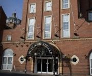
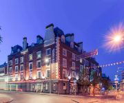
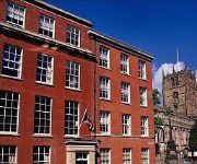
Hilton Nottingham
PREMIER SUITES Nottingham
Crowne Plaza NOTTINGHAM
St James Hotel
Mercure Nottingham City Centre George Hotel
Park Plaza Nottingham
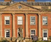
Colwick Hall Hotel
Lace Market
ROOMZZZ NOTTINGHAM CITY
TRAVELODGE NOTTINGHAM CENTRAL
Videos from this area
These are videos related to the place based on their proximity to this place.
West Bridgford Arts & Craft Fair
West Bridgford Arts & Craft Fair takes place on the Croquet Lawn, Central Avenue. For dates check: westbridgfordwire.com/events.
Central Avenue's Restricted Traffic West Bridgford
Many West Bridgford residents have contacted The Wire to discuss traffic using the restricted zone on Central Avenue during weekdays - the restriction is Mon-Sat 0700-1900 except for buses/loading/...
WEST BRIDGFORD RUGBY CLUB U12s OCT14
Under 12s training with West Bridgford Rugby Club on 5 October 2014.
Nook And Cranny West Bridgford - Cafe Culture
Nook And Cranny West Bridgford are proud to present our beautiful one bedroom apartment, situated in the heart of West Bridgford, Nottingham - the city's most affluent area. This one bedroom...
Nook & Cranny West Bridgford - Musters Road, West Bridgford.
Nook & Cranny West Bridgford are proud to present our beautiful 2 bedroom flat situated in the heart of West Bridgford, one of Nottinghamshire's most affluent areas. This property contains...
Victorian Tile Cleaning and Sealing in West Bridgford, Nottingham (www.FloorCareSpecialists.co.uk)
http://www.thecarpetcleaningman.co.uk/?p=1022 - Here Chris Bailey taking about a Victorian Tile floor that he's restored by removing all the paint and spots, cleaning and then sealing the clay...
Osteopathy & Colic - Moore Osteopathy, Nottingham
A brief video to explain how we approach babies suffering from colic. We've found that osteopathy can really help reduce symptoms and discomfort in many babies. Moore Osteopathy is based in...
Videos provided by Youtube are under the copyright of their owners.
Attractions and noteworthy things
Distances are based on the centre of the city/town and sightseeing location. This list contains brief abstracts about monuments, holiday activities, national parcs, museums, organisations and more from the area as well as interesting facts about the region itself. Where available, you'll find the corresponding homepage. Otherwise the related wikipedia article.
Trent Bridge
Trent Bridge is a Test, One-day international and County cricket ground located in West Bridgford, Nottinghamshire, England and is also the headquarters of Nottinghamshire County Cricket Club. As well as International cricket and Nottinghamshire's home games, the ground has hosted the Finals Day of the Twenty20 Cup twice. In 2009 the ground was used for the ICC World Twenty20 and hosted the semi-final between South Africa and Pakistan.
Meadow Lane
Not to be confused with The Meadow, home of Southern Football League Premier Division football team Chesham United The Meadow Lane Stadium (usually known simply as Meadow Lane) is a football stadium in Nottingham, England. It is the home ground of Notts County, who have played there since 1910. The stadium has also been home to Nottingham R.F.C. since 2006. It currently has an all-seated capacity of 20,229.
City Ground
The City Ground is a football stadium in the West Bridgford area of Nottingham, Nottinghamshire, England, on the banks of the River Trent. It has been home to Nottingham Forest Football Club since 1898, and has an all-seated capacity of 30,602.
Abbey Park, Nottinghamshire
Abbey Park in West Bridgford, Nottinghamshire is a housing estate that was constructed in the mid– to late–70s by Costain Homes on land that were previously uncultivated fields and allotments. The Willow Tree pub was constructed at the same time. All the roads are named after famous abbeys and are laid out in a tight, twisty manner that precludes fast driving.
Lady Bay, West Bridgford
Lady Bay is an area of West Bridgford, in Nottinghamshire, England, bounded by the River Trent to the north and the (now disused) Grantham Canal to the south. It is within 2 miles of the centre of Nottingham, but is more suburban/semi-rural in its character. It enjoys good bus links (route 11/11C) with Nottingham city centre.
Lady Bay Bridge
Lady Bay Bridge is a road bridge of two lanes that spans the River Trent in West Bridgford, Nottingham. It is the bridge following (downstream) from Trent Bridge and connects the main thoroughfare of Radcliffe Road (on the south side) with Meadow Lane (on the north side). See Lady Bay Bridge on Google Street View. Originally, the bridge was the rail crossing for the Midland Railway from Melton Mowbray to Nottingham Station (formerly known as Nottingham Midland).
A606 road
The A606 is an A road in England that starts in West Bridgford and heads southeastwards through Leicestershire and the towns of Melton Mowbray and Oakham, terminating at Stamford, Lincolnshire, on the former Great North Road.
St Saviours in the Meadows, Nottingham
St Saviours in the Meadows is a parish church in the Church of England in The Meadows, Nottingham. The church is Grade II listed by the Department for Culture, Media & Sport as it is a building of special architectural or historic interest.
St. Giles Church, West Bridgford
St. Giles' Church, West Bridgford is an Anglican parish church in West Bridgford, Nottinghamshire. The church is Grade II listed by the Department for Culture, Media & Sport as it is a building of special architectural or historic interest.
Wilford Suspension Bridge
Wilford Suspension Bridge is a combined pedestrian footbridge and aqueduct which crosses the River Trent linking the town of West Bridgford to the Meadows in the city of Nottingham. It also carries a gas main. The bridge is owned by Severn Trent Water. There is no public right of way along the bridge and so can be closed by Severn Trent Water whenever it is deemed expedient to do so.
West Park, West Bridgford
West Park is a cricket ground in West Bridgford, Nottinghamshire. The ground was constructed by cricket philanthropist Sir Julien Cahn. The first recorded match on the ground was in 1928, when Sir J Cahn's XI played the touring West Indians in a non first-class match. In 1932 the ground held its first first-class match when Sir J Cahn's XI played the touring South Americans.
Friary United Reformed Church
Friary United Reformed church was built on Musters Road in West Bridgford, Nottingham between 1898 and 1901. It is a Grade II listed building.


