Safety Score: 3,0 of 5.0 based on data from 9 authorites. Meaning we advice caution when travelling to United Kingdom.
Travel warnings are updated daily. Source: Travel Warning United Kingdom. Last Update: 2024-05-11 07:34:58
Explore Hameldon Hill
The district Hameldon Hill of Accrington in Lancashire (England) with it's 1,500 inhabitants Hameldon Hill is located in United Kingdom about 180 mi north-west of London, the country's capital.
If you need a place to sleep, we compiled a list of available hotels close to the map centre further down the page.
Depending on your travel schedule, you might want to pay a visit to some of the following locations: Burnley, Bury, Blackburn, Rochdale and Bolton. To further explore this place, just scroll down and browse the available info.
Local weather forecast
Todays Local Weather Conditions & Forecast: 22°C / 71 °F
| Morning Temperature | 13°C / 56 °F |
| Evening Temperature | 17°C / 63 °F |
| Night Temperature | 13°C / 55 °F |
| Chance of rainfall | 0% |
| Air Humidity | 56% |
| Air Pressure | 1021 hPa |
| Wind Speed | Gentle Breeze with 8 km/h (5 mph) from North-West |
| Cloud Conditions | Overcast clouds, covering 96% of sky |
| General Conditions | Overcast clouds |
Sunday, 12th of May 2024
18°C (64 °F)
13°C (56 °F)
Moderate rain, moderate breeze, overcast clouds.
Monday, 13th of May 2024
18°C (64 °F)
13°C (55 °F)
Light rain, moderate breeze, overcast clouds.
Tuesday, 14th of May 2024
11°C (52 °F)
10°C (51 °F)
Moderate rain, moderate breeze, overcast clouds.
Hotels and Places to Stay
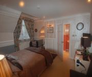
Norwood Guest House
JCT.10 Holiday Inn Express BURNLEY M65
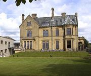
Best Western Oaks Hotel & Leisure Club
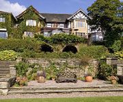
Best Western Higher Trapp Country House
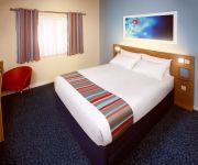
TRAVELODGE BURNLEY
Burnley
Videos from this area
These are videos related to the place based on their proximity to this place.
BURNLEY BUSES 1986 to 1996
A trailer for www.pmpvideo.com this is a clip from the first volume in the Burnley Bus Collection Shop at Amazon, bargains on EBay and order and listings on our own website.
High Definition- Playing cricket in stoneyholme burnley park cheap wicket + Ayaz bowling
muslims playing cricket amongst them selves, May Allah Keep them Happy in this world and the next burnley stoneyholme nwfp lancashire england uk cricket bowling moulana hafiz waisa attock...
SEO Burnley
http://bigseobuzz.com/google-places SEO Burnley Marketing your business could very well be the most essential thing you can do to keep your doors open. Google Places SEO Burnley Think...
BodySkye Number One Health and Fitness Gym in Burnley
BodySkye is the Number One Health and Fitness Gym in Burnley. Providing one to one personal training service and dance classes to cover all levels of health and fitness Bodysyke make your goal...
BODYSYKE Burnley Gym for weight loss and building stamina
BODYSYKE Burnley Gym is the best Gym to lose weight and build stamina. Watch this funny video to promote http://www.bodysyke.com.
Burnley vs Bristol City at Turf Moor - Alexander takes the first penalty...
Burnley vs Bristol City at Turf Moor - Alexander takes the first penalty...
Adventures to: Burnley
WATCH IN 1080p FOR THE BEST VIEWING EXPERIENCE!!! Follow me on my trip to Turf Moor, Burnley for the new home shirt. I discuss where I've been, microphone problems, The Capital One Cup, ...
Tattooist Burnley | Addictive Ink | Body Piercing
Best Tattooist in Burnley are found in Addictive Ink Burnley Tattoo Studio. visit http://www.burnleytattoostudio.com.
Lee cox from the Hakuda-gym in burnley Golden belt Thai boxing title
lee cox from Hakuda Thai boxing gym in Burnley winning the golden belt title.
Stovax Studio 2 Verve wood burning fire at The Fireplace Warehouse (Burnley)
The Fireplace Warehouse Ltd - TEL: 0844 334 9655 or visit www.thefireplacewarehouse.co.uk Now on 'live' display at the impressive & unique new Burn Booth at The Fireplace Warehouse (Burnley)...
Videos provided by Youtube are under the copyright of their owners.
Attractions and noteworthy things
Distances are based on the centre of the city/town and sightseeing location. This list contains brief abstracts about monuments, holiday activities, national parcs, museums, organisations and more from the area as well as interesting facts about the region itself. Where available, you'll find the corresponding homepage. Otherwise the related wikipedia article.
Borough of Burnley
The Borough of Burnley is a local government district of Lancashire, England, with the status of a non-metropolitan district and borough. It has an area of {{#invoke:Math|precision_format| 110.7*1,000,000/2,589,988.110336 | 1}} square miles (110.7 km) and a population of 87,000 (2011 est. ), and is named for its largest town, Burnley. The borough is bounded by Hyndburn, Ribble Valley, Pendle, Rossendale – all in Lancashire – and the borough of Calderdale in West Yorkshire.
Burnley (UK Parliament constituency)
Burnley is a constituency centred on the town of Burnley in Lancashire, which is represented in the House of Commons of the UK Parliament since 2010 by Gordon Birtwistle of the Liberal Democrats.
Burnley Manchester Road railway station
Burnley Manchester Road is a railway station serving the town of Burnley, Lancashire, England.
Padiham F.C
Padiham Football Club are an English football team based in Padiham, Lancashire. As of 2012–13, they play in the Premier Division of the North West Counties League.
River Hyndburn
The River Hyndburn is a river in Lancashire, England. It passes through the towns of Haslingden, Baxenden, Accrington, Clayton-le-Moors, Great Harwood, before meeting Hyndburn Brook, before ultimately joining the River Calder. The Hyndburn borough of Lancashire is named for the river.
Burnley Rural District
Burnley was a rural district of Lancashire, England from 1894 to 1974. It was named after but did not include Burnley, which was a county borough. It was created in 1894 under the Local Government Act 1894. In 1974 it was abolished under the Local Government Act 1972, with its territory going on to form part of the districts of Pendle, Ribble Valley, Burnley and Hyndburn. The offices of the Rural District Council were in Reedley Hallows, Reedley at what is now the Oaks Hotel on Colne Road.
Huncoat railway station
Huncoat railway station is a request stop only railway station which serves the village of Huncoat, between Accrington and Burnley in Lancashire. The station is 8 miles east of Blackburn railway station on the East Lancashire Line operated by Northern Rail.
Hapton railway station
Hapton railway station serves the village of Hapton 3 miles west of Burnley Central railway station on the East Lancashire Line operated by Northern Rail. It is unmanned. Between 2004–5 and 2005–6, passenger usage fell by 21% but in the years since then has risen again by more than 60%.
Rose Grove railway station
Rose Grove railway station is located in the western part of Burnley in Lancashire, England, 11 miles (17 km) east of Blackburn railway station. The Caldervale Line and the East Lancashire Line converge at Gannow Junction east of Rose Grove. However the station is only served by the East Lancashire Line, as the semi fast Blackpool North to York service via Burnley Manchester Road does not call at Rose Grove. Trains go instead towards Burnley Central and terminate at Colne.
Moorhouse's Brewery
Moorhouse's is an independent brewery founded in 1865 by William Moorhouse in Burnley in Lancashire, UK as a producer of mineral waters and low alcohol beers known as hop bitters. It first produced cask ales in 1978.
Rawtenstall railway station
Rawtenstall railway station serves the town of Rawtenstall in Lancashire, England, and is the northern terminus of the East Lancashire Railway. It was formerly on the national railway network and also had a connection to Bacup as well as Bury and Manchester. The Association of Train Operating Companies have identified that the community of Rawtenstall on the East Lancashire Railway Heritage Railway could benefit from services connecting the station to the National Network.
River Brun
The River Brun is a river in eastern Lancashire. Rising at the confluence of Hurstwood Brook (draining Wether Edge, Hameldon and supplying the Hurstwood Reservoir) and Rock Water at Foxstones Bridge near the village of Hurstwood, the river runs northwest towards the town of Burnley. The river passes through the artificial Rowley Lake near Rowley Hall and collects Swinden Water and the River Don, the latter at Netherwood Bridge.
Rossendale Forest
The Rossendale Forest is the area of hills in Lancashire, England between the Manchester basin and the upper Ribble valley. Despite its name it is largely open country and moorland.
Singing Ringing Tree (Panopticons)
The Singing Ringing Tree is a wind powered sound sculpture resembling a tree set in the landscape of the Pennine mountain range overlooking Burnley, in Lancashire, England. Completed in 2006, it is part of the series of four sculptures within the Panopticons arts and regeneration project created by the East Lancashire Environmental Arts Network (ELEAN).
Ightenhill
Ightenhill is a civil parish in the Borough of Burnley in Lancashire, England, with a population of 1,512. It is also considered to be a district of the town of Burnley, with boundaries that do not follow those of the parish. The district is composed principally of a large 1990s housing estate. It is bounded to the north and east by the River Calder, to the south by the Leeds and Liverpool Canal and the M65 motorway, and to the west by Padiham Road.
Baxenden railway station
Baxenden railway station served the village of Baxenden in Hyndburn. It was situated on the line from Bury Bolton Street to Accrington, which was opened in August 1848 by the East Lancashire Railway. The station gave its name to the nearby Baxenden Bank - a two-mile section towards Accrington that included gradients as steep as 1 in 38. In 1887 the Accrington Corporation Steam Tramways Company built a tramline from Accrington which terminated at the station.
Burnley Way
The Burnley Way is a 40 mile (64 km) long distance footpath in Lancashire, England. As a circular walk it can be walked from any point, but it is considered to start and finish at the Weavers' Triangle Visitor Centre in Burnley. It covers a range of terrain from canal towpaths to open moorland. The path is waymarked by a letter "B" and a bird symbol. It was created in 1993 and relaunched in May 2008.
Haslingden Canal
The Haslingden Canal was a proposed canal link between the Bury arm of the Manchester Bolton & Bury Canal in Greater Manchester, England, and the Leeds and Liverpool Canal in Accrington, England, passing through Haslingden. {{#invoke:Coordinates|coord}}{{#coordinates:53.7|-2.3|region:GB|||||| |primary |name= }} Authorised by an Act of Parliament in 1794, the canal was not built.
Butterworth & Dickinson
Butterworth and Dickinson were textile machinery manufacturers in Burnley Lancashire UK. It made looms. The Saunders Bank works was founded by Samuel Dickinson, and inherited in 1871, by his nephew William, from Tosside, Bolton-by-Bowland who went into partnership with John Butterworth, of "Oak Bank".
Angels (nightclub)
Angels was a nightclub and music venue in Burnley, England. It became most famous during the early 1990s with the rise of the house music scene, drawing visitors from across the United Kingdom. It occupied part of a Multi-storey car park on Curzon St, currently the site of another car park and Wilkinson store. Carl Cox, Paul Oakenfold, Pete Tong, Sasha, Judge Jules, all regularly DJ'd, and there were also memorable appearances from Boy George and Nigel Benn.
Weavers' Triangle
The Weavers' Triangle is located on the western side of Burnley town centre in Lancashire. The development of predominantly 19th-century industrial buildings is clustered around the Leeds and Liverpool Canal. It has been identified as a significant conservation area as the remaining cotton mills and associated buildings encapsulate the social and economic development of Burnley and its weaving industry.
St John's Church, Rawtenstall
St John's Church, Rawtenstall, is a redundant Anglican church located in Newchurch Road, Cloughfold, Rawtenstall, Lancashire, England. It has been designated by English Heritage as a Grade II listed building.
St John the Evangelist's Church, Crawshawbooth
St John the Evangelist's Church, Crawshawbooth, is located in the village of Crawshawbooth, near Rawtenstall, Lancashire, England. It is an active Anglican parish church in the deanery of Rossendale, the archdeaconry of Bolton, and the diocese of Manchester. Its benefice has been united with that of St Mary and All Saints, Goodshaw. The church has been designated by English Heritage as a Grade II* listed building.
St Paul's Church, Constable Lee
St Paul's Church, Constable Lee, is located in Burnley Road, Constable Lee, Rawtenstall, Lancashire, England. It is an active Anglican parish church in the deanery of Rossendale, the archdeaconry of Bolton, and the diocese of Manchester. The church has been designated by English Heritage as a Grade II listed building.
St Matthew's Church, Burnley
St Matthew's Church, Burnley, is located in St Matthew Street, Burnley, Lancashire, England. It is an active Anglican parish church in the deanery of Burnley, the archdeaconry of Blackburn, and the diocese of Blackburn.


