Safety Score: 3,0 of 5.0 based on data from 9 authorites. Meaning we advice caution when travelling to United Kingdom.
Travel warnings are updated daily. Source: Travel Warning United Kingdom. Last Update: 2024-05-10 08:04:54
Delve into Brixton
The district Brixton of Brixton Hill in Greater London (England) with it's 66,300 habitants Brixton is a district located in United Kingdom a little south of London, the country's capital town.
In need of a room? We compiled a list of available hotels close to the map centre further down the page.
Since you are here already, you might want to pay a visit to some of the following locations: Camberwell, City of Westminster, London, City of London and Islington. To further explore this place, just scroll down and browse the available info.
Local weather forecast
Todays Local Weather Conditions & Forecast: 20°C / 69 °F
| Morning Temperature | 13°C / 55 °F |
| Evening Temperature | 20°C / 67 °F |
| Night Temperature | 14°C / 56 °F |
| Chance of rainfall | 0% |
| Air Humidity | 55% |
| Air Pressure | 1024 hPa |
| Wind Speed | Gentle Breeze with 6 km/h (4 mph) from West |
| Cloud Conditions | Overcast clouds, covering 100% of sky |
| General Conditions | Overcast clouds |
Saturday, 11th of May 2024
21°C (70 °F)
14°C (57 °F)
Scattered clouds, gentle breeze.
Sunday, 12th of May 2024
22°C (71 °F)
16°C (60 °F)
Light rain, gentle breeze, broken clouds.
Monday, 13th of May 2024
13°C (56 °F)
11°C (52 °F)
Moderate rain, moderate breeze, overcast clouds.
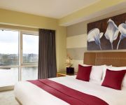
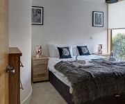
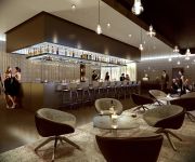
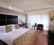
Hotels and Places to Stay
Plaza on the River London
CITY MARQUE LAMBETH NORTH
Park Plaza London Waterloo
Novotel London Waterloo
Park Plaza London Riverbank
Lambeth North One
H10 London Waterloo
Kennington B&B
Holiday Inn Express LONDON - VAUXHALL NINE ELMS
Days Hotel London- Waterloo
Videos from this area
These are videos related to the place based on their proximity to this place.
South/Central London RIG 1
This talk was given by Prof. Cathie Wallace, UCL IoE, at the first meeting of NALDIC's South and Central London Regional Interest Group on March 19, 2015 at St Gabriel's College, Lambeth. In...
Horse 'pedroscope'
Pedro is a Shetland pony who lives at Ebony Horse Club, a community riding centre in Brixton, London UK. He is one of nine horses used by the charity to teach riding and horse care to young...
Trains at Herne Hill 27/08/14
Some Southeastern and First Capital Connect trains seen at Herne Hill on the afternoon of Wednesday 27th August 2014. 0:00 465914 passes on 1A34 1230 Ashford International to London Victoria....
Sing Out Streatham Umbrella Flash Mob - Official Film
Sing Out Streatham's Flash Mob extravaganza on 28th March in Brixton Village! We meet on Thursday evenings in Streatham and we're open to all, regardless of experience. Led by Michael Carlyon...
Midnight Madness 2012 Second Qualifer Brixton - Rowell Graham DOMINATES!
Subscribe NOW to be the first to see our new vids! Click here to subscribe - http://bit.ly/hoopsfixsub Like us on Facebook: http://www.facebook.com/hoopsfix Follow us on Twitter: http://www.twitter...
Rochelle Davids Drops Defender on the Break & Finishes! LSBU Brixton Lady Topcats vs Sussex Thunder!
Subscribe NOW to be the first to see our new vids! Click here to subscribe - http://bit.ly/HoopsfixWomenSub Like us on Facebook: http://www.facebook.com/hoopsfixwomen Follow us on Twitter:...
Midnight Madness 2012 Opens up in Brixton! Matthew Bryan-Amaning Shows Out!
Subscribe NOW to be the first to see our new vids! Click here to subscribe - http://bit.ly/hoopsfixsub Like us on Facebook: http://www.facebook.com/hoopsfix Follow us on Twitter: http://www.twitter...
Victoria line - Brixton to Stockwell (27-07-2011)
Exactly two years after my previous video between these two stations was filmed, we embark on the same journey (this time, on a train of 2009 Tube Stock) as a way of comparing interior views.
Dick's In Brixton
Follow Dick in Brixton. The real Made In Brixton. Who's buying all the flats in Brixton and who's moving out of Brixton. Dick has the answer! Also check out Dick going into the Library and...
Skunk Anansie: Skin goes into Brixton crowd
Brixton Academy (O2 Academy Brixton): 1 Dec 2012 Excuse crappy sound quality.
Videos provided by Youtube are under the copyright of their owners.
Attractions and noteworthy things
Distances are based on the centre of the city/town and sightseeing location. This list contains brief abstracts about monuments, holiday activities, national parcs, museums, organisations and more from the area as well as interesting facts about the region itself. Where available, you'll find the corresponding homepage. Otherwise the related wikipedia article.
Metropolitan Borough of Lambeth
Lambeth was a civil parish and metropolitan borough in south London, England. It was an ancient parish in the county of Surrey. The parish was included in the area of responsibility of the Metropolitan Board of Works in 1855 and became part of the County of London in 1889. The parish of Lambeth became a metropolitan borough in 1900, following the London Government Act 1899, with the parish vestry replaced by a borough council.
Brixton Market
Brixton Market comprises a street market in the centre of Brixton, south London, England, and the adjacent covered market areas in nearby arcades Reliance Arcade, Market Row and Granville Arcade (recently rebranded as 'Brixton Village'). The market sells a wide range of foods and goods but is best known for its African and Caribbean produce, which reflect the diverse community of Brixton and surrounding areas of Lambeth. There is some controversy over the selling of live African snails.
Brixton Academy
The Brixton Academy, officially called O2 Academy, Brixton, is one of London's leading music venues, nightclubs and theatres. Situated in Brixton, South London, England, the building has hosted a range of leading rock acts since becoming a music venue in 1983. The maximum capacity is 4,921 (3,760 standing downstairs; 1,083 seated and 78 standing in the circle), alternatively the all-seated capacity is 2,391.
1981 Brixton riot
The 1981 Brixton riot (or Brixton uprising) was a confrontation between the Metropolitan Police and protesters in Lambeth, South London, England, between 10 and 11 April 1981. The main riot on 11 April, dubbed "Bloody Saturday" by TIME magazine, resulted in almost 280 injuries to police and 45 injuries to members of the public; over a hundred vehicles were burned, including 56 police vehicles; and almost 150 buildings were damaged, with thirty burned. There were 82 arrests.
Stockwell Skatepark
Stockwell Skatepark (also known as Brixton Bowls or Brixton Beach) is situated on Stockwell Park Walk in South London, England. Unsupervised and free at all hours, the skatepark was built in the 1970s and has been used since then by skateboarders and practitioners of other extreme sports such as BMX. The park remains popular and has been skated by the likes of Bam Margera, John Cardiel and Jason Lee and the Stereo Sound Agency
Electric Avenue
Electric Avenue is a street in Brixton, London. Built in the 1880s, it was the first market street to be lit by electricity. Today, the street contains several butchers and fish mongers and hosts a part of Brixton Market, which specializes in selling a mix of African, Caribbean, and Portuguese products. It is located just round the corner from Brixton tube station (1972). The elegant Victorian canopies over the pavements survived until the 1980s.
Morleys Stores Ltd
Morleys Stores Ltd is a group of seven department stores in Greater London and a business-to-business furniture supply subsidiary called Morley’s of Bicester Ltd. The group is named after the original store that opened in Brixton, south London as Morley & Lanceley. In the year to January 2012 group profit was £4.56 million on turnover was £41.08 million. During that year it paid 484 employees £9.44 million and 11 directors £412,000.
Brixton Road
Brixton Road is a road in the London Borough of Lambeth, leading from the Oval at Kennington to Brixton, where it forms the high street and then forks into Effra Road and Brixton Hill at St Matthew's church at the junction with Acre Lane and Coldharbour Lane. Brixton Market is located in Electric Avenue near Brixton Underground station and in a network of covered arcades adjacent to the two railway viaducts.
Railton Road
Railton Road runs between Brixton and Herne Hill in the London Borough of Lambeth. In the 1970s, Railton Road was a run down area that was known as "The Frontline" locally. The 1981 Brixton riot, the most serious riot in the United Kingdom during the 20th century, started here. The George public house was burnt down and a number of other buildings were damaged.
A2217 road
The A2217 is an A road in London, England. It connects Clapham Common with Camberwell via Brixton. It is made up of three streets, Coldharbour Lane, Acre Lane and Clapham Park Road.
Ritzy Cinema
The Ritzy is a cinema in Brixton, South London, United Kingdom. The cinema opened on 11 March 1911 as 'the Electric Pavilion'. It was built by E. C. Homer and Lucas for Israel Davis, one of a noted family of cinema developers, and was one of England's earliest purpose built cinemas seating over 750 seats in the single auditorium. Like many cinemas of the period, it was fitted with an organ. In 1954 it was renamed 'the Pullman' and the organ was removed.
Loughborough Junction
Loughborough Junction is an area of South London, in the Borough of Lambeth, which lies on the borderline of Brixton and Camberwell. It is centred at a junction which consists of 7 railway bridges which can all be seen at once from the centre of the junction.
Coldharbour Lane
Coldharbour Lane is a road in South London that leads south-westwards from Camberwell to Brixton. In total the road is over 1 mile long with a mixture of residential, business and retail buildings - the stretch of Coldharbour Lane near Brixton Market contains shops, bars and restaurants. The junction of Coldharbour Lane and Denmark Hill in Camberwell SE5 marks part of the boundary between Lambeth and Southwark boroughs.
Camberwell railway station
Camberwell railway station was a railway station on the London, Chatham and Dover Railway (LC&DR). It opened in 1862 as part of the company's ambitious second London railway. In 1863 the name was changed to Camberwell New Road but in 1908 reverted to Camberwell. As with many other London stations wartime restraints forced it to close in 1916. The station was mentioned in the 1956 film Private's Progress as a good place to get off a train and avoid paying a fare.
How Does It Feel To Be Loved
How Does It Feel To Be Loved? (often abbreviated to HDIF) is a London-based nightclub, which predominately plays indie pop, Northern Soul and Motown music. On the club's website, founder Ian Watson explains: "We love pop, we love guitars that jangle, we love foot stomping melodies and huge choruses. " The club's name is taken from the lyrics to The Velvet Underground song "Beginning to See the Light".
Torture Garden (fetish club)
Torture Garden (or TG) is a fetish club in London, UK. The club started in 1990 and is now Europe's largest fetish club, featuring monthly at the Mass Club in the converted St. Matthews Church, Brixton. It features dance floors, musical acts, performance art, fashion shows, and an S&M 'dungeon'. Initially threatened with closure by the police, it is now described as "legendary" and "a capital institution" by Time Out magazine.
Evelyn Grace Academy
Evelyn Grace Academy is a non-selective, co-educational secondary school within the English Academy programme, in Brixton, London. The Academy opened in September 2008 in temporary accommodation admitting its first 180 Year 7 pupils. In September 2010 the academy moved to a new purpose built school building as it admitted its third year 7 year group. The building, designed by architect Zaha Hadid, was awarded the 2011 Stirling Prize.
Brixton Mosque
The Brixton Mosque and Islamic Cultural Centre (the "Brixton Mosque", or "Masjid ibn Taymeeyah") is a mosque located in Gresham Road in the Brixton area of South London, England. The mosque has facilities for both men and women and space for 500 worshippers during prayer and is currently expanding to accommodate over 1000 worshippers. It also has the largest number of converts for a mosque in the United Kingdom.
Vassall (ward)
Vassall ward is an administrative division of the London Borough of Lambeth, United Kingdom. It is located in the North of borough bordering Southwark, in the SW9 and SE5 postcode area. The area is named for Henry Vassall-Fox, 3rd Baron Holland who was responsible for the first building development in the area in the 1820s. The ward includes parts of Kennington, Oval, Brixton, Stockwell and Camberwell. The ward is noted for its high numbers of households living in deprived conditions.
Coldharbour (Lambeth ward)
Coldharbour ward is an administrative division of the London Borough of Lambeth, England. It is located in Brixton and, as the name suggests contains part of Coldharbour Lane. Brixton tube station, Brixton railway station and Loughborough Junction railway station are located in the ward. Coldharbour ward is located in the Dulwich and West Norwood Parliamentary constituency - it was formerly split between Vauxhall and Dulwich and West Norwood constituencies.
Herne Hill (ward)
Herne Hill ward is an administrative division of the London Borough of Lambeth, England. It is located in Herne Hill and contains Brockwell park, Ruskin Park, and Kings College Hospital. Herne Hill ward is located in the Dulwich and West Norwood Parliamentary constituency.
Myatt's Fields Park
Myatt's Fields Park is a Victorian park in the London Borough of Lambeth. It is located in Camberwell, SE5. It was designed by Fanny Wilkinson.
Lambeth Archives
Lambeth Archives is an archive in South London, managed by the London Borough of Lambeth. Containing records of Lambeth businesses, organisations and individuals, it is housed at the Minet Library on Knatchbull Road. The archive holds various documents for tracing family history, including parish records, electoral registers, civil registers, census returns, poll books, cemetery records, trade and commercial directories, and historic newspapers. The archive is open to the public free of charge.
Mayall Road
Mayall Road is in Brixton. It runs parallel to Railton Road and the area between them has been known as the Front Line - an area of troubled race relations and conflict with the police. A street party is held there every year during the August bank holiday.
Bonnington Square
Bonnington Square is a square in Vauxhall, south London, built in the 1870s to house railway workers. It became famous in the 1980s when all the houses in it, vacant and awaiting demolition, were squatted. In the late 1970s, Bonnington Square was compulsorily purchased by the Greater London Council (GLC) for the Inner London Education Authority (ILEA), which intended to demolish it in order to build a new school.


