Safety Score: 3,0 of 5.0 based on data from 9 authorites. Meaning we advice caution when travelling to United Kingdom.
Travel warnings are updated daily. Source: Travel Warning United Kingdom. Last Update: 2024-04-28 08:22:10
Explore Baslow
Baslow in Derbyshire (England) with it's 1,178 inhabitants is a city in United Kingdom about 136 mi (or 218 km) north-west of London, the country's capital.
Local time in Baslow is now 10:56 PM (Sunday). The local timezone is named Europe / London with an UTC offset of one hour. We know of 8 airports in the vicinity of Baslow, of which 5 are larger airports. The closest airport in United Kingdom is Manchester Woodford Airport in a distance of 23 mi (or 36 km), West. Besides the airports, there are other travel options available (check left side).
There are several Unesco world heritage sites nearby. The closest heritage site in United Kingdom is Liverpool – Maritime Mercantile City in a distance of 28 mi (or 45 km), North-East. Also, if you like golfing, there are multiple options in driving distance. We found 1 points of interest in the vicinity of this place. If you need a place to sleep, we compiled a list of available hotels close to the map centre further down the page.
Depending on your travel schedule, you might want to pay a visit to some of the following locations: Matlock, Bradfield, Sheffield, Bradley and Wortley. To further explore this place, just scroll down and browse the available info.
Local weather forecast
Todays Local Weather Conditions & Forecast: 9°C / 48 °F
| Morning Temperature | 4°C / 39 °F |
| Evening Temperature | 8°C / 47 °F |
| Night Temperature | 5°C / 40 °F |
| Chance of rainfall | 11% |
| Air Humidity | 73% |
| Air Pressure | 1004 hPa |
| Wind Speed | Fresh Breeze with 14 km/h (9 mph) from East |
| Cloud Conditions | Overcast clouds, covering 100% of sky |
| General Conditions | Rain and snow |
Monday, 29th of April 2024
11°C (52 °F)
9°C (48 °F)
Light rain, fresh breeze, overcast clouds.
Tuesday, 30th of April 2024
14°C (57 °F)
10°C (50 °F)
Light rain, fresh breeze, scattered clouds.
Wednesday, 1st of May 2024
14°C (56 °F)
12°C (53 °F)
Light rain, moderate breeze, overcast clouds.
Hotels and Places to Stay
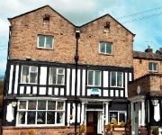
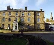
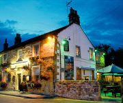
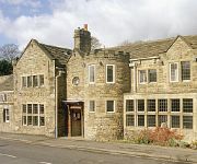
Millstone Country Inn
The Rutland Arms Hotel
The Peacock
George
George Hotel Hathersage
Chesterfield West
Videos from this area
These are videos related to the place based on their proximity to this place.
Chatsworth Country Fair. Sept 2012
Chatsworth Country Fair was great! Spread over several acres it has so much to see and expierence. I was there on Saturday and hopefully my footage gives you a taste of the event. Bet you...
Chatsworth Country Fair. Aug 2014
Chatsworth Country Fair. Aug 2014 Had a great time at this years fair. A vibrant and busy day full of entertainment, food and displays. A marvellous family day out! This years fair was opened...
A Ride Through the Village of Edensor in Derbyshire
A ride through the very pretty Derbyshire village near Chatsworth House. The village is owned by the Duke of Devonshire. http://en.wikipedia.org/wiki/Edensor SK250700, 28.09.13.
The Red Arrows at Chatsworth Country Fair. Sept 2012
It was amazing to see the world famous Red Arrows air display at Chatsworth Country Fair. When they flew low, you could actually feel the roar of the engines! -- Watch my video Chatsworth...
The Red Arrows !st Air Display since loss of red 4 Flt Lt Jon Egging. Chatsworth Country Fair.
Flt Lt Jon Egging Red Arrows Chatsworth red 4.
TVR Chatsworth 2013
These are a selection of photos from the TVRCC annual meet at Chatsworth (UK) which this year occurred at the end of April. It was a glorious sunny day with nearly 600 different TVRs in attendance!...
Chatsworth prepares for Christmas
Janet Bitton, Assistant Head Housekeeper talks us through the making of the Dwarves' mine, part of the pantomime themed Christmas displays in the house.
RAF Red Arrows - Chatsworth Show 2nd September 2011 - RIP Jon Egging
The RAF Red Arrows Aerial Display Team fly for the public for the first time since their tragic loss of Jon Egging Red 4. Note the space left where Red 4 should be. Filmed at Chatsworth, Bakewell...
Chatsworth Preserved Bus Gathering 2010 HD video 3
The annual event with interest for all! Preserved buses in the beautiful setting of Chatsworth Park organised by TRANSPIRE and the Chesterfield 123 Bus Preservation Group.
Videos provided by Youtube are under the copyright of their owners.
Attractions and noteworthy things
Distances are based on the centre of the city/town and sightseeing location. This list contains brief abstracts about monuments, holiday activities, national parcs, museums, organisations and more from the area as well as interesting facts about the region itself. Where available, you'll find the corresponding homepage. Otherwise the related wikipedia article.
Chatsworth House
Chatsworth House is a stately home in North Derbyshire, England, 3.5 miles northeast of Bakewell and 9 miles west of Chesterfield (GB Grid SK260700). It is the seat of the Duke of Devonshire, and has been home to his family, the Cavendish family, since Bess of Hardwick settled at Chatsworth in 1549. Standing on the east bank of the River Derwent, Chatsworth looks across to the low hills that divide the Derwent and Wye valleys.
Upper Derwent Valley
The Upper Derwent Valley is an area of the Peak District National Park in England. It largely lies in Derbyshire, but its north eastern area lies in Sheffield, South Yorkshire. Its most significant features are the Derwent Dams, Ladybower, Derwent and Howden, which form Ladybower Reservoir, Derwent Reservoir and Howden Reservoir respectively.
Birchen Edge
Birchen Edge is a rock face in the Peak District, England, popular with walkers and with novice climbers as most of the climbing routes are in the lower grades.
Froggatt Edge
Froggatt Edge is a gritstone escarpment in the Dark Peak area of the Peak District National Park, in Derbyshire, England and situated in close proximity to the villages of Froggatt, Calver, Curbar, Baslow and Grindleford. The name Froggat Edge applies only to the northernmost section of the escarpment; the middle and southernmost sections are called Curbar Edge and Baslow Edge respectively. The escarpment, like many in this area, is easily accessible from Sheffield.
Gardom's Edge
Gardom's Edge is located near Baslow in Derbyshire, England. The shelf between Gardom's Edge and Birchen Edge is now moorland used for grazing sheep, but was inhabited and arably farmed during the Bronze Age.
Cliff College
Cliff College is a Christian theological college in Calver, Derbyshire, that teaches Biblical Theology at the undergraduate level and a number of mission courses to postgraduates. There are currently about 60 full-time undergraduates, 40 part-time undergraduates and 100 part-time postgraduates. There are also a number of research (MPhil and PhD) students and full-time postgraduates enrolled at the College.
Middleton Hall, Stoney Middleton
Middleton Hall is a restored 17th century country house at Stoney Middleton, Derbyshire. It is a Grade II listed building. The house was built in the mid 17th century for Robert Ashton (who was High Sheriff of Derbyshire in 1665) whose son sold it to Edward Finney in 1690. Finney's daughter and, in 1790 his heir, married Joseph Denman MD of Bakewell, on whose death the property passed to his nephew Thomas Denman, who was Lord Chief Justice, 1832-50. see Baron Denman.
St. Anne's Church, Baslow
St. Anne’s Church, Baslow is a Grade II* listed parish church in Baslow, England.


