Safety Score: 3,0 of 5.0 based on data from 9 authorites. Meaning we advice caution when travelling to United Kingdom.
Travel warnings are updated daily. Source: Travel Warning United Kingdom. Last Update: 2024-04-27 08:23:39
Touring Old Brampton
Old Brampton in Derbyshire (England) is a town located in United Kingdom about 133 mi (or 214 km) north-west of London, the country's capital place.
Time in Old Brampton is now 10:19 PM (Saturday). The local timezone is named Europe / London with an UTC offset of one hour. We know of 8 airports nearby Old Brampton, of which 5 are larger airports. The closest airport in United Kingdom is Robin Hood Doncaster Sheffield Airport in a distance of 26 mi (or 42 km), North-East. Besides the airports, there are other travel options available (check left side).
There are several Unesco world heritage sites nearby. The closest heritage site in United Kingdom is Liverpool – Maritime Mercantile City in a distance of 23 mi (or 37 km), North-East. Also, if you like the game of golf, there are several options within driving distance. Need some hints on where to stay? We compiled a list of available hotels close to the map centre further down the page.
Being here already, you might want to pay a visit to some of the following locations: Matlock, Sheffield, Orgreave, Bradfield and Rotherham. To further explore this place, just scroll down and browse the available info.
Local weather forecast
Todays Local Weather Conditions & Forecast: 8°C / 47 °F
| Morning Temperature | 2°C / 36 °F |
| Evening Temperature | 7°C / 45 °F |
| Night Temperature | 4°C / 40 °F |
| Chance of rainfall | 0% |
| Air Humidity | 71% |
| Air Pressure | 1004 hPa |
| Wind Speed | Moderate breeze with 9 km/h (6 mph) from South-West |
| Cloud Conditions | Overcast clouds, covering 100% of sky |
| General Conditions | Overcast clouds |
Sunday, 28th of April 2024
3°C (38 °F)
4°C (39 °F)
Moderate rain, moderate breeze, overcast clouds.
Monday, 29th of April 2024
11°C (52 °F)
9°C (48 °F)
Light rain, fresh breeze, broken clouds.
Tuesday, 30th of April 2024
14°C (57 °F)
10°C (50 °F)
Broken clouds, fresh breeze.
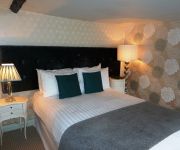
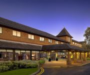
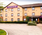
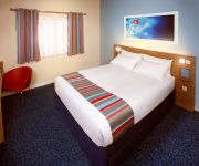
Hotels and Places to Stay
PEAK EDGE HOTEL
Manor House Hotel
Casa
DoubleTree by Hilton Sheffield Park
BUCKINGHAMS HOTEL - TO BE DELE
Chesterfield North
ibis Chesterfield Centre - Market Town
TRAVELODGE CHESTERFIELD
Chesterfield West
Videos from this area
These are videos related to the place based on their proximity to this place.
Chesterfield v Mansfield FA Cup 1st round 08/11/2008
View from the kop as the teams come out for what was probably the last derby for a while...
Chesterfield v Bradford - After Game ( Pitch Invastion by Chesterfield )
Bradford city players coming over to thank the fans, after the Bradford V Chesterfield game on the 2nd May 2009. This video taken from the Bradford supporters end. Ater the Bradford players...
Mantelpiece Fireplace Centre Chesterfield
If you're looking to stay warm and comfy this winter - look no further than The Mantelpiece - Chesterfield's largest fireplace centre. You can find the latest in high efficiency multifuel...
Paperclip Admin, based in Dronfield
Paperclip Admin, based in Dronfield, are a business support and administration service specialising in telephone answering, sales and marketing, credit control and dictation transcription....
Dronfield Documentary: Return of Chris Paul - Red Band Trailer
For the launch of Dronfield Digital, Chris Paul is back and more vivacious than ever. If you have never seen this man before (and you're missing out) please watch: http://www.youtube.com/watch?v=zc...
St George's Day Parade - Dronfield, Derbyshire (ending)
The scouts from Dronfield celebrate St George's Day. (25.04.2010)
St George's Day Parade - Dronfield, Derbyshire (beginning)
The scouts from Dronfield celebrate St George's Day. (25.04.2010)
Nicola Farnon Trio
The massively talented Nicola Farnon Trio, performing The Lady is a tramp at The Green Dragon, Dronfield, Derbyshire 12/10/14. Nicola Farnon, Vocals & Double Base Piero Tucci, Piano Phil Johnson,.
Videos provided by Youtube are under the copyright of their owners.
Attractions and noteworthy things
Distances are based on the centre of the city/town and sightseeing location. This list contains brief abstracts about monuments, holiday activities, national parcs, museums, organisations and more from the area as well as interesting facts about the region itself. Where available, you'll find the corresponding homepage. Otherwise the related wikipedia article.
North East Derbyshire
North East Derbyshire is a local government district in Derbyshire, England. It borders the districts of Chesterfield, Bolsover, Amber Valley and Derbyshire Dales in Derbyshire, and Sheffield and Rotherham in South Yorkshire. The district offices are based outside the district, in the town of Chesterfield, which the district surrounds on three sides, and thus acts as the shopping and work centre for much of the district.
Walton, Chesterfield
Walton is a suburb of Chesterfield. Among its attractions are a few shops, a golf course, and a pub called The Blue Stoops on Matlock Road. The name Walton comes from settlement/farmstead of Wealas - native Celts which is what the new Anglo Saxon speaking peoples called the native inhabitants of England.
New Brampton
New Brampton is a suburb of Chesterfield in Derbyshire. It is mostly located along the Chatsworth Road, Old Road and Baslow Road (A619). The suburb grew out of the expansion of Chesterfield during the Nineteenth century through a combination of industrial development and, as far back as the Nineteenth century, tourism. This is thanks to the fact the Baslow Road leads out into the Peak District, to nearby Baslow and the Beeley Moor, as well as Holymoorside and Chatsworth House.
Barlow Common
Barlow Common is a village in Derbyshire, England near Barlow and Chesterfield.
Somersall Hall
For a similarly named house in Derbyshire see Somersal Herbert Hall Somersall Hall is a small country house near Brampton, Chesterfield, Derbyshire. It is a Grade II listed building. The Clarke family owned the estate in the 16th century. Godfrey Clarke and his son Sir Gilbert Clarke served as High Sheriff of Derbyshire in 1652 and 1676 respectively. Sir Gilbert bought an additional estate at Chilcote Hall in 1672. His son Godfrey Clarke was Member of Parliament for Derbyshire.
Barlow Woodseats Hall
Barlow Woodseats Hall is a Grade II* listed manor house situated at Barlow Woodseats, on the edge of the village of Barlow, in Derbyshire. It remains the only manor house in the Parish of Barlow, and the current house dates from the early 17th century, although there are much earlier origins to before 1269.
Ingmanthorpe, Derbyshire
Ingmanthorpe is a hamlet in Derbyshire, England. Ingmanthorpe is located on the B6050 road some 3 miles west of the town of Chesterfield.


