Safety Score: 3,0 of 5.0 based on data from 9 authorites. Meaning we advice caution when travelling to United Kingdom.
Travel warnings are updated daily. Source: Travel Warning United Kingdom. Last Update: 2024-04-25 08:17:04
Touring Holmesfield
Holmesfield in Derbyshire (England) with it's 753 residents is a town located in United Kingdom about 137 mi (or 220 km) north-west of London, the country's capital place.
Time in Holmesfield is now 10:58 AM (Thursday). The local timezone is named Europe / London with an UTC offset of one hour. We know of 8 airports nearby Holmesfield, of which 5 are larger airports. The closest airport in United Kingdom is Robin Hood Doncaster Sheffield Airport in a distance of 24 mi (or 39 km), North-East. Besides the airports, there are other travel options available (check left side).
There are several Unesco world heritage sites nearby. The closest heritage site in United Kingdom is Liverpool – Maritime Mercantile City in a distance of 22 mi (or 36 km), East. Also, if you like the game of golf, there are several options within driving distance. Need some hints on where to stay? We compiled a list of available hotels close to the map centre further down the page.
Being here already, you might want to pay a visit to some of the following locations: Sheffield, Bradfield, Matlock, Orgreave and Wortley. To further explore this place, just scroll down and browse the available info.
Local weather forecast
Todays Local Weather Conditions & Forecast: 7°C / 44 °F
| Morning Temperature | 4°C / 40 °F |
| Evening Temperature | 6°C / 43 °F |
| Night Temperature | 2°C / 36 °F |
| Chance of rainfall | 0% |
| Air Humidity | 66% |
| Air Pressure | 1004 hPa |
| Wind Speed | Moderate breeze with 9 km/h (6 mph) from South-East |
| Cloud Conditions | Overcast clouds, covering 99% of sky |
| General Conditions | Light rain |
Friday, 26th of April 2024
8°C (47 °F)
3°C (37 °F)
Overcast clouds, gentle breeze.
Saturday, 27th of April 2024
6°C (42 °F)
5°C (42 °F)
Light rain, moderate breeze, overcast clouds.
Sunday, 28th of April 2024
9°C (49 °F)
8°C (46 °F)
Moderate rain, moderate breeze, overcast clouds.
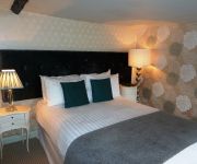
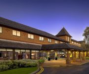
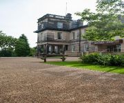
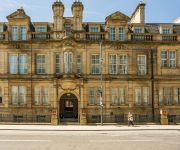
Hotels and Places to Stay
CORAL KHARTOUM HOTEL
Manor House Hotel
DoubleTree by Hilton Sheffield Park
Best Western Plus Kenwood Hall Hotels
Halifax Hall
Rutland
Copthorne Sheffield
Novotel Sheffield Centre
Leopold Hotel
Mercure Sheffield St Paul's Hotel and Spa
Videos from this area
These are videos related to the place based on their proximity to this place.
Paperclip Admin, based in Dronfield
Paperclip Admin, based in Dronfield, are a business support and administration service specialising in telephone answering, sales and marketing, credit control and dictation transcription....
Dronfield Documentary: Return of Chris Paul - Red Band Trailer
For the launch of Dronfield Digital, Chris Paul is back and more vivacious than ever. If you have never seen this man before (and you're missing out) please watch: http://www.youtube.com/watch?v=zc...
St George's Day Parade - Dronfield, Derbyshire (ending)
The scouts from Dronfield celebrate St George's Day. (25.04.2010)
St George's Day Parade - Dronfield, Derbyshire (beginning)
The scouts from Dronfield celebrate St George's Day. (25.04.2010)
Nicola Farnon Trio
The massively talented Nicola Farnon Trio, performing The Lady is a tramp at The Green Dragon, Dronfield, Derbyshire 12/10/14. Nicola Farnon, Vocals & Double Base Piero Tucci, Piano Phil Johnson,.
Jordanthorpe to Woodseats
A short film of a road trip between Jordanthorpe and Woodseats on 29th of December 2007. This film plays a dual speed so it isn't too boring.
Sheffield Outer Ring Road - December 2007
A trip around the incomplete ring road. Some parts are enormous dual carriageway, but others are twisty local roads with speed bumps to slow you down. I shot this one in widescreen.
Videos provided by Youtube are under the copyright of their owners.
Attractions and noteworthy things
Distances are based on the centre of the city/town and sightseeing location. This list contains brief abstracts about monuments, holiday activities, national parcs, museums, organisations and more from the area as well as interesting facts about the region itself. Where available, you'll find the corresponding homepage. Otherwise the related wikipedia article.
Dore and Totley
Dore and Totley ward—which includes the districts of Bradway, Dore, Totley, and Whirlow—is one of the 28 electoral wards in City of Sheffield, England. It is currently represented by three Liberal Democrat councillors. It is located in the southwestern part of the city and covers an area of 26.3 km. The population of this ward in 2001 was 16,400 people in 7,000 households. Dore and Totley ward is one of the five wards that make up the Sheffield Hallam Parliamentary constituency.
Bradway Tunnel
Bradway Tunnel, 2,027 yards long, was built in 1870 about 1-mile north of Dronfield, Derbyshire, in South Yorkshire, England. It is at the summit of the Midland Main Line between Chesterfield and Sheffield, on what is known to railwaymen as the "New Road" built by the Midland Railway to serve Sheffield, which was bypassed by the North Midland Railway's "Old Road" due to the gradients involved.
Totley Brook
The Totley Brook is a stream in Sheffield, South Yorkshire, England. It rises on a millstone grit ridge some 7 miles to the south-west of the centre of Sheffield. Over its course it drops from 740 feet to 430 feet near its junction with the Old Hay Brook close to Baslow Road. The streams form the River Sheaf once they have joined. There is an estate in Dore called Totley Brook, despite the fact that it is actually situated on the Old Hay Brook.
Old Hay Brook
The Old Hay Brook is a small river in Sheffield, South Yorkshire, England. It is formed from the Redcar Brook, Blacka Dike and another stream, which rise on moors to the south of Sheffield, and is joined by Needham's Dyke near Totley Grange. At Totley Rise it joins Totley Brook, to become the River Sheaf. Water from the river was used to power mills processing lead, corn and paper from at least the 1600s, which were later used for grinding scythes as the Sheffield metal industry expanded.
Abbeydale Park
Abbeydale Park is a sports venue in Dore, South Yorkshire, England. It is unusual in having hosted home games for two different county cricket teams.
Barlow Common
Barlow Common is a village in Derbyshire, England near Barlow and Chesterfield.
Barlow Woodseats Hall
Barlow Woodseats Hall is a Grade II* listed manor house situated at Barlow Woodseats, on the edge of the village of Barlow, in Derbyshire. It remains the only manor house in the Parish of Barlow, and the current house dates from the early 17th century, although there are much earlier origins to before 1269.
List of United Kingdom locations: New T-Ney


