Safety Score: 3,0 of 5.0 based on data from 9 authorites. Meaning we advice caution when travelling to United Kingdom.
Travel warnings are updated daily. Source: Travel Warning United Kingdom. Last Update: 2024-04-28 08:22:10
Discover Eyam
Eyam in Derbyshire (England) with it's 969 citizens is a place in United Kingdom about 139 mi (or 224 km) north-west of London, the country's capital city.
Current time in Eyam is now 09:14 PM (Sunday). The local timezone is named Europe / London with an UTC offset of one hour. We know of 8 airports near Eyam, of which 5 are larger airports. The closest airport in United Kingdom is Manchester Woodford Airport in a distance of 20 mi (or 32 km), West. Besides the airports, there are other travel options available (check left side).
There are several Unesco world heritage sites nearby. The closest heritage site in United Kingdom is Liverpool – Maritime Mercantile City in a distance of 29 mi (or 47 km), East. Also, if you like playing golf, there are a few options in driving distance. We encountered 1 points of interest in the vicinity of this place. If you need a hotel, we compiled a list of available hotels close to the map centre further down the page.
While being here, you might want to pay a visit to some of the following locations: Bradfield, Matlock, Sheffield, Penistone and Wortley. To further explore this place, just scroll down and browse the available info.
Local weather forecast
Todays Local Weather Conditions & Forecast: 9°C / 48 °F
| Morning Temperature | 4°C / 39 °F |
| Evening Temperature | 8°C / 47 °F |
| Night Temperature | 5°C / 40 °F |
| Chance of rainfall | 11% |
| Air Humidity | 73% |
| Air Pressure | 1004 hPa |
| Wind Speed | Fresh Breeze with 14 km/h (9 mph) from East |
| Cloud Conditions | Overcast clouds, covering 100% of sky |
| General Conditions | Rain and snow |
Monday, 29th of April 2024
11°C (52 °F)
9°C (48 °F)
Light rain, fresh breeze, overcast clouds.
Tuesday, 30th of April 2024
14°C (57 °F)
10°C (50 °F)
Light rain, fresh breeze, scattered clouds.
Wednesday, 1st of May 2024
14°C (56 °F)
12°C (53 °F)
Light rain, moderate breeze, overcast clouds.
Hotels and Places to Stay
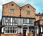
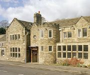
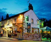
Millstone Country Inn
George Hotel Hathersage
George
The Peacock
Videos from this area
These are videos related to the place based on their proximity to this place.
Carlswark Cavern and Triple Hole Derbyshire Caving Aug 2014
Caving trip to Triple Hole and Carlswark Cavern near Stoney Middleton with Explorers From The Future.
Carlswark Resurgence Entrance in flood
27.11.2012 Recent heavy rain has filled the large and often explorable Resurgence Entrance to Carlswark Cavern to the roof. The entrance crawl is approximatley 1 foot under the surface of...
Over the back from Bradwell to Dore (Sheffield)
late in the day but still plenty of lift, cloud base 4600ft+ with the wind WNW at approx 5km.. I flew approx 16km point-to-point, the flight took 40min, my max speed was 55km.
On Board Camera ride
A on board camera ride.Here we take a a ride on a inter modal train been hauled by Hornby class 50 035 in large logo livery.The loco is named Ark royal.This is what I call my test track layout.Thi...
Dark &White Hathersage Winter League Trailquest Round 6
The final round of the winter league series. 3hrs of mountain bike orienteering in the superb surroundings of the Peak District National Park. Over 160 people took part in what was a tough...
A Class 142 Pacer arrives at Hathersage
One of Northern Rail's Class 142 Pacer DUMs arrives at Hathersage on 25 April 2011. The arrival here is very easy to film with the linear route of the railway in evidence. 142047 was the train...
Hathersage to Ladybower Peak District MTB
Mountain biking in the Peak District. A taster of the circuit from Hathersage to Ladybower reservoir including descents of Brough Lane and the scary one at Hope Cross. I had to take that one...
Videos provided by Youtube are under the copyright of their owners.
Attractions and noteworthy things
Distances are based on the centre of the city/town and sightseeing location. This list contains brief abstracts about monuments, holiday activities, national parcs, museums, organisations and more from the area as well as interesting facts about the region itself. Where available, you'll find the corresponding homepage. Otherwise the related wikipedia article.
Upper Derwent Valley
The Upper Derwent Valley is an area of the Peak District National Park in England. It largely lies in Derbyshire, but its north eastern area lies in Sheffield, South Yorkshire. Its most significant features are the Derwent Dams, Ladybower, Derwent and Howden, which form Ladybower Reservoir, Derwent Reservoir and Howden Reservoir respectively.
Hathersage railway station
Hathersage railway station serves the village of Hathersage in the Derbyshire Peak District, in England. It was opened in 1894 on the Midland Railway's Dore and Chinley line. The original buildings were of timber and have disappeared with the platforms being rebuilt in masonry. The villagers' initial reaction to proposals to build the railway may have been unenthusiastic.
Eyam Hall
Eyam Hall is a 17th century historic house in the village of Eyam, Derbyshire, England, UK, situated in the Hope Valley, off the A623 from Chapel-en-le-Frith to Chesterfield. It is a Grade II* listed building. The Hall was built ca. 1676 by the Wright family, about 11 years after the plague outbreak in the village of Eyam. The same family still owns the house. Features of this gritstone-built house include a Jacobean staircase, knot garden, kitchen garden, and stone flagged hall.
Hassop Hall
Hassop Hall is a 17th-century country house near Bakewell, Derbyshire which is now operated as an hotel. It is a Grade II* listed building. The Manor was owned by the Foljambe family until the 14th century when it passed by the marriage of Alice Foljambe to Sir Robert Plumpton. His son Sir William Plumpton served as High Sheriff of Derbyshire in 1453. The Plumptons sold the estate in 1498 to Catherine Eyre. The manor house was substantially rebuilt in the early 17th century by Thomas Eyre.
Middleton Hall, Stoney Middleton
Middleton Hall is a restored 17th century country house at Stoney Middleton, Derbyshire. It is a Grade II listed building. The house was built in the mid 17th century for Robert Ashton (who was High Sheriff of Derbyshire in 1665) whose son sold it to Edward Finney in 1690. Finney's daughter and, in 1790 his heir, married Joseph Denman MD of Bakewell, on whose death the property passed to his nephew Thomas Denman, who was Lord Chief Justice, 1832-50. see Baron Denman.
Rowland, Derbyshire
Rowland is a village and a civil parish in the Derbyshire Dales District, in the English county of Derbyshire. It is near the larger village of Great Longstone. Rowland lies within the chapelry of Baslow.
Eyam Museum
Eyam Museum is a local museum in the village of Eyam, located in the Peak District, Derbyshire, England.


