Safety Score: 3,0 of 5.0 based on data from 9 authorites. Meaning we advice caution when travelling to United Kingdom.
Travel warnings are updated daily. Source: Travel Warning United Kingdom. Last Update: 2024-04-26 08:02:42
Delve into Ughill
Ughill in Sheffield (England) is located in United Kingdom about 146 mi (or 234 km) north-west of London, the country's capital town.
Current time in Ughill is now 03:19 PM (Friday). The local timezone is named Europe / London with an UTC offset of one hour. We know of 8 airports close to Ughill, of which 5 are larger airports. The closest airport in United Kingdom is Manchester Woodford Airport in a distance of 23 mi (or 36 km), West. Besides the airports, there are other travel options available (check left side).
There are several Unesco world heritage sites nearby. The closest heritage site in United Kingdom is Liverpool – Maritime Mercantile City in a distance of 25 mi (or 40 km), East. Also, if you like playing golf, there are some options within driving distance. If you need a hotel, we compiled a list of available hotels close to the map centre further down the page.
While being here, you might want to pay a visit to some of the following locations: Bradfield, Wortley, Penistone, Sheffield and Stainborough. To further explore this place, just scroll down and browse the available info.
Local weather forecast
Todays Local Weather Conditions & Forecast: 6°C / 43 °F
| Morning Temperature | 2°C / 35 °F |
| Evening Temperature | 7°C / 44 °F |
| Night Temperature | 2°C / 36 °F |
| Chance of rainfall | 0% |
| Air Humidity | 76% |
| Air Pressure | 1006 hPa |
| Wind Speed | Gentle Breeze with 6 km/h (4 mph) from South-West |
| Cloud Conditions | Overcast clouds, covering 86% of sky |
| General Conditions | Light rain |
Saturday, 27th of April 2024
9°C (47 °F)
5°C (41 °F)
Overcast clouds, gentle breeze.
Sunday, 28th of April 2024
6°C (43 °F)
5°C (41 °F)
Moderate rain, moderate breeze, overcast clouds.
Monday, 29th of April 2024
13°C (55 °F)
8°C (46 °F)
Light rain, moderate breeze, few clouds.
Hotels and Places to Stay
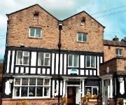
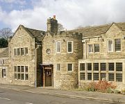
Millstone Country Inn
George
George Hotel Hathersage
Videos from this area
These are videos related to the place based on their proximity to this place.
Bathroom/ En Suite for Master Bedroom at Spring Grove Gardens
Video of Living Room Space, Landing, Master Bedroom with En Suite Shower & Bathroom Suite at New home for sale in Spring Grove Gardens, Wharncliffe Side, S35 0EL.
Georgia Pacific Oughtibridge Mill. Boiler house chimney demolition.
Demolition of the chimney at Georgia Pacific's Oughtibridge Mill boiler house. 25th February 2012 @ 10:00am.
City of Sheffield Rowing Club - Training Day - 16th November 2014
Novice crews on the water filmed from the launch by Alan Brown and Jamie Parker.
Sheffield - Heathy Lane & Stake Hill Road (Byway, S-N)
Subscribe for the love of motorcycles and the great outdoors: http://www.youtube.com/subscription_center?add_user=wiltshirebyways Please click 'S H O W M O R E' for route info: ↓↓↓↓↓↓...
Sheffield - Moscar Cross & Heathy Lane (Byway, E-W-S)
Subscribe for the love of motorcycles and the great outdoors: http://www.youtube.com/subscription_center?add_user=wiltshirebyways Please click 'S H O W M O R E' for route info: ↓↓↓↓↓↓...
Spinning in the middle of the road
One of the dumbest things I've ever tried to do - ending in inevitable results..
Stannington Brass Band on Look North
Stannington Brass Band on BBC Look North, featured in the 4th movement of A Symphony for Yorkshire, 5th August 2010.
Videos provided by Youtube are under the copyright of their owners.
Attractions and noteworthy things
Distances are based on the centre of the city/town and sightseeing location. This list contains brief abstracts about monuments, holiday activities, national parcs, museums, organisations and more from the area as well as interesting facts about the region itself. Where available, you'll find the corresponding homepage. Otherwise the related wikipedia article.
Low Bradfield
Low Bradfield is a village within the civil parish of Bradfield in South Yorkshire, England. It is situated within the boundary of the city of Sheffield in the upper part of the Loxley Valley, 6¼ miles west-northwest of the city centre and just inside the northeast boundary of the Peak District National Park. Low Bradfield and the surrounding area is noted for its attractive countryside which draws many visitors from the more urban parts of Sheffield.
Damflask Reservoir
Damflask Reservoir is an English water feature situated at grid reference SK277907 five miles (eight kilometres) west of the centre of Sheffield in the Loxley valley close to the village of Low Bradfield and within the city's boundaries. The reservoir has a capacity of 4,250.9 million litres (1,123.1 million gallons) and has a surface area of 47 hectares (116 acres) with a maximum depth of 27 metres (88 ft).
Agden Reservoir
Agden Reservoir is a water storage reservoir, situated at grid reference SK260925, 6.5 miles west of the centre of Sheffield, South Yorkshire, England. It is owned by Yorkshire Water which is part of the Kelda Group. The reservoir covers an area of 25 hectares and has a capacity of 559 million gallons (2.11x10 litres) of water, the dam wall has a width of approximately 350 metres with a height of 30 metres.
Dale Dike Reservoir
Dale Dike Reservoir or Dale Dyke Reservoir, infamous for causing the Great Sheffield Flood, is in the north-east Peak District, in the City of Sheffield South Yorkshire, England, a mile (1.6 km) west of Bradfield, eight miles (13 km) from the centre of Sheffield, on the Dale Dike, a tributary of the River Loxley.
Church of St Nicholas, Bradfield
The Church of St. Nicholas, Bradfield, is situated in the small village of High Bradfield which is located 6 miles north west of the centre of the city of Sheffield in South Yorkshire, England. It is one of only five Grade One Listed buildings in Sheffield. Apart from its historic architecture, the church is situated in a charming setting, 260 metres above sea level, giving fine views over the north eastern moors and valleys of the Peak District National Park.
Fair House Farmhouse
Fair House Farmhouse is a 17th century building situated on Annet Lane in the village of Low Bradfield within the boundary of the City of Sheffield in South Yorkshire, England. The farmhouse is a Grade II* Listed Building while the stable and garage buildings immediately to the west of the main house are Grade II listed..
Hallfield House
Hallfield House is a Grade II listed building situated in Bradfield Dale, 1.7 miles west of the village of Low Bradfield, near Sheffield in England.
Rivelin Dams
Rivelin Dams are a pair of water storage reservoirs situated in the upper part of the Rivelin Valley, 5 miles west of Sheffield in South Yorkshire, England. The dams are owned by Yorkshire Water and provide water to 319,000 people as well as compensation water for the River Rivelin. They are named Upper and Lower and fall just within the eastern boundary of the Peak District.


