Safety Score: 3,0 of 5.0 based on data from 9 authorites. Meaning we advice caution when travelling to United Kingdom.
Travel warnings are updated daily. Source: Travel Warning United Kingdom. Last Update: 2024-04-26 08:02:42
Delve into Westbourne
The district Westbourne of Bournemouth in Bournemouth (England) is a district located in United Kingdom about 94 mi south-west of London, the country's capital town.
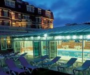
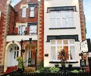
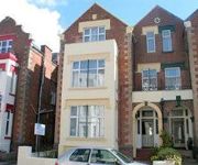
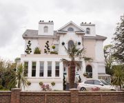
In need of a room? We compiled a list of available hotels close to the map centre further down the page.
Since you are here already, you might want to pay a visit to some of the following locations: Poole, Bower Chalke, Bishopstone, Downton and Ansty. To further explore this place, just scroll down and browse the available info.
Local weather forecast
Todays Local Weather Conditions & Forecast: 9°C / 47 °F
| Morning Temperature | 6°C / 43 °F |
| Evening Temperature | 9°C / 48 °F |
| Night Temperature | 7°C / 45 °F |
| Chance of rainfall | 4% |
| Air Humidity | 90% |
| Air Pressure | 1002 hPa |
| Wind Speed | Fresh Breeze with 15 km/h (9 mph) from South-West |
| Cloud Conditions | Overcast clouds, covering 100% of sky |
| General Conditions | Moderate rain |
Sunday, 28th of April 2024
8°C (47 °F)
8°C (46 °F)
Heavy intensity rain, fresh breeze, overcast clouds.
Monday, 29th of April 2024
11°C (52 °F)
11°C (51 °F)
Light rain, fresh breeze, scattered clouds.
Tuesday, 30th of April 2024
13°C (55 °F)
11°C (52 °F)
Light rain, fresh breeze, scattered clouds.
Hotels and Places to Stay
The Living Room
Hallmark Hotel & Spa
Bournemouth Highcliff Marriott Hotel
Newbury Hotel Bournemouth
Shirley B&B
Washington House Hotel
Durley Dean
Hampton by Hilton Bournemouth
Savoy
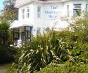
Montague Hotel
Videos from this area
These are videos related to the place based on their proximity to this place.
BOURNEMOUTH BUSES 2001
a trailer for www.pmpvideo.com Buses in Bournemouth filmed 2001 purchase on Amazon, E Bay or direct from Dave and Mandy at PMP.
BOURNEMOUTH POOLE BUSES 1996
a trailer for www.pmpvideo.com Bournemouth and Poole buses filmed 1996 purchase on Amazon, EBay or direct from PMP.
Rubyz In Bournemouth - Titanic With Dame Kitty
A fun night out at Rubyz in Bournemouth (www.Rubyz.co.uk), the one and only "Dame Kitty" playing the main role in their musical Titanic-ish.
2012.12.07 Bournemouth Christmas Market 1.MTS
Irene and Dave Hurr visit the Bournemouth Christmas Market.
Tornado Steam Loco 60163 at Coy Pond, Bournemouth
Tornado had been on a day trip, starting at London Victoria, to Swanage. This is the train crossing Coy Pond Road Bridge between Branksome and Bournemouth Stations on the return (UP) journey...
Shop Local - Westbourne
The fashionable shopping area of Westbourne is just a mile from Bournemouth square. The majority of shops here are located along Poole Road and the crescent shaped Seamoor Road, with ...
Mother Of The Bride & Groom Outfits - Fab Frocks Bournemouth Dorset
Mothers looking for that perfect outfit for their son or daughters wedding need look no further than Fab Frocks. As one of the leading special occasion boutiques on the south coast we have...
theWIC - Trip to Poole Show, Upton Park (August 2012)
While WIC has a rest during the summer, we have being doing different things. On 5 August, we went to the Poole Show at Upton Country Park, and Ivan (one of ...
CashStash - Emergency Cash On Your Key-Ring
Get yours - http://www.trueutility.com/pocket-tools-store/cash_stash.html.
NailClip Kit True Utility
Contains man sized super strong and sharp nail clippers for the hardest nails. Clippers spring out from the ergonomically shaped Stainless steel body. It also houses a sharp blade, nail file,...
Videos provided by Youtube are under the copyright of their owners.
Attractions and noteworthy things
Distances are based on the centre of the city/town and sightseeing location. This list contains brief abstracts about monuments, holiday activities, national parcs, museums, organisations and more from the area as well as interesting facts about the region itself. Where available, you'll find the corresponding homepage. Otherwise the related wikipedia article.
Bournemouth
Bournemouth is a large coastal resort town in the ceremonial county of Dorset, England. According to the mid-year estimates for 2010 from the Office for National Statistics, the town has a population of 168,100, making it the largest settlement in Dorset. It is also the largest settlement between Southampton and Plymouth. With Poole and Christchurch, Bournemouth forms the South East Dorset conurbation, which has a total population of approximately 400,000.
Bournemouth University
Bournemouth University, also abbreviated as BU, is a university in and around the large south coast town of Bournemouth, UK (although its main campus is actually situated in neighbouring Poole).
Bournemouth International Centre
The Bournemouth International Centre (BIC) in Bournemouth, Dorset, is one of the primary venues for conferences, exhibitions, entertainment and events in southern England. Additionally, it is well known for hosting national conferences of major British political parties and trade unions. The venue's Windsor Hall has a concert capacity of 6,500 and is one of the bigger indoor music venues in the UK, often included on the arena tours of major artists.
Arts University Bournemouth
Arts University Bournemouth (formerly The Arts University College at Bournemouth and The Arts Institute at Bournemouth) is a further and higher education university college based in Poole, United Kingdom specialising in arts, performance, design, and media. Arts University Bournemouth (AUB) was named No.1 Creative University in the Which? University 2012 survey. In Nov 2012 the University also celebrated a 97.7% employment rate. (*2011 Destination of Leavers from Higher Education Survey – HESA.
Bournemouth West (UK Parliament constituency)
Bournemouth West is a borough constituency represented in the House of Commons of the Parliament of the United Kingdom. It elects one Member of Parliament (MP) by the first past the post system of election.
Brownsea Open Air Theatre
Brownsea Open Air Theatre (commonly abbreviated B.O.A. T) is an open-air Shakespearian theatre company based in Poole, Dorset that have performed large theatrical productions since 1964. Annually performing a play from the extensive works of William Shakespeare for three weeks in July and August, the production is set on the National Trust's Brownsea Island in Poole Harbour with boats transporting patrons to the island from Poole Quay.
Branksome railway station
Branksome railway station is a railway station serving the Branksome and Branksome Park areas of Poole in Dorset, England. It is located on the South Western Main Line from London Waterloo to Weymouth.
A338 road
The A338 is a major trunk road in southern England, that runs from the junction with the A35 at Poole in Dorset to the junction with the A420 at Besselsleigh in Oxfordshire, a distance of 84 miles .
Branksome Park
Branksome Park is a suburb of Poole in Dorset, which adjoins Branksome, Dorset. The area covers approximately 360 acres, mostly occupied by housing, and includes Branksome Chine which leads to the award-winning blue-flagged beaches of Poole.
The Square, Bournemouth
The Square is a public square that marks the centre of Bournemouth, England. It has been almost totally pedestrianised since 2000. Prior to this it was a large roundabout.
Bournemouth West railway station
Bournemouth West railway station was a railway station in Bournemouth, Dorset, England. Although passenger trains were withdrawn from 6 September 1965 a substitute bus service was provided until official closure on 4 October 1965 The closure was originally temporary, but the became permanent and the station was demolished. The station was the southern terminus of the Somerset and Dorset Joint Railway, as well as being the terminus for trains from London Waterloo and other local trains.
Bournemouth (UK Parliament constituency)
Bournemouth is a former United Kingdom Parliamentary constituency. The seaside resort was created as a parliamentary borough in 1918 and the seat existed until it was divided in 1950. During the existence of the constituency it was the most south-westerly seat in Hampshire (although the border between Dorset and Hampshire was altered in the late twentieth century so the town was transferred to Dorset).
Westover, Hampshire
Westover, Hampshire, is the ancient manor, now in Dorset, over which much of modern Bournemouth has developed. This area of land marked a historic boundary between Celtic and Saxon civilisations, which found expression as the county boundary between Hampshire to the east and Dorset to the west.
County Gates
County Gates is the historic crossing point between the shire counties of Dorset and Hampshire. On April 1, 1974 when Bournemouth and Christchurch were incorporated into Dorset, it became the main crossing point between the Borough of Poole and the Borough of Bournemouth. County Gates sits on the A35 road. Today, County Gates is a busy gyratory that sits on the Poole side of the border with Bournemouth. In the centre of the roundabout is the Liverpool Victoria (LV) head quarters.
Bournemouth Borough Council
Bournemouth Borough Council is the local authority of Bournemouth in Dorset, England. The council is now a unitary authority, although between 1974 and 1997 it was an administrative district council with Dorset. Previously most of the borough was part of Hampshire. The Borough can trace its history back to 27 August 1890 when the Municipal Borough of Bournemouth was created by Royal Charter. On 1 April 1900 it received County Borough status which lasted until 1974.
Talbot Heath School
Talbot Heath School is a selective, independent day and boarding school for girls aged 3–18 located in Talbot Woods, Bournemouth; the school was established in 1886. Facilities The large campus, much of which is still woodland, comprises of a Senior School and a Junior School accommodating girls aged between 3 and 18. The main buildings were constructed in 1935 and designed by Hubert Worthington, a pupil of Edwin Lutyens.
Meyrick Park Halt railway station
Meyrick Park Halt was a railway station just west of Bournemouth railway station in the county of Hampshire in England. Located on what is now the South Western Main Line, it was opened by the L.S.W.R. on 1 March 1906. The 'Halt' was a minor stop on the line, intended to serve a rapidly developing suburban district of Bournemouth including Winton and Talbot Woods, it also provided access to Meyrick Park, an area of open space, where an extensive golf course was newly laid out.
West Cliff Railway
The West Cliff Railway, or West Cliff Lift, is a funicular railway located in the English seaside resort of Bournemouth. The line serves to link the seaside promenade and beach with the cliff top and the town behind.
St Stephen's Church, Bournemouth
St Stephen's Church is an Anglican church in Bournemouth, Dorset. The liturgical life of the Church is deeply rooted in a rich Anglo-Catholic tradition; the Church boasting a magnificent Lady Chapel, celebrating Marian masses, benediction and recitation of the Rosary for The Society of Mary. Devotion to Our Lady of Walsingham is also encouraged.
Oceanarium Bournemouth
Oceanarium Bournemouth is an aquarium located on the seafront in Bournemouth, England. It offers visitors a journey around the waters of the world. 10 recreated environments include the Amazon, Key West, the Mediterranean, Abyss, and the Great Barrier Reef.
Bournemouth Highcliff Marriott Hotel
The Bournemouth Highcliff Marriott Hotel is located in St. Michael’s Road, Bournemouth, Dorset. Formerly four large mansions in 1873 and part of the Coastguard station, the hotel boasts spectacular sea views.
Bournemouth Winter Gardens
Bournemouth Winter Gardens was a theatre in Bournemouth, England. Many notable artists such as The Beatles, Whitesnake, Elton John and Thin Lizzy have performed at this venue. It closed in 2002 and the building was demolished in 2006.
The West Hants Club
The West Hants Club (often known simply as West Hants) is a sports and fitness club situated in just outside Bournemouth, Dorset in the south of England. The club is primarily a tennis club but also incorporates a gym, swimming pool and squash and racquetball courts. West Hants was opened in 1926 and two years later the club began hosting the British Hard Court Championships, an event that was held there for 55 years until 1983.
List of public art in Dorset
This is a list of public art in Dorset, in England. This list applies only to works of public art accessible in an outdoor public space. For example, this does not include artwork visible inside a museum.
Sacred Heart Church, Bournemouth
The Catholic Church of the Sacred Heart, or Sacred Heart Church, is a Roman Catholic church in the seaside resort of Bournemouth, England. Located on Albert Road close to the town centre, it was the first Roman Catholic church built in Bournemouth and is part of the Diocese of Portsmouth. It has been designated a Grade II* listed building by English Heritage.


