Safety Score: 3,0 of 5.0 based on data from 9 authorites. Meaning we advice caution when travelling to United Kingdom.
Travel warnings are updated daily. Source: Travel Warning United Kingdom. Last Update: 2024-04-18 08:12:24
Touring Stanpit
The district Stanpit of in Dorset (England) is a subburb located in United Kingdom about 89 mi south-west of London, the country's capital place.
Need some hints on where to stay? We compiled a list of available hotels close to the map centre further down the page.
Being here already, you might want to pay a visit to some of the following locations: Bournemouth, Totland, Poole, Freshwater and Yarmouth. To further explore this place, just scroll down and browse the available info.
Local weather forecast
Todays Local Weather Conditions & Forecast: 12°C / 53 °F
| Morning Temperature | 3°C / 37 °F |
| Evening Temperature | 10°C / 50 °F |
| Night Temperature | 9°C / 48 °F |
| Chance of rainfall | 0% |
| Air Humidity | 61% |
| Air Pressure | 1024 hPa |
| Wind Speed | Moderate breeze with 12 km/h (7 mph) from East |
| Cloud Conditions | Few clouds, covering 20% of sky |
| General Conditions | Few clouds |
Friday, 19th of April 2024
13°C (55 °F)
7°C (44 °F)
Light rain, fresh breeze, broken clouds.
Saturday, 20th of April 2024
10°C (49 °F)
6°C (43 °F)
Few clouds, moderate breeze.
Sunday, 21st of April 2024
10°C (50 °F)
6°C (43 °F)
Scattered clouds, fresh breeze.
Hotels and Places to Stay
CHEWTON GLEN
Cliff House Hotel
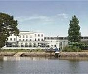
Christchurch Harbour
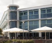
Captains Club and Spa
The Beech Tree
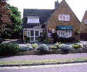
Grosvenor Lodge Guest House
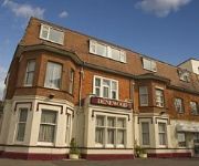
Denewood
VILLAGE BOURNEMOUTH
Urban Beach Hotel
The Fisherman's Haunt
Videos from this area
These are videos related to the place based on their proximity to this place.
Mudeford Quay, Christchurch, Dorset, England ( 1 )
Mudeford was originally a small fishing village in the borough of Christchurch, Dorset southern England, lying at the entrance to Christchurch Harbour. The River Mude ( which starts from Poors...
The Jetty, Christchurch
Water's Edge Dining in Christchurch, Dorset Voted Christchurch's Best Seafood Restaurant 2011, this Christchurch Restaurant, Bar and Grill is set right on the water's edge looking across...
Mudeford Quay, Christchurch, Dorset, England ( 2 )
Mudeford was originally a small fishing village in the borough of Christchurch, Dorset southern England, lying at the entrance to Christchurch Harbour. The River Mude ( which starts from Poors...
Christchurch & Christchurch Priory, Dorset, England ( 8 )
Christchurch is a borough and town in the county of Dorset on the south coast of England. The town adjoins Bournemouth in the west and the New Forest lies to the east. Historically within...
Mudeford Quay, & Stanpit Marshes, Christchurch, Dorset, England ( 3 )
Mudeford was originally a small fishing village in the borough of Christchurch, Dorset southern England, lying at the entrance to Christchurch Harbour. The River Mude ( which starts from Poors...
Christchurch & Christchurch Priory, Dorset, England ( 3 )
Christchurch is a borough and town in the county of Dorset on the south coast of England. The town adjoins Bournemouth in the west and the New Forest lies to the east. Historically within...
Christchurch & Christchurch Priory, Dorset, England ( 6 )
Christchurch is a borough and town in the county of Dorset on the south coast of England. The town adjoins Bournemouth in the west and the New Forest lies to the east. Historically within...
Mudeford Quay, Christchurch BH23 4AB in 4K - Panasonic Lumix GH4
shot hand held in 4k with Panasonic Lumix GH4 + Panasonic LUMIX G VARIO 7-14mm F4.0 ASPH Wide Angle Lens + Mercalli 3.0 stabilization + Sony Vegas 13 + NewBlue Titler Pro 3.
Christchurch & Christchurch Priory, Dorset, England ( 4 )
Christchurch is a borough and town in the county of Dorset on the south coast of England. The town adjoins Bournemouth in the west and the New Forest lies to the east. Historically within...
Christchurch Harbour wedding photography - Toni & Richard
http://www.fionamooreyphotography.com - Toni & Richards wedding at Christchurch Harbour Hotel on 29th June 2013, Christchurch Harbour Hotel Wedding Photography, Dorset wedding photographer ...
Videos provided by Youtube are under the copyright of their owners.
Attractions and noteworthy things
Distances are based on the centre of the city/town and sightseeing location. This list contains brief abstracts about monuments, holiday activities, national parcs, museums, organisations and more from the area as well as interesting facts about the region itself. Where available, you'll find the corresponding homepage. Otherwise the related wikipedia article.
Bailey bridge
The Bailey bridge is a type of portable, pre-fabricated, truss bridge. It was developed by the British during World War II for military use and saw extensive use by both British and the American military engineering units. A Bailey bridge had the advantages of requiring no special tools or heavy equipment to construct. The wood and steel bridge elements were small and light enough to be carried in trucks and lifted into place by hand, without requiring the use of a crane.
Bournemouth East (UK Parliament constituency)
Bournemouth East is a borough constituency represented in the House of Commons of the Parliament of the United Kingdom. It elects one Member of Parliament (MP) by the first past the post system of election. It has elected Conservative MPs since its creation.
Hengistbury Head
Hengistbury Head is a headland jutting into the English Channel between Bournemouth and Milford on Sea in the English county of Dorset. It is a site of international importance in terms of its archaeology and is scheduled as an Ancient Monument. Declared a Local Nature Reserve in 1990, the head and its surroundings form part of the Christchurch Harbour Site of Special Scientific Interest.
Christchurch Priory
Christchurch Priory is an ecclesiastical parish and former priory church in Christchurch in the English county of Dorset. Christchurch Priory is rated as in the top 18 churches in the Country and described by The Times as the least appreciated of the Great Churches of England. It is the longest parish church in the country and is larger than 21 English Anglican Cathedrals.
Moors River
The Moors River is a river in east Dorset, England, which starts at the point where the River Crane and the Ebblake Stream meet, at Ebblake, south of Verwood. It runs south then southeast, past Bournemouth International Airport and Hurn to join the River Stour at Blackwater, Dorset. It is well-known to dragonfly enthusiasts as the last site in Britain where Orange-spotted Emerald occurred.
Christchurch railway station
Christchurch railway station is a station serving the town of Christchurch in Dorset in England. The station is on the London Waterloo to Weymouth line operated by South West Trains.
Signals Research and Development Establishment
The Signals Research and Development Establishment (SRDE) was a British government military research establishment, based in Christchurch, Dorset from 1948 until it merged with the Royal Radar Establishment (RRE) in Malvern, Worcestershire to form the Royal Signals and Radar Establishment (RSRE) in 1980. Its focus was military communications (signals).
Hinton Admiral railway station
Hinton Admiral railway station is a station serving the villages of Bransgore and Hinton and the town of Highcliffe on the Hampshire/Dorset border in southern England. The station is on the stretch of line opened in 1885 between Brockenhurst and Christchurch to provide a direct line from London to Bournemouth, bypassing the original "Castleman's Corkscrew" line via Ringwood and reducing that line to a backwater. There is no village as such that is called Hinton Admiral.
Blackwater, Dorset
Blackwater, Dorset is a small hamlet in the borough of Christchurch, Dorset, in southern England. It is best known for the grade separated road junction between the A338 Ringwood to Bournemouth road and the B3073 road to Bournemouth Airport (and to Christchurch in the opposite direction). It was once the site of a ferry crossing on the River Stour.
Christchurch Castle
Christchurch Castle is located in Christchurch, Dorset, England. The earliest stonework has been dated to 1160 AD. It is a Norman motte and bailey castle. The castle's site is inside the old Saxon Burh dominating the River Avon's lowest crossing. The Constable's House standing adjacent to the castle was added at around 1160 and is a rare and notable example of a Norman domestic dwelling.
Tucktonia
Tucktonia was a late 1970s theme park located on Stour Road, Christchurch, Dorset, England. It was officially opened on 23 May 1976 by Arthur Askey. It originally occupied 4 acres of the 21-acre Tuckton Park Leisure Complex. The park was closed down in 1986, having become run-down and neglected. The site has since been redeveloped for residential use.
Hinton Admiral
Hinton Admiral is the estate and ancestral home of the Tapps-Gervis-Meyrick family. It is located in the settlement of Hinton, near Bransgore, Hampshire. The gardens are open to the public by arrangement. The current house was built in 1720 for Sir Peter Mews. The house was remodelled after a fire in 1777. Additional alterations were made by the landscape architect Harold Peto around 1905, who remodelled the interior in an early 18th century style.
Christchurch Airfield
For the World War II use of this facility, see RAF Christchurch Christchurch Airfield was located southeast of the A337/B3059 intersection in Somerford, Christchurch, Dorset, England. It was a civil airfield starting from 1926, then it was used during World War II by the Royal Air Force and the United States Army Air Forces Ninth Air Force. After the war the airfield returned to civilian use and the airfield complex was then demolished in 1966.
RAF Winkton
RAF Station Winkton is a former World War II airfield in Hampshire, England. The airfield is located approximately 3 miles north of Christchurch; about 89 miles southwest of London Opened in 1944, Winkton was a prototype for the type of temporary Advanced Landing Ground type airfield which would be built in France after D-Day, when the need advanced landing fields would become urgent as the Allied forces moved east across France and Germany.
1958 Bristol Britannia 312 crash
G-AOVD was a Bristol Britannia 312 operated by BOAC that crashed near Christchurch, Dorset, in the south of England on Christmas Eve 1958, killing 2 of the 5 crew and all 7 passengers.
Fisherman's Walk Cliff Railway
The Fisherman's Walk Cliff Railway, or Southbourne Cliff Railway, is a funicular railway located in Southbourne, a seaside suburb of the English seaside resort of Bournemouth. The line serves to link the seaside promenade and beach with the cliff top and the town behind.
The Grange School, Christchurch
The Grange School is a school for 11–18 year olds in Christchurch, Dorset. The school is sited in Somerford & takes pupils from the Somerford, Mudeford & Burton areas.
Battle of Mudeford
The Battle of Mudeford was a skirmish fought between smugglers and Customs and Excise officers which occurred in 1784 on what is now a car park at Mudeford Quay, Mudeford, Christchurch, England near the entrance of Christchurch Harbour. The battle showed how widespread smuggling was at the time and resulted in the death of a Customs officer and subsequent trial and execution of one of the smugglers.
Highcliffe Castle
Highcliffe Castle, situated on the cliffs at Highcliffe, Dorset, was built between 1831 and 1835 by Charles Stuart, 1st Baron Stuart de Rothesay in a Gothic Revival style on the site of High Cliff house, a Georgian Mansion designed for the 3rd Earl of Bute (a founder of Kew Gardens) with the gardens laid out by Capability Brown.
Christchurch original railway station
Christchurch was a railway station in Christchurch in the county of Hampshire. It was opened on 13 November 1862 by the Ringwood, Christchurch and Bournemouth Railway. Becoming part of the London and South Western Railway, it was closed on 13 May 1886, and replaced by the current Christchurch railway station located to the west of the newly created junction with the rail route to Hinton Admiral, New Milton, Sway and Brockenhurst. In 1935 the line from Christchurch to Ringwood was closed.
Christchurch Hospital, Dorset
Christchurch Hospital is part of The Royal Bournemouth and Christchurch Hospitals NHS Foundation Trust.
RAF Christchurch
RAF Christchurch is a former Royal Air Force installation and was located southeast of the A337/B3059 junction in Somerford, Christchurch, Dorset, England. Christchurch Airfield was a civil airfield starting from 1926. It was used during World War II by the Royal Air Force and the United States Army Air Forces Ninth Air Force. After the war the airfield returned to civilian use. The airfield complex was demolished in 1966.
Mudeford Lifeboat Station
Mudeford Lifeboat Station is the base for Royal National Lifeboat Institution (RNLI) search and rescue operations at Mudeford, Christchurch, Dorset in England. The first lifeboat was stationed on Mudeford Quay 1963 and the present station was opened in 2003. It operates an Atlantic 85 inshore lifeboat (ILB).
Moorlands College
Moorlands College is an Evangelical bible college in Sopley, Christchurch, Dorset. Moorlands College is accredited by the British Accreditation Council (BAC), and all degree courses are validated by the University of Gloucestershire. The college is non-denominational and acclaims a "Statement of Faith" that is shared by several Evangical Christian organisations.
Warren Hill, Dorset
Warren Hill is the elevated part of Hengistbury Head, overlooking Christchurch to the North and dominating Poole Bay to the West. With finds stretching back over 10,000 years, it is a site of international importance in terms of its archaeology and is scheduled both as an Ancient Monument, and a Local Nature Reserve. The head and its surroundings form part of the Christchurch Harbour Site of Special Scientific Interest.


