Safety Score: 3,0 of 5.0 based on data from 9 authorites. Meaning we advice caution when travelling to United Kingdom.
Travel warnings are updated daily. Source: Travel Warning United Kingdom. Last Update: 2024-04-26 08:02:42
Discover Lower Hamworthy
The district Lower Hamworthy of in Poole (England) is a district in United Kingdom about 98 mi south-west of London, the country's capital city.
Looking for a place to stay? we compiled a list of available hotels close to the map centre further down the page.
When in this area, you might want to pay a visit to some of the following locations: Poole, Bournemouth, Bower Chalke, Bishopstone and Ansty. To further explore this place, just scroll down and browse the available info.
Local weather forecast
Todays Local Weather Conditions & Forecast: 8°C / 46 °F
| Morning Temperature | 5°C / 42 °F |
| Evening Temperature | 8°C / 46 °F |
| Night Temperature | 8°C / 46 °F |
| Chance of rainfall | 3% |
| Air Humidity | 89% |
| Air Pressure | 1002 hPa |
| Wind Speed | Moderate breeze with 10 km/h (6 mph) from West |
| Cloud Conditions | Overcast clouds, covering 100% of sky |
| General Conditions | Light rain |
Saturday, 27th of April 2024
11°C (52 °F)
7°C (44 °F)
Moderate rain, moderate breeze, overcast clouds.
Sunday, 28th of April 2024
6°C (44 °F)
6°C (43 °F)
Moderate rain, fresh breeze, overcast clouds.
Monday, 29th of April 2024
12°C (54 °F)
8°C (47 °F)
Light rain, moderate breeze, clear sky.
Hotels and Places to Stay
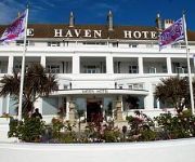
Haven
Harbour Heights
Sandbanks
Loch Fyne Restaurant and Hotel Poole
Number 9
Hotel Du Vin Poole
Antelope
TRAVELODGE POOLE
THISTLE POOLE
Holiday Inn Express POOLE
Videos from this area
These are videos related to the place based on their proximity to this place.
2013 FIM Speedway Grand Prix Challenge - Poole (GBR)
Best Shots of the 2013 FIM Speedway Grand Prix Challenge - Poole (Great Britain)
bass fishing poole team waistline 2014
2014...Lure fishing for Bass in Poole with Team Waistline.....
Twin Sails Bridge, Poole, Dorset, England ( 3 )
The Twin Sails Bridge will be the first bridge of its type to be built and the world class design was chosen to symbolise the aspirations of the town. Poole is proud of its maritime and industrial...
Massive Charity Shop Haul - Ashley Road, Poole
Charity shopping, ethical clothing, beauty, and lifestyle at http://WWW.PAUPERTOPRINCESS.COM Welcome to my first Charity Shop Haul video! Hope you guys like it, would love your feedback. ...
New Years Bath Race 2012 - Poole Quay
The annual New Year's Bath Race along Poole Quay, shot on the 1 Jan 2012.
Render Cleaning, Poole, Dorset by purple-rhino.co.uk 0800 1577484
http://purple-rhino.co.uk/case-studies/view/render-cleaning-poole-dorset Render Cleaning in Poole Dorset caried out by Purple Rhino K Render Cleaning Specialists. Render Cleaning needs to...
Regal 2250 Poole Oct 2014
A quick blast around Poole Harbour and out to Swanage in our Regal 2250 (Speed restrictions lifted for winter)
Flyboarding, Poole, Dorset
Don't forget to watch in HD ** I took my GoPro with me on my recent Flyboarding experience. I thought it only fair to film the other guy taking part at the same time as me. Not bad for...
Square One Guitar Tutorial By Coldplay
How to play Square One on guitar by Coldplay. I'm using a Vigier Excalibur Ultra, a Fender Blues Deluxe, a Mooer Green Mile, and an MXR Carbon Copy delay.
Videos provided by Youtube are under the copyright of their owners.
Attractions and noteworthy things
Distances are based on the centre of the city/town and sightseeing location. This list contains brief abstracts about monuments, holiday activities, national parcs, museums, organisations and more from the area as well as interesting facts about the region itself. Where available, you'll find the corresponding homepage. Otherwise the related wikipedia article.
Poole
Poole is a large coastal town and seaport in the county of Dorset, on the south coast of England. The town is 33 kilometres east of Dorchester, and Bournemouth adjoins Poole to the east. The local authority is Poole Borough Council and was made a unitary authority in 1997, gaining administrative independence from Dorset County Council. The town had a population of 138,288 according to the 2001 census, making it the second largest settlement in Dorset.
Poole Harbour
Poole Harbour is a large natural harbour in Dorset, southern England, with the town of Poole on its shores. The harbour is a drowned valley formed at the end of the last ice age and is the estuary of several rivers, the largest being the Frome. The harbour has a long history of human settlement stretching to pre-Roman times. The harbour is extremely shallow, with one main dredged channel through the harbour, from the mouth to Holes Bay.
Poole Town F.C
Poole Town F.C. is a football club based in Poole, Dorset, England. They were established in 1890 and joined the Western League Division Two in 1930. The club is affiliated to the Dorset County Football Association and is a FA Charter Standard Community Club. They won the Western League title in 1957 and reached the First Round Proper of the FA Cup four times in their history. They are currently members of the Southern Football League Division One South & West.
Hamworthy United F.C
Hamworthy United F.C. are a football club based in Hamworthy, a suburb of Poole, England. They were formed as a merger between Hamworthy and Trinidad Old Boys in 1970. The club is affiliated to the Dorset County Football Association and is a FA chartered Standard club. In the 2003–04 season, they reached the 2nd round of the FA Vase. They reached the Second Round Qualifying of the FA Cup in season 2007–08. They are currently members of the Wessex League Premier Division.
The Lighthouse (Poole)
Lighthouse is an arts centre in Poole, Dorset, England. According to the Arts council of England it is the largest arts centre in the United Kingdom outside London. It has a 669 seat theatre, a 1,500 seat concert hall, a 150 seat studio, a 105 seat cinema, an Image Lab/media suite, a large gallery for photography and digital art, a restaurant and three function rooms. The concert hall is home to the Bournemouth Symphony Orchestra.
Poole railway station
Poole railway station is a railway station on the South Western Main Line serving the town of Poole in Dorset, England. The station is situated in the town centre next to Holes Bay. It is one of four stations in the Borough of Poole. The station is operated by South West Trains and is served by London Waterloo to Weymouth express and semi-fast services. It is also the terminus for the London Waterloo to Poole stopping service.
Hamworthy railway station
Hamworthy railway station serves Hamworthy, an area of Poole in Dorset, England.
Oakdale, Dorset
Oakdale is a suburb of Poole in Dorset, England with a population of 10,949. It is adjacent to Fleetsbridge, Poole town centre, Sterte, Longfleet and Parkstone. The main type of land use in Oakdale is residential. There are also small private businesses such as convenience stores, take away restaurants and pubs, as well as a Texaco petrol station.
St James' Church, Poole
St James is a Church of England parish church in Poole on the south coast of England, in the ceremonial county of Dorset. The church is located in the historic quarter of the town, near Poole Quay. It is the parish church for the St James sub district of Poole. R. Mason is the current minister of the church. Today the church is still in use by the local population and has a large playgroup.
Creekmoor Light Railway
The Creekmoor Light Railway was a small privately run 2ft gauge narrow gauge railway. It was situated off Creekmoor Lane, to the north of Poole, between Broadstone and Fleetsbridge, Dorset, and was operated by a group of local enthusiasts from October 1968, to April 1973.
Creekmoor Halt railway station
Creekmoor was a halt on the former Southampton and Dorchester Railway opened by the Southern Railway for workers at the adjacent "Oerlikon" munitions factory, later run by Plesseys, now owned by Siemens. The halt was situated ¾ mile south of Broadstone, 1½ miles from Poole town centre and 116 miles 79 chains from Waterloo Station.
Sterte
Sterte is a part of Poole in Dorset, England. It is directly next to Poole Stadium and Holes Bay. It is near to the areas of Oakdale, Upton and Hamworthy.
Oakdale South Road Middle School
Oakdale South Road Middle School is a middle school for 8–12 year-olds in Poole, Dorset, attended by 540 pupils. The school was opened in 1997 after the amalgamation of Oakdale Middle School and South Road Combined School (now Old Town First School). It was originally intended to be named Tatnam Farm Middle School. Pupils come to the school mainly from Stanley Green First School in Oakdale and Old Town First School in the town centre.
Fleetsbridge
Fleetsbridge is a small area of Poole, Dorset, centred on a busy gyratory and flyover. It lies north of Poole town centre and borders the neighbouring suburbs of Waterloo, Creekmoor, Oakdale and Canford Heath. The use of land varies between residential, retail and some light industry. The area is also home to Parkstone Grammar School when it moved there from Lower Parkstone in 1962.
Creekmoor
Creekmoor is a suburb of Poole in Dorset, England, with a population of 9,257. Bordered by the Upton Heath nature reserve and Upton Country Park, the area is mainly populated by families.
Poole Stadium
Poole Stadium is a greyhound racing venue and speedway track located in the town centre of Poole, Dorset in England. The stadium is owned by the Borough of Poole. It was built in the early 1930s in an attempt to provide a source of entertainment to the residents of Poole during the Great Depression. Due to a sponsorship deal with local radio station Wave 105, the stadium is also known as the Wave 105 Stadium.
Poole Museum
Poole Museum (formerly known as the Waterfront Museum) is a local history museum situated on the Lower High Street in the Old Town area of Poole, Dorset, and is part of the Borough of Poole Museum Service. Entrance to Poole Museum is free.
Waterloo, Dorset
Waterloo is a suburb of Poole, Dorset, England. Once a small village near Broadstone, Waterloo is now a large housing estate. The estate was built in the early 1950s and covers an area of 85 acres .
Poole Bridge
Poole Bridge (also known as Poole Lifting Bridge) is a bascule bridge in Poole, Dorset, England. Constructed in 1927, the bridge provides a road link across a busy boating channel. In February 2012 a second bridge was completed intending to operate in conjunction with the existing bridge
Poole Hospital
Poole Hospital (also known as Poole General Hospital) is an acute general hospital in Poole, Dorset, England. Built in 1907, it has expanded from a basic 14-bed facility into a 789-bed NHS foundation trust hospital. It is the trauma centre for east Dorset and provides specialist services such as cancer treatment for the entire county.
Hamworthy Beach
Hamworthy Beach is situated between the Marine Camp and Rockley Sands in Poole, Dorset. The local community refer to it as "Up Lake". It is a muddy beach with sand and shingle. It has its own jetty which is quite popular with local fishermen. From the beach can be seen Arne Nature Reserve, Brownsea Island and the Purbeck Hills. Behind the beach is Ham Common.
Poole Lifeboat Station
Poole Lifeboat Station is the base for Royal National Lifeboat Institution (RNLI) search and rescue operations at Poole, Dorset in England. The first lifeboat was stationed at Poole Harbour in 1865 and the present station was opened in 1988. Since 2008 it has operated a Tyne-class all weather boat (ALB) and an Atlantic 85 inshore lifeboat (ILB).
Turlin Moor
Turlin Moor is a suburb of Poole in Dorset, England, located between Hamworthy and Upton. Turlin Moor is classed as part of the Hamworthy Community and is host to Hamworthy railway station. The two railway bridges at the end of the estate on Blandford Road, form the meeting point between Hamworthy, Turlin Moor and Upton Park. Turlin Moor is on the Hamworthy Spit which is linked to Poole via the Upton Bypass, and the Two Poole Bridges.
Twin Sails Bridge
The Twin Sails Bridge (also known as The second harbour crossing) is a double leaved bascule bridge in Poole, Dorset, England. The bridge provides a second road link from Poole town centre to Hamworthy. The intention is that the bridge will allow development of four major sites, two in the town centre and two in Hamworthy, including the old power station which was closed in 1988.
St Mary's Church, Longfleet
St Mary's, Longfleet, (informally referred to as SML) is a Church of England parish church in Longfleet, a district of Poole, in the ceremonial county of Dorset, on the south coast of England. It is part of the New Wine network and describes itself as a large, vibrant, evangelical charismatic church with an informal atmosphere.


