Safety Score: 3,0 of 5.0 based on data from 9 authorites. Meaning we advice caution when travelling to United Kingdom.
Travel warnings are updated daily. Source: Travel Warning United Kingdom. Last Update: 2024-04-26 08:02:42
Explore Parkstone
Parkstone in Dorset (England) with it's 9,593 inhabitants is a city in United Kingdom about 95 mi (or 154 km) south-west of London, the country's capital.
Local time in Parkstone is now 05:01 AM (Saturday). The local timezone is named Europe / London with an UTC offset of one hour. We know of 9 airports in the vicinity of Parkstone, of which 5 are larger airports. The closest airport in United Kingdom is Bournemouth Airport in a distance of 6 mi (or 9 km), North-East. Besides the airports, there are other travel options available (check left side).
There are several Unesco world heritage sites nearby. The closest heritage site in United Kingdom is Dorset and East Devon Coast in a distance of 41 mi (or 66 km), East. Also, if you like golfing, there are multiple options in driving distance. If you need a place to sleep, we compiled a list of available hotels close to the map centre further down the page.
Depending on your travel schedule, you might want to pay a visit to some of the following locations: Poole, Bournemouth, Bower Chalke, Bishopstone and Downton. To further explore this place, just scroll down and browse the available info.
Local weather forecast
Todays Local Weather Conditions & Forecast: 10°C / 50 °F
| Morning Temperature | 6°C / 44 °F |
| Evening Temperature | 8°C / 47 °F |
| Night Temperature | 8°C / 47 °F |
| Chance of rainfall | 10% |
| Air Humidity | 84% |
| Air Pressure | 1002 hPa |
| Wind Speed | Fresh Breeze with 14 km/h (9 mph) from South-West |
| Cloud Conditions | Overcast clouds, covering 100% of sky |
| General Conditions | Moderate rain |
Sunday, 28th of April 2024
6°C (42 °F)
5°C (42 °F)
Moderate rain, moderate breeze, overcast clouds.
Monday, 29th of April 2024
12°C (54 °F)
9°C (49 °F)
Sky is clear, moderate breeze, clear sky.
Tuesday, 30th of April 2024
11°C (52 °F)
10°C (51 °F)
Moderate rain, fresh breeze, broken clouds.
Hotels and Places to Stay
Washington House Hotel
Loch Fyne Restaurant and Hotel Poole
Harbour Heights
Sandbanks
The Living Room
Hallmark Hotel & Spa
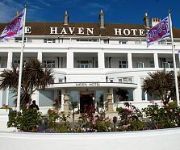
Haven
Riviera
The Croham Hotel
The Chocolate Boutique Hotel
Videos from this area
These are videos related to the place based on their proximity to this place.
FOOD by Andrew Potter.wmv
A timelapse film showing how I created some simple images of Fruit and Vegitables using A4 sheets of white papper and two SB-600 speedlights to be printed and hung on our kitchen wall. Contact:...
Poole Park
http://www.PooleTown.co.uk Poole Park, Poole, Dorset. Poole Park Lake, Poole Harbour Birds and Wildlife. Poole Cricket Club, Poole Minature Railway, Poole Park Bowling Club.
Blackvue DR550GW-2CH Front & Rear Heavy Rain Footage
Heavy Rain footage of the Blackvue DR550 GW 2-CHL Wifi DashCam. Available To Purchase Here: http://goo.gl/Qj23TA The front camera was recording at 1080p whilst the rear was recording at 720p.
TimeLapse near Tower Park, Poole, UK
Time Lapse near Tower Park, Poole, UK 11612 frames taken at 5 second intervals. Stitched together at 33.33 fps each frame lasting 0.03 seconds.
1001 assaults Parkstone bank 08.08.10
Cab View between Poole and Bournemouth from Hastings DEMU 1001, working 1Z82 the return 'Andy Piper Memorial Tour'. Camera was unmanned and therefore picks up a lot of vibration. For more of...
66515 6M42 Parkstone 25th April 2014
TURN YER VOLUME UP......66515 Destroys the tranquil setting of Parkstone Railway station as it struggles up Parkstone Bank with 1500 tons of sand with the 6M42 Wool - Neasdon loaded sand.
66507 tnt 66572 6M42 Parkstone 23rd December 2013
66572 passes through Poole with the 1Z99 from Southampton to rescue 66507 that stalled on Parkstone Bank whilst hauling the 6M42 Wool - Neasdon Sand. Then I film it passing Parkstone doing...
34067 Tangmere, Parkstone to Branksome, 21/06/12.
SR Orginal Streamlined Light Pacific Battle of Britan Class locomotive 34067 Tangmere climbs up Branksome/Parkstone Bank from Parkstone station up to Branksome station and junction. Filmed...
Parkstone Youth Week 2011 Trailer
Lily & Oli Bye prepare to race in Parkstone Yacht Club Youth Week 2011.
Videos provided by Youtube are under the copyright of their owners.
Attractions and noteworthy things
Distances are based on the centre of the city/town and sightseeing location. This list contains brief abstracts about monuments, holiday activities, national parcs, museums, organisations and more from the area as well as interesting facts about the region itself. Where available, you'll find the corresponding homepage. Otherwise the related wikipedia article.
Penn Hill
Penn Hill is an electoral ward of Poole in Dorset, England, bordering on Branksome Park, Canford Cliffs, Sandbanks, Lilliput and Parkstone. It is effectively part of Parkstone.
Parkstone railway station
Parkstone railway station is a railway station serving the Parkstone area of Poole in Dorset, England. The platform sign used to say "Parkstone". The station is operated by South West Trains and is served by both the Weymouth express and the Poole stopping services. The station is able to accommodate trains of up to 5 coaches, longer trains only open the doors in the first 5 or 4 coaches depending on the type of unit operating the service.
Bournemouth and Poole College
The Bournemouth and Poole College is a well established educational provider which delivers further education, higher education and community based courses in Bournemouth and in Poole on the south coast of England. It is one of the larger UK colleges with thousands of learners each year.
Alderney, Dorset
Alderney is a suburb and electoral ward in the town of Poole in Dorset, England with a population of 11,196. It is Poole's second most densely populated area with 31 people to each hectare (2.5 acres) and suffers much higher than average levels of poverty, illiteracy and crime.
Newtown, Dorset
Newtown is a suburb and electoral ward in the town of Poole in Dorset, England with a population of 11,132.
Whitecliff
Whitecliff, is a small area of Parkstone in Poole, Dorset, England. It is situated near the eastern shore of Poole Harbour and is a very sought-after residential district of Poole due to its park and harbour view. Whitecliff Recreation Ground (part of Poole's Harbourside Park) offers a cricket pitch, used by various local teams, including those from Poole Cricket Club, and several football pitches which host all of Parkstone Heights Falcons/Hawks home games from under-12 level upwards.
Manorside Combined School
Manorside Combined School is a school in Alderney in Parkstone, Poole, Dorset, in the United Kingdom. The school teaches children ages 4–12 years old. The school opened in 2004 after the merger between Trinidad First School and Alderney Middle School, in which Trinidad moved to the Alderney site. Alderney Middle School was opened in 1962 and Trinidad opened in 1952. Trinity's site was then demolished.
Uplands School (Poole)
Alexandra Park, Poole
Alexandra Park is a small (six-acre) public open space set within the densely urbanised area of Parkstone in Poole, on the south coast of England. Its bowling green and pavilion is home to Alexandra Park Lawn Bowls Club, established in the 1920s. The park is essentially Edwardian in concept, but evolved over a period of more than 30 years as what was once open farmland was transformed into a new residential neighbourhood.


