Safety Score: 3,0 of 5.0 based on data from 9 authorites. Meaning we advice caution when travelling to United Kingdom.
Travel warnings are updated daily. Source: Travel Warning United Kingdom. Last Update: 2024-04-26 08:02:42
Explore Mere
Mere in Wiltshire (England) with it's 2,686 inhabitants is located in United Kingdom about 97 mi (or 156 km) west of London, the country's capital.
Local time in Mere is now 05:43 AM (Saturday). The local timezone is named Europe / London with an UTC offset of one hour. We know of 9 airports in the wider vicinity of Mere, of which 5 are larger airports. The closest airport in United Kingdom is RNAS Yeovilton in a distance of 17 mi (or 27 km), West. Besides the airports, there are other travel options available (check left side).
There are several Unesco world heritage sites nearby. The closest heritage site in United Kingdom is City of Bath in a distance of 34 mi (or 54 km), North-East. Also, if you like golfing, there are multiple options in driving distance. If you need a place to sleep, we compiled a list of available hotels close to the map centre further down the page.
Depending on your travel schedule, you might want to pay a visit to some of the following locations: Kilmington, Corsley, Hindon, Chapmanslade and Chicklade. To further explore this place, just scroll down and browse the available info.
Local weather forecast
Todays Local Weather Conditions & Forecast: 7°C / 44 °F
| Morning Temperature | 4°C / 40 °F |
| Evening Temperature | 7°C / 44 °F |
| Night Temperature | 6°C / 43 °F |
| Chance of rainfall | 7% |
| Air Humidity | 91% |
| Air Pressure | 1002 hPa |
| Wind Speed | Moderate breeze with 11 km/h (7 mph) from South-West |
| Cloud Conditions | Overcast clouds, covering 100% of sky |
| General Conditions | Moderate rain |
Sunday, 28th of April 2024
4°C (40 °F)
3°C (38 °F)
Moderate rain, moderate breeze, overcast clouds.
Monday, 29th of April 2024
12°C (53 °F)
5°C (41 °F)
Few clouds, moderate breeze.
Tuesday, 30th of April 2024
9°C (49 °F)
9°C (48 °F)
Moderate rain, fresh breeze, overcast clouds.
Hotels and Places to Stay
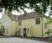
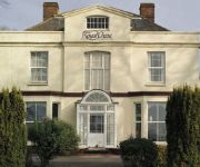
Chetcombe House
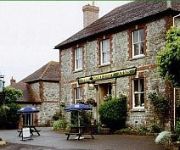
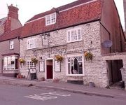
Spread Eagle Inn
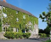
The Somerset Arms
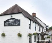
The Bath Arms
George Inn
The Butt of Sherry
Holbrook B&B
BW SHAFTESBURY RYL CHASE HTL
The Grosvenor Arms
Coppleridge Inn
Videos from this area
These are videos related to the place based on their proximity to this place.
A Ride Through Stourton, Wiltshire
Subscribe for the love of bikes: http://www.youtube.com/subscription_center?add_user=wiltshirebyways Please click 'S H O W M O R E' for route info: ↓↓↓↓↓↓↓↓↓ Channel home...
Stourhead autumn colour 2012 - timelapse
At the National Trust's gardens in Stourhead, Wiltshire, autumn colours develop over several weeks as the colours washes through the huge variety of trees which make up the landscape gardens....
A Ride Through Mere in Wiltshire
Subscribe for the love of motorcycles and the great outdoors: http://www.youtube.com/subscription_center?add_user=wiltshirebyways Please click 'S H O W M O R E' for route info: ↓↓↓↓↓↓...
Stourhead House & Gardens, Wiltshire (2)
Sweep of the lake, from the Pantheon to the Grotto. Taken on an iPhone.
Stourhead House & Gardens, Wiltshire (1)
Participants promenading in a Regency event at Stourhead House and Gardens, Wiltshire. (Sorry about the lady waffling on in the background!) Taken on an iPhone.
Panasonic HX-DC2 Test film - Stourhead Gardens
This is a short video taken at Stourhead Gardens using the Panasonic HX-DC2 dual camera. Shot in 1080p at 30fps. Audio left in purposely to demonstrate. Subscribe http://tinyurl.com/thirdrepublic.
Stourton - The Drove (Bridleway, E-W)
Subscribe for the love of motorcycles and the great outdoors: http://www.youtube.com/subscription_center?add_user=wiltshirebyways Please click 'S H O W M O R E' for route info: ↓↓↓↓↓↓...
Dakota III TS436 Crash Memorial near Stourton in Wiltshire
Subscribe for the love of motorcycles and the great outdoors: http://www.youtube.com/subscription_center?add_user=wiltshirebyways Please click 'S H O W M O R E' for route info: ↓↓↓↓↓↓...
Videos provided by Youtube are under the copyright of their owners.
Attractions and noteworthy things
Distances are based on the centre of the city/town and sightseeing location. This list contains brief abstracts about monuments, holiday activities, national parcs, museums, organisations and more from the area as well as interesting facts about the region itself. Where available, you'll find the corresponding homepage. Otherwise the related wikipedia article.
Charnage Down Chalk Pit
Charnage Down Chalk Pit is a 3.7 hectare geological Site of Special Scientific Interest in Wiltshire, England, notified in 1971.
Dead Maid Quarry
Dead Maid Quarry is a 4,400 square metre geological Site of Special Scientific Interest in Wiltshire, England, notified in 1951.
Whitesheet Hill
Whitesheet Hill is a 136.1 hectare biological Site of Special Scientific Interest in Wiltshire, notified in 1965. As one of the most westerly areas of downland in Britain the area is noted for its chalky farmland which contains a rich variety of rare and protected fauna and flora. The hill is also the site of a neolithic causeway camp and barrows; and an Iron Age hill fort. The Roman road which runs along the hill was at one time the main route through the Selwood Forest.
Milton, Dorset
The former town Milton (or Middleton) in Dorset was cleared by the local landowner, Joseph Damer, in the 1770s. This was a result of a fashion amongst English landowners to improve the amenity of their homes by converting surrounding farmland into open parkland. Where buildings were deemed to spoil the view, they were removed, including villages and towns, as in the case of Milton. Damer's former residence, Milton Abbey is now occupied by Milton Abbey School.


