Safety Score: 3,0 of 5.0 based on data from 9 authorites. Meaning we advice caution when travelling to Italy.
Travel warnings are updated daily. Source: Travel Warning Italy. Last Update: 2024-05-05 08:24:42
Delve into Tanas
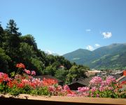
The district Tanas of Traga in Bolzano (Trentino-Alto Adige) with it's 112 habitants Tanas is a district located in Italy about 340 mi north of Rome, the country's capital town.
In need of a room? We compiled a list of available hotels close to the map centre further down the page.
Since you are here already, you might want to pay a visit to some of the following locations: Lasa, Prato Allo Stelvio, Sluderno, Silandro and Glorenza. To further explore this place, just scroll down and browse the available info.
Local weather forecast
Todays Local Weather Conditions & Forecast: 16°C / 60 °F
| Morning Temperature | 8°C / 46 °F |
| Evening Temperature | 14°C / 57 °F |
| Night Temperature | 11°C / 52 °F |
| Chance of rainfall | 0% |
| Air Humidity | 69% |
| Air Pressure | 1013 hPa |
| Wind Speed | Light breeze with 4 km/h (3 mph) from North |
| Cloud Conditions | Broken clouds, covering 61% of sky |
| General Conditions | Light rain |
Monday, 6th of May 2024
15°C (59 °F)
10°C (49 °F)
Light rain, light breeze, overcast clouds.
Tuesday, 7th of May 2024
12°C (54 °F)
9°C (49 °F)
Moderate rain, light breeze, overcast clouds.
Wednesday, 8th of May 2024
12°C (54 °F)
9°C (48 °F)
Light rain, gentle breeze, overcast clouds.
Hotels and Places to Stay
Garden Park Hotel
Zentral Aktiv- und Wellnesshotel
Saldur Small Active Hotel
Engel Hotel
Videos from this area
These are videos related to the place based on their proximity to this place.
Stilfserjoch - Umbrailpass Yamaha MT-07 & MT-09
Visit us on Facebook for more Infos https://www.facebook.com/mtertainment0709 Another part of our 1000km Daytrip through the Alps Have fun and don't forget to subscribe :)
EVERYTHING FLOWS AND NOTHING STANDS STILL
Note: This movie begins without audio. Title TUTTO SCORRE E NULLA RIMANE FIRMO Client Parco Nazionale dello Stelvio, Italy - Aquaprad Visitor Centre. Commissioned by Seledison S.p.A....
Südtiroler Ritterspiele großer Umzug durch Schluderns Gichi Medievali Sluderno
Großer Festumzug durch die Gassen von Schluderns im Rahmen der Südtiroler Ritterspiele am Fuße der Churburg. Gefilmt vom Balkon des Hotels Alte Mühle Schluderns u.a. mit: Gaukler Davide...
BeachvolleyTurnier & Beachfete 2014 - AfterMovie!
"We DANCE. We PLAY. We SHOUT." 48 Stunden "NON-STOP" ////////////////////////////////////////////////////////////////////////////////////////////////// MASHUP GERMANY LIVE ON STAGE //////////////...
Videos provided by Youtube are under the copyright of their owners.
Attractions and noteworthy things
Distances are based on the centre of the city/town and sightseeing location. This list contains brief abstracts about monuments, holiday activities, national parcs, museums, organisations and more from the area as well as interesting facts about the region itself. Where available, you'll find the corresponding homepage. Otherwise the related wikipedia article.
Marienberg Abbey
Marienberg Abbey is a Benedictine abbey in Mals, Vinschgau in South Tyrol, northern Italy. It was founded in 1149 or 1150 by Ulrich von Tarasp and other nobles. It has maintained a long tradition of education and, at 1,340 m, it is Europe’s highest abbey. It retains a Baroque style with Romanesque elements, and has some well-maintained frescos.
Vinschgau
The Vinschgau or Vinschgau Valley is the upper part of the Etsch or Adige river valley, in the western part of the province of South Tyrol, Italy.
Plima
The Plima is a stream in South Tyrol, Italy.
Reschensee
Reschensee or Lake Reschen is an artificial lake in the western portion of South Tyrol, Italy, approximately 2 km south of the Reschen Pass, which forms the border with Austria, and 3 km east of the mountain ridge forming the border with Switzerland. With its capacity of 120 million cubic metres (97,000 ac·ft) it is the largest lake in the province. Its surface area of 6.6 km² makes it also the largest lake above 1,000 m in the Alps.
Suldenbach
The Suldenbach is a stream in South Tyrol, Italy.
Haidersee
The Haidersee is a lake in South Tyrol, Italy, which belongs to the municipality of Graun im Vinschgau.
Vernagt-Stausee
The Vernagt-Stausee is a reservoir in the Schnalstal in South Tyrol, Italy. The water of the reservoir is used to generate electricity at the Etschwerke power station in the village of Naturns.
Hochjoch
The Hochjoch (elevation 2,875 m, 9,432 ft) is a mountain pass in the Ötztal Alps on the border between Tyrol, Austria, and South Tyrol, Italy. Located between the Venter and Schnalser valleys, the Hochjoch is covered by the Hochjoch-Ferner glacier.
Matscher Tal
The Matscher Tal is a side valley of the Vinschgau in South Tyrol, Italy. It is part of the municipality of Mals.
Morter
Morter is a subdivision of the municipality of Latsch in South Tyrol, Italy.
Burgeis
Burgeis is the largest frazione of the commune of Mals and sits at an altitude of 1216m in Vinschgau in South Tyrol beneath the mountain Watles (2557) on the upper reaches of the Adige. The name goes all the way back to a Roman founding, as a fort on the "Via Claudia Augusta", which runs through the village. This fort later gave the name of the Edelfreien von Burgus-Wanga, whose arms the village bears today. Burgeis has 828 inhabitants . It lies 2.5 Kilometer from Mals.
St. Valentin auf der Haide
St. Valentin auf der Haide (Italian: San Valentino alla Muta) is a village in South Tyrol in the parish of Graun im Vinschgau. The village on the Reschen Pass lies at a height of 1,472 metres between the Haidersee and Reschensee on the scree slope of the Mals Heath. St. Valentin auf der Haide has about 800 inhabitants who predominantly earn a living from summer and winter tourism. St. Valentin also has a ski resort, Haideralm, which is part of the Skiparadies Reschenpass. Since 1965 St.


