Safety Score: 2,7 of 5.0 based on data from 9 authorites. Meaning we advice caution when travelling to United States.
Travel warnings are updated daily. Source: Travel Warning United States. Last Update: 2024-04-26 08:02:42
Touring Berkley
Berkley in City of Norfolk (Virginia) is a town located in United States about 148 mi (or 239 km) south of Washington DC, the country's capital place.
Time in Berkley is now 10:20 AM (Friday). The local timezone is named America / New York with an UTC offset of -4 hours. We know of 8 airports nearby Berkley, of which 4 are larger airports. The closest airport in United States is Norfolk International Airport in a distance of 6 mi (or 10 km), North-East. Besides the airports, there are other travel options available (check left side).
There is one Unesco world heritage site nearby. It's Monticello and the University of Virginia in Charlottesville in a distance of 106 mi (or 171 km), North-West. Also, if you like the game of golf, there are several options within driving distance. We collected 6 points of interest near this location. Need some hints on where to stay? We compiled a list of available hotels close to the map centre further down the page.
Being here already, you might want to pay a visit to some of the following locations: Portsmouth, Norfolk, Chesapeake, Hampton and Poquoson. To further explore this place, just scroll down and browse the available info.
Local weather forecast
Todays Local Weather Conditions & Forecast: 15°C / 59 °F
| Morning Temperature | 11°C / 51 °F |
| Evening Temperature | 12°C / 54 °F |
| Night Temperature | 11°C / 52 °F |
| Chance of rainfall | 0% |
| Air Humidity | 62% |
| Air Pressure | 1030 hPa |
| Wind Speed | Moderate breeze with 9 km/h (6 mph) from South-West |
| Cloud Conditions | Broken clouds, covering 80% of sky |
| General Conditions | Broken clouds |
Friday, 26th of April 2024
17°C (62 °F)
14°C (57 °F)
Overcast clouds, gentle breeze.
Saturday, 27th of April 2024
24°C (75 °F)
19°C (67 °F)
Scattered clouds, gentle breeze, broken clouds.
Sunday, 28th of April 2024
28°C (83 °F)
20°C (69 °F)
Broken clouds, gentle breeze.
Hotels and Places to Stay
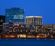
Sheraton Norfolk Waterside Hotel
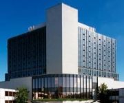
Hilton Norfolk The Main
Renaissance Portsmouth-Norfolk Waterfront Hotel
NORFOLK PLAZA DOWNTOWN
ODYSSEY CORPORATE HOUSING - NORFOLK
Delta Hotels Chesapeake
Norfolk Waterside Marriott
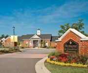
ExecuStay at Belmont Freemason
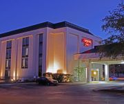
Hampton Inn Norfolk-Chesapeake -Greenbrier Area-
ExecuStay at Belmont Greenbrie
Videos from this area
These are videos related to the place based on their proximity to this place.
Norfolk Southern Coal Train Crosses Drawbridge Norfolk Virginia
This is the Millenniumforce Tour continuing in Norfolk Virginia at the Amtrak train station and a Norfolk Southern coal train heading over the Elizabeth river drawbridge in Norfolk Virginia....
NMCP Holiday Top Ten, December 2014
Join Capt. Darin Via, NMCP commanding officer, as he reveals the "Top Ten Things Not to Do during the Holidays."
Portsmouth and Chesapeake VA Chiropractor - Call 757-337-5205 Chiropractic Care
Call 757-337-5205 for Portsmouth and Chesapeake Chiropractors near Western Branch and Churchland, Virginia. Do you want the best Chiropractic care in Portsmouth or Chesapeake, VA?
Pediatric Residency Program at Naval Medical Center Portsmouth
Naval Medical Center Portsmouth's Pediatric Residency program trains military medicine's future pediatricians in a state of the art training curriculum.
Renaissance Portsmouth-Norfolk Waterfront Hotel
Renaissance Portsmouth-Norfolk Waterfront Hotel 425 Water St, Portsmouth, Virginia 23704 757-673-3000 http://www.marriott.com/hotels/travel/orfpt-renaissance-portsmouth-norfolk-waterfront-hotel/...
The Historic Seaport of Portsmouth Virginia
I'm happy to share my story of Portsmouth Virginia. The gateway to the world is right here in where the land meets the sea. History is rich right here in our background and must be shared...
NEW WRESTLING PROMO JULY 19 2008 NORFOLK LIVE TV TAPING
Pro WRESTLING IS COMING BACK TO NORFOLK, VA! SATURDAY NIGHT JULY 19, 2008 THIS IS A LIVE TV TAPING FOR FOX 43! NORFOLK MASONIC TEMPLE ACROSS FROM GRANBY HIGH ...
PRHA residents take concerns to city council
PRHA residents take concerns to city council | WAVY.com | Portsmouth, Va.
Portsmouth curfew could include 17-year-olds
Portsmouth curfew could include 17-year-olds | WAVY.com | Portsmouth, Va.
Videos provided by Youtube are under the copyright of their owners.
Attractions and noteworthy things
Distances are based on the centre of the city/town and sightseeing location. This list contains brief abstracts about monuments, holiday activities, national parcs, museums, organisations and more from the area as well as interesting facts about the region itself. Where available, you'll find the corresponding homepage. Otherwise the related wikipedia article.
Waterside (Norfolk, Virginia)
The Waterside, a festival marketplace on the Elizabeth River in downtown Norfolk, Virginia, opened June 1, 1983. A critical component of Norfolk's ongoing post-WWII revitalization, the complex connects via a cross-street pedestrian bridge to a parking garage, sits at the foot of the Portsmouth Ferry terminal, and connects via a waterfront promenade to the downtown, the nearby baseball stadium, naval museum and waterfront neighborhood of Freemason Harbor.
Berkley, Virginia
Berkley was an incorporated town in Norfolk County, Virginia. Chartered by an Act of Assembly in 1890, the Town of Berkley was located directly across the eastern branch of the Elizabeth River from the City of Norfolk in the South Hampton Roads area. Berkley featured port facilities and a shipyard.
Berkley Bridge (Virginia)
The Berkley Bridge is a double-leaf bascule bridge across the Eastern Branch of the Elizabeth River in Norfolk, Virginia, United States. It carries Interstate 264, U.S. Route 460 Alternate, and State Route 337 across the river, connecting the Berkley neighborhood south of the river with downtown Norfolk to the north. The toll-free facility is one of only a small number of movable bridges on the Interstate Highway System. At each end af the bridge is a complicated interchange.
Downtown Tunnel
The Downtown Tunnel on Interstate 264 crosses the Southern Branch of the Elizabeth River in the South Hampton Roads area. It links the independent City of Portsmouth with the independent City of Norfolk. In conjunction with the Berkley Bridge, the Downtown Tunnel connects to Interstate 464 to the City of Chesapeake and a continuation I-264 to the downtown and Waterside areas of Norfolk, and on to Virginia Beach.
Basilica of Saint Mary of the Immaculate Conception, Norfolk
For the Basilica in Phoenix, Arizona see Saint Mary's Basilica. For the Basilica in Natchez, Mississippi see St. Mary Basilica. For the Basilica in Galveston, Texas see St. Mary's Cathedral Basilica, Galveston. For the Basilica in Minneapolis, Minnesota see Basilica of Saint Mary. The Minor Basilica of Saint Mary of the Immaculate Conception, located in downtown Norfolk, Virginia is the oldest Roman Catholic parish community in the Diocese of Richmond.
Harbor Park
Harbor Park is a stadium along the Elizabeth River, in downtown Norfolk, Virginia, USA. It has been rated the best minor league stadium by Baseball America. It is primarily used for baseball, and is the home field of the Norfolk Tides minor league baseball team. The Tides are the International League AAA farm team for the Baltimore Orioles. Harbor Park opened on April 14, 1993 and seats 12,067 people.
WNOR
WNOR is a Mainstream Rock formatted broadcast radio station licensed to Norfolk, Virginia, serving Hampton Roads. WNOR is owned and operated by Saga Communications.
Norfolk–Portsmouth Bridge–Tunnel
The Norfolk–Portsmouth Bridge–Tunnel was a project to connect downtown Norfolk, Virginia, United States with downtown Portsmouth via a drawbridge over the Eastern Branch of the Elizabeth River and a tunnel under the Southern Branch. It opened on May 23, 1952, predating the area's better-known bridge–tunnel complexes: the Hampton Roads Bridge–Tunnel, opened in 1957; the Chesapeake Bay Bridge–Tunnel, opened in 1964; and the Monitor–Merrimac Memorial Bridge–Tunnel, opened in 1992.
WJOI
WJOI is an Adult Standards formatted broadcast radio station licensed to Norfolk, Virginia, serving Hampton Roads. WJOI is owned and operated by Saga Communications, Inc.
Civic Plaza (Tide station)
Civic Plaza is a light rail station on the Tide Light Rail line in Norfolk, Virginia, U.S.A. , which opened in August 2011. Civic Plaza Station is situated in downtown Norfolk in the plaza in front of Norfolk City Hall, just east of St. Pauls Boulevard. The station is adjacent to Norfolk City Hall, other city of Norfolk government buildings and just north of the Dominion Tower and Elizabeth River waterfront.
Harbor Park (Tide station)
Harbor Park is a light rail station on the Tide Light Rail line in Norfolk, Virginia, U.S.A. , which opened in August 2011. Harbor Park Station is situated in downtown Norfolk along Park Avenue adjacent to Harbor Park stadium. The light rail station formed the first part of a planned intermodal public transport hub for Norfolk, which is intended to link together bus, light rail, commuter rail and ferry services.
Norfolk (Amtrak station)
The Norfolk Amtrak station is located at 190 Park Avenue in downtown Norfolk, Virginia. It is the terminus of a branch of the Northeast Regional service which begins in Boston. Service began on December 12, 2012. This station will return intercity passenger rail service to Norfolk proper for the first time since 1977 when the Mountaineer ended. The station is adjacent to the Harbor Park baseball stadium along the Elizabeth River on the eastern edge of downtown.


