Avalon
in City of Chesapeake of Virginia, United States

Noteable things around
Location Summary
Decimal Coordinates (Latitude, Longitude):
36.806 and -76.275 (Lat./Lng.)
Coordinates by Time:
N 36° 48' 22" and W -76° 16' 30"
Currency and Currency Code:
Dollar - USD
Spoken languages:
English, Spanish, French
Local electricity:
230 V - 50 Hz (plugs: G)
Mobile phone / cellular frequencies (MHz):
900 MHz, 1800 MHz, 3G, 4G
Local Time: 10:40 PM (Friday)
Timezone: America/New_York
UTC/GMT offset: -10 hours
Sunrise and Sunset:
6:00 am and 8:02 pm
Antipode Coordinates:
-34.226 and 115.057 (Lat./Lng.)
Closest place to antipode coordinates:
Hamelin Bay
References
This place on Wikipedia
This place on Geonames.org
Current travel safety evaluation for United States in Northern America

Safety Score: 2,7 of 5.0 based on data from 9 authorites. Meaning we advice caution when travelling to United States.

Travel warnings are updated daily. Source: Travel Warning United States. Last Update: 2024-05-10 08:04:54

Delve into Avalon

Avalon in City of Chesapeake (Virginia) is a town located in United States about 150 mi (or 242 km) south of Washington DC, the country's capital town.

Time in Avalon is now 10:40 PM (Friday). The local timezone is named America / New York with an UTC offset of -4 hours. We know of 8 airports closer to Avalon, of which 4 are larger airports. The closest airport in United States is Norfolk International Airport in a distance of 7 mi (or 12 km), North-East. Besides the airports, there are other travel options available (check left side).

There is one Unesco world heritage site nearby. It's Monticello and the University of Virginia in Charlottesville in a distance of 108 mi (or 174 km), North-West. Also, if you like the game of golf, there are some options within driving distance. We saw 6 points of interest near this location. In need of a room? We compiled a list of available hotels close to the map centre further down the page.

Since you are here already, you might want to pay a visit to some of the following locations: Chesapeake, Portsmouth, Norfolk, Hampton and Virginia Beach. To further explore this place, just scroll down and browse the available info.

Local weather forecast

Todays Local Weather Conditions & Forecast: 15°C / 60 °F

Morning Temperature 13°C / 56 °F
Evening Temperature 16°C / 61 °F
Night Temperature 14°C / 56 °F
Chance of rainfall 1%
Air Humidity 57%
Air Pressure 1010 hPa
Wind Speed Moderate breeze with 10 km/h (6 mph) from South
Cloud Conditions Overcast clouds, covering 94% of sky
General Conditions Light rain

Saturday, 11th of May 2024

22°C (71 °F)
16°C (60 °F)
Few clouds, moderate breeze.

Sunday, 12th of May 2024

23°C (74 °F)
17°C (63 °F)
Sky is clear, gentle breeze, clear sky.

Monday, 13th of May 2024

21°C (70 °F)
19°C (66 °F)
Light rain, gentle breeze, overcast clouds.

Hotels and Places to Stay

Norfolk Waterside Marriott

Address
2,9 mi
235 E Main Street
23510 Norfolk
United States

Time Information

Checkout: 11:00 - Checkin: 16:00
Reception
Weekday: -
Weekend: closed


Hilton Norfolk The Main

Address
2,9 mi
100 Main Street
23510 Norfolk
United States

Time Information

Checkout: 11:00 - Checkin: 16:00
Reception
Weekday: -
Weekend: closed


Renaissance Portsmouth-Norfolk Waterfront Hotel

Address
2,4 mi
425 Water St
23704 Portsmouth
United States

Time Information

Checkout: 12:00 - Checkin: 16:00
Reception
Weekday: -
Weekend: closed


Aloft Chesapeake

Address
2,6 mi
1454 CROSSWAYS BLVD
23320 Chesapeake
United States

Time Information

Checkout: 12:00 - Checkin: 15:00
Reception
Weekday: -
Weekend: closed


Sheraton Norfolk Waterside Hotel

Address
2,7 mi
777 WATERSIDE DRIVE
23510 Norfolk
United States

Time Information

Checkout: 11:00 - Checkin: 16:00
Reception
Weekday: -
Weekend: closed


Delta Hotels Chesapeake

Address
2,5 mi
725 Woodlake Drive
23320 Chesapeake
United States

Time Information

Checkout: 11:00 - Checkin: 16:00
Reception
Weekday: -
Weekend: closed


SpringHill Suites Chesapeake Greenbrier

Address
2,6 mi
1446 Crossways Boulevard
23320 Chesapeake
United States

Time Information

Checkout: 12:00 - Checkin: 15:00
Reception
Weekday: -
Weekend: closed


Residence Inn Chesapeake Greenbrier

Address
2,7 mi
1500 Crossways Blvd.
23320 Chesapeake
United States

Time Information

Checkout: 12:00 - Checkin: 15:00
Reception
Weekday: -
Weekend: closed


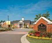
ExecuStay at Belmont Greenbrie

Address
2,1 mi
1212 TRIPLE CROWN CIRCLE
23320 CHESAPEAKE
United States

Time Information

Checkout: - Checkin: 15:30
Reception
Weekday: -
Weekend: closed


The Mermaids' Porch Bed and Breakfast

Address
2,7 mi
497 North Street
23704 Portsmouth
United States

Time Information

Checkout: 11:00 - Checkin: 15:00
Reception
Weekday: -
Weekend: closed


Videos from this area

These are videos related to the place based on their proximity to this place.

Chesapeake Bay Academy

Published: March 22, 2012
Length: 07:52 min
Rating: 5 of 5
Author: wavy

Chesapeake Bay Academy.


Fashion Forward: Travel Accessories

Published: January 31, 2012
Length: 01:31 min
Rating: 0 of 5
Author: wvbt

Fashion Forward: Travel Accessories.


Crab Pot Pies

Published: November 11, 2010
Length: 41:55 min
Rating: 5 of 5
Author: wvbt

Crab Pot Pies.


Hurricane evacuation routes - 5 pm

Published: August 24, 2011
Length: 36:27 min
Rating: 0 of 5
Author: wavy

Hurricane evacuation routes - 5 pm.


Phish - Fishman Tucks For Sleeping Monkey - nTelos Pavilion, Portsmouth, VA

Published: June 21, 2012
Length: 26:08 min
Rating: 0 of 5
Author: Nate Anderson

Jon Fishman tucks and comes out front to sing a lil Sleeping Monkey.


Norfolk - Petersburg VA trip for TVRM Steam Engine #630

Published: March 31, 2013
Length: 02:58 min
Rating: 5 of 5
Author: vbbilling

TVRM Engine #630 on trip from Norfolk to Petersburg, VA on March 23, 2013. Train is just a few minutes from the station in Norfolk and is passing under the 22nd St bridge in South Norfolk.


Holiday tipping and gift etiquette

Published: December 16, 2011
Length: 26:18 min
Rating: 1 of 5
Author: wavy

Holiday tipping and gift etiquette.


Holiday Craft Fair

Published: November 10, 2009
Length: 33:52 min
Rating: 0 of 5
Author: wvbt

Holiday Craft Fair.


Creme Brulee & Holiday Drinks

Published: November 24, 2010
Length: 51:54 min
Rating: 0 of 5
Author: wvbt

Creme Brulee & Holiday Drinks.


nicks picks -- holiday traditions

Published: December 23, 2009
Length: 39:34 min
Rating: 0 of 5
Author: wvbt

nicks picks -- holiday traditions.


Videos provided by Youtube are under the copyright of their owners.

Attractions and noteworthy things

Distances are based on the centre of the city/town and sightseeing location. This list contains brief abstracts about monuments, holiday activities, national parcs, museums, organisations and more from the area as well as interesting facts about the region itself. Where available, you'll find the corresponding homepage. Otherwise the related wikipedia article.

South Norfolk, Virginia

South Norfolk was an independent city in the South Hampton Roads region of eastern Virginia and is now a section of the city of Chesapeake, one of the cities of Hampton Roads which surround the harbor of Hampton Roads and are linked by the Hampton Roads Beltway.

Located at 36.7941, -76.273 (Lat. / Lng.), about 1 miles away.
Wikipedia Article
Boroughs of Chesapeake, Virginia, Chesapeake, Virginia communities, Former municipalities in Virginia, Lost cities and towns

WPTE

WPTE is a Hot Adult Contemporary formatted broadcast radio station licensed to Virginia Beach, Virginia, serving Hampton Roads. WPTE is owned and operated by Entercom Communications.

Located at 36.8103, -76.2831 (Lat. / Lng.), about 1 miles away.
Wikipedia Article, Homepage
Radio stations in the Hampton Roads-Tidewater area, Adult top 40 radio stations in the United States, Radio stations established in 1984

Jordan Bridge

Jordan Bridge was a tolled highway lift bridge which carried State Route 337 over the southern branch of the Elizabeth River from the City of Portsmouth into the City of Chesapeake in South Hampton Roads, Virginia. Opened in 1928, it was privately built by an organization led by South Norfolk businessmen Wallace and Carl Jordan. It was later renamed the Jordan Bridge, principally to honor long-standing manager Carl M. Jordan.

Located at 36.8084, -76.2901 (Lat. / Lng.), about 1 miles away.
Wikipedia Article
Intracoastal Waterway, Toll bridges in Virginia, Bridges completed in 1928, Vertical lift bridges, Bridges in Chesapeake, Virginia, Road bridges in Virginia

WHKT

WHKT is a conservative (or right-leaning) News/Talk/Sports broadcast radio station, licensed to Portsmouth, Virginia serving the Hampton Roads market. WHKT is owned by Chesapeake-Portsmouth Broadcasting Corporation.

Located at 36.8028, -76.2828 (Lat. / Lng.), about 0 miles away.
Wikipedia Article, Homepage
Radio stations in the Hampton Roads-Tidewater area, Portsmouth, Virginia, Radio stations established in 1999

WCPK

WCPK is a Gospel formatted broadcast radio station licensed to Chesapeake, Virginia, serving the Southside of Hampton Roads in Virginia. WCPK is owned and operated by Christian Broadcasting of Chesapeake.

Located at 36.8028, -76.2828 (Lat. / Lng.), about 0 miles away.
Wikipedia Article
Radio stations in Virginia, Gospel radio stations in the United States, Christian radio stations in the United States, Radio stations established in 1967, 1967 establishments in the United States

Southern Branch Elizabeth River

The Southern Branch Elizabeth River is a 14.5-mile-long, primarily tidal river in the U.S. state of Virginia. It flows from south to north through the city of Chesapeake and forms the boundary between the cities of Portsmouth and Chesapeake for its northernmost 3 miles . It is a tributary of the Elizabeth River, connecting to the harbor of Hampton Roads to the north.

Located at 36.8094, -76.29 (Lat. / Lng.), about 1 miles away.
Wikipedia Article
Rivers of Virginia

Avalon, Virginia

Avalon is an unincorporated community in Northumberland County, in the U.S. state of Virginia.

Located at 36.8043, -76.2709 (Lat. / Lng.), about 0 miles away.
Wikipedia Article
Unincorporated communities in Virginia, Populated places in Northumberland County, Virginia

WMOV-FM

WMOV-FM is a broadcast radio station licensed to Norfolk, Virginia, serving Hampton Roads. WMOV-FM is owned and operated by Clear Channel Communications.

Located at 36.8103, -76.283 (Lat. / Lng.), about 1 miles away.
Wikipedia Article, Homepage
Radio stations in the Hampton Roads-Tidewater area, Radio stations in Virginia, Rhythmic adult contemporary radio stations, Clear Channel radio stations, Radio stations established in 1990

capture of the webcam Norfolk › South-East: Fred Heutte Center - Friends of Fred Heutte Foundation

Norfolk › South-East: Fred Heutte Center - Friends of Fred Heutte Foundation, Norfolk (source)

Webcams provided by webcam.travel are under the copyright of their owners.