Safety Score: 2,7 of 5.0 based on data from 9 authorites. Meaning we advice caution when travelling to United States.
Travel warnings are updated daily. Source: Travel Warning United States. Last Update: 2024-04-23 08:18:23
Delve into Campostella
Campostella in City of Norfolk (Virginia) is located in United States about 149 mi (or 240 km) south of Washington DC, the country's capital town.
Current time in Campostella is now 10:37 PM (Tuesday). The local timezone is named America / New York with an UTC offset of -4 hours. We know of 8 airports close to Campostella, of which 4 are larger airports. The closest airport in United States is Norfolk International Airport in a distance of 5 mi (or 9 km), North-East. Besides the airports, there are other travel options available (check left side).
There is one Unesco world heritage site nearby. It's Monticello and the University of Virginia in Charlottesville in a distance of 107 mi (or 173 km), North-West. Also, if you like playing golf, there are some options within driving distance. We encountered 6 points of interest near this location. If you need a hotel, we compiled a list of available hotels close to the map centre further down the page.
While being here, you might want to pay a visit to some of the following locations: Chesapeake, Norfolk, Portsmouth, Hampton and Virginia Beach. To further explore this place, just scroll down and browse the available info.
Local weather forecast
Todays Local Weather Conditions & Forecast: 16°C / 61 °F
| Morning Temperature | 12°C / 54 °F |
| Evening Temperature | 19°C / 67 °F |
| Night Temperature | 16°C / 62 °F |
| Chance of rainfall | 0% |
| Air Humidity | 71% |
| Air Pressure | 1017 hPa |
| Wind Speed | Moderate breeze with 11 km/h (7 mph) from South |
| Cloud Conditions | Overcast clouds, covering 100% of sky |
| General Conditions | Light rain |
Wednesday, 24th of April 2024
13°C (56 °F)
8°C (47 °F)
Light rain, moderate breeze, broken clouds.
Thursday, 25th of April 2024
15°C (60 °F)
10°C (51 °F)
Broken clouds, gentle breeze.
Friday, 26th of April 2024
15°C (59 °F)
16°C (60 °F)
Overcast clouds, gentle breeze.
Hotels and Places to Stay
Sheraton Norfolk Waterside Hotel
Norfolk Waterside Marriott
Hilton Norfolk The Main
NORFOLK PLAZA DOWNTOWN
Renaissance Portsmouth-Norfolk Waterfront Hotel
ODYSSEY CORPORATE HOUSING - NORFOLK
Delta Hotels Chesapeake
Courtyard Norfolk Downtown
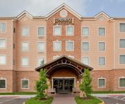
Staybridge Suites CHESAPEAKE - VIRGINIA BEACH
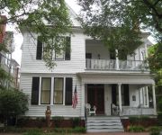
The Mermaids' Porch Bed and Breakfast
Videos from this area
These are videos related to the place based on their proximity to this place.
BETHUNE COOKMAN UNIVERSITY MARCHING WILDCATS CRANK IT UP AT NORFOLK STATE 2014
BCU strikes the stadium with a stand tune and it goes surround sound! Hail those wildcats.
Take A Ride On The Tide Rail Commuter Train Norfolk Virginia
This is a video I made in Norfolk Virginia on April 8, 2014 on my Millenniumforce Tour up to the Northeast. Here in Norfolk Virginia we take a ride on the Tide. The Tidewater of Virginia...
The Tide Commuter Train Railroad Crossing Norfolk Virginia
This is a video I made on my Millenniumforce Tour in Norfolk Virginia of the rail commuter line named The Tide.
Norfolk - Petersburg VA trip for TVRM Steam Engine #630
TVRM Engine #630 on trip from Norfolk to Petersburg, VA on March 23, 2013. Train is just a few minutes from the station in Norfolk and is passing under the 22nd St bridge in South Norfolk.
Videos provided by Youtube are under the copyright of their owners.
Attractions and noteworthy things
Distances are based on the centre of the city/town and sightseeing location. This list contains brief abstracts about monuments, holiday activities, national parcs, museums, organisations and more from the area as well as interesting facts about the region itself. Where available, you'll find the corresponding homepage. Otherwise the related wikipedia article.
WWDE-FM
WWDE-FM is a Light Adult Contemporary formatted broadcast radio station licensed to Hampton, Virginia, serving Hampton Roads. WWDE-FM is owned and operated by Entercom Communications.
WNOR
WNOR is a Mainstream Rock formatted broadcast radio station licensed to Norfolk, Virginia, serving Hampton Roads. WNOR is owned and operated by Saga Communications.
WYFI
WYFI is a Religious formatted broadcast radio station licensed to Norfolk, Virginia, serving Hampton Roads. WYFI is owned and operated by Bible Broadcasting Network.
WJOI
WJOI is an Adult Standards formatted broadcast radio station licensed to Norfolk, Virginia, serving Hampton Roads. WJOI is owned and operated by Saga Communications, Inc.
Norfolk Assembly
Norfolk Assembly was a Ford manufacturing plant that opened on April 20, 1925 on the Elizabeth River, near downtown Norfolk, Virginia. Modeled after the River Rouge Plant, the facility eventually including a power house, water treatment plant, barber shop, safety-shoe store, restaurant, fitness center and TV studio.
Eastern Branch Elizabeth River
The Eastern Branch Elizabeth River is a 9.0-mile-long tidal river in the Hampton Roads area of the U.S. state of Virginia. The river flows from east to west, starting in Virginia Beach. At its crossing by Interstate 64 it becomes the boundary between Virginia Beach and the city of Norfolk, and farther west it is the boundary between Norfolk and the city of Chesapeake. For its final 3 miles it is entirely within the city of Norfolk.
NSU (Tide station)
NSU is a light rail station on the Tide Light Rail line in Norfolk, Virginia, U.S.A. , which opened in August 2011. NSU Station is situated adjacent to Norfolk State University just west of Brambleton Avenue. NSU Station is the only Tide station that is elevated, and is accessible by stairs and elevator.
Ballentine / Broad Creek (Tide station)
Ballentine / Broad Creek is a light rail station on the Tide Light Rail line in Norfolk, Virginia, U.S.A. , which opened in August 2011. Ballentine / Broad Creek is situated just west of Ballentine Boulevard. The station is adjacent to the east end of Norfolk State University and several residential neighborhoods.
Marty L. Miller Field
Marty L. Miller Field is a baseball venue in Norfolk, Virginia, United States. It is home to the Norfolk State Spartans baseball team of the NCAA Division I Mid-Eastern Athletic Conference. The venue is named for former Norfolk State baseball coach Marty Miller. Built in 1997, it has a capacity of 1,500 spectators.


