Safety Score: 3,0 of 5.0 based on data from 9 authorites. Meaning we advice caution when travelling to United Kingdom.
Travel warnings are updated daily. Source: Travel Warning United Kingdom. Last Update: 2024-04-28 08:22:10
Discover Varteg Hill
Varteg Hill in Torfaen County Borough (Wales) is a city in United Kingdom about 127 mi (or 205 km) west of London, the country's capital city.
Local time in Varteg Hill is now 05:29 AM (Monday). The local timezone is named Europe / London with an UTC offset of one hour. We know of 10 airports in the vicinity of Varteg Hill, of which 5 are larger airports. The closest airport in United Kingdom is Bristol Filton Airport in a distance of 26 mi (or 42 km), South-East. Besides the airports, there are other travel options available (check left side).
There are several Unesco world heritage sites nearby. The closest heritage site in United Kingdom is Blaenavon Industrial Landscape in a distance of 7 mi (or 11 km), East. Also, if you like golfing, there are a few options in driving distance. Looking for a place to stay? we compiled a list of available hotels close to the map centre further down the page.
When in this area, you might want to pay a visit to some of the following locations: Pontypool, New Inn, Crumlin, Newbridge and Cwm. To further explore this place, just scroll down and browse the available info.
Local weather forecast
Todays Local Weather Conditions & Forecast: 9°C / 48 °F
| Morning Temperature | 6°C / 43 °F |
| Evening Temperature | 8°C / 47 °F |
| Night Temperature | 8°C / 47 °F |
| Chance of rainfall | 9% |
| Air Humidity | 91% |
| Air Pressure | 1012 hPa |
| Wind Speed | Fresh Breeze with 16 km/h (10 mph) from North |
| Cloud Conditions | Overcast clouds, covering 100% of sky |
| General Conditions | Moderate rain |
Tuesday, 30th of April 2024
11°C (52 °F)
7°C (44 °F)
Moderate rain, fresh breeze, overcast clouds.
Wednesday, 1st of May 2024
10°C (51 °F)
7°C (45 °F)
Moderate rain, gentle breeze, overcast clouds.
Thursday, 2nd of May 2024
10°C (50 °F)
7°C (44 °F)
Light rain, light breeze, overcast clouds.
Hotels and Places to Stay
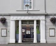
The Angel Hotel Abergavenny
BW PONTYPOOL METRO HOTEL
Pontypool
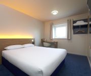
TRAVELODGE PONTYPOOL
Cwmbran
Videos from this area
These are videos related to the place based on their proximity to this place.
Don't Starve in the Country - what to eat if you get lost
The bounty of nature. Things you can eat if you are lost in the countryside. If you are very desperate. Eat the world! Some of it anyway.
daric books promo
Promotional trailer for Daric Books, a Pontypool/Wales based publisher of science fiction and fantasy.
Sheep Collision
Hitting a sheep on a mountain bike at full tilt. No sheep were harmed in the making of this movie (although the rider suffered scrapes and bruises... That'll be me then...) Filmed 25 June...
Blaenavon heritage railway
Blaenavon Heritage Railway is a visitor attraction run on a charitable basis by a dedicated team of volunteers who give up their free-time to keep a piece of living history alive. Running...
Darren Graceland Jones - See See Rider
Elvis Tribute Double Bill: Darren Jones + Ricky Rivers Recorded at Blaenavon Workman's Hall.
Videos provided by Youtube are under the copyright of their owners.
Attractions and noteworthy things
Distances are based on the centre of the city/town and sightseeing location. This list contains brief abstracts about monuments, holiday activities, national parcs, museums, organisations and more from the area as well as interesting facts about the region itself. Where available, you'll find the corresponding homepage. Otherwise the related wikipedia article.
Varteg
Varteg (Welsh: Farteg or Y Farteg) is a village in the county borough of Torfaen in Wales.
Snatchwood
Snatchwood is a small, predominantly working class suburb to the north of Pontypool, Torfaen in Wales. It is situated between Abersychan and Pontnewynydd (not to be confused with Pontnewydd, a suburb of nearby Cwmbran).
Talywain
Talywain is situated between Garndiffaith, Abersychan and Pentwyn in Torfaen in south east Wales, within the historic boundaries of Monmouthshire.
Abersychan and Talywain railway station
Abersychan and Talywain railway station served the west of Abersychan village in the Welsh county of Monmouthshire. The station was the meeting point for two major pre-grouping railways as they competed for the South Wales coal traffic.
Abersychan Low Level railway station
Abersychan Low Level railway station served the centre of Abersychan village in the Welsh county of Monmouthshire. It was located near the junction of the A4043 and the B4246 at the eastern end of the village.
Varteg railway station
Varteg railway station was a railway station which served the village of Varteg, in the county of Monmouthshire, on the Brynmawr and Blaenavon Railway. Built by the London and North Western Railway (LNWR) as an expansion to meet the Great Western Railway (GWR) at Abersychan and Talywain. It was sometimes referred to on old Ordnance Survey and British Railway Clearing House (RCH) as 'Varteg Halt', despite it having an extensive station building.
Garndiffaith Viaduct
Garndiffaith Viaduct is a brickwork railway viaduct that formerly carried the Brynmawr and Blaenavon Railway over the valley at Abersychan in South Wales. It was built by the engineer John Gardiner between 1871 and 1874 to extend the London and North Western Railway line that principally carried coal from Brynmawr and Blaenavon to meet the Great Western Railway at Abersychan and Talywain.
Pontnewynydd Primary School
Pontnewynydd Primary School is located in Pontnewynydd, Wales and is situated close to the settlements of Pontnewynydd, Abersychan, Trevethin and Pontypool. It was opened in 1903 in a large, imposing building which was built in 1901. Its motto is Only the Best is Good Enough. The school's catchment area is deprived and in 2005, 51% of the pupils received free school dinners as compared with the national average of 20%.


