Safety Score: 3,0 of 5.0 based on data from 9 authorites. Meaning we advice caution when travelling to United Kingdom.
Travel warnings are updated daily. Source: Travel Warning United Kingdom. Last Update: 2024-04-28 08:22:10
Discover Pont Newydd
Pont Newydd in Monmouthshire (Wales) is a city in United Kingdom about 128 mi (or 207 km) west of London, the country's capital city.
Local time in Pont Newydd is now 12:22 PM (Sunday). The local timezone is named Europe / London with an UTC offset of one hour. We know of 11 airports in the vicinity of Pont Newydd, of which 5 are larger airports. The closest airport in United Kingdom is Bristol Filton Airport in a distance of 31 mi (or 51 km), South-East. Besides the airports, there are other travel options available (check left side).
There are several Unesco world heritage sites nearby. The closest heritage site in United Kingdom is Blaenavon Industrial Landscape in a distance of 9 mi (or 15 km), South-East. Also, if you like golfing, there are a few options in driving distance. Looking for a place to stay? we compiled a list of available hotels close to the map centre further down the page.
When in this area, you might want to pay a visit to some of the following locations: Longtown, Llanveynoe, Brynmawr, Llancillo and Rowlstone. To further explore this place, just scroll down and browse the available info.
Local weather forecast
Todays Local Weather Conditions & Forecast: 11°C / 52 °F
| Morning Temperature | 3°C / 38 °F |
| Evening Temperature | 8°C / 47 °F |
| Night Temperature | 3°C / 37 °F |
| Chance of rainfall | 2% |
| Air Humidity | 61% |
| Air Pressure | 1006 hPa |
| Wind Speed | Moderate breeze with 10 km/h (6 mph) from East |
| Cloud Conditions | Overcast clouds, covering 100% of sky |
| General Conditions | Light rain |
Monday, 29th of April 2024
11°C (52 °F)
9°C (48 °F)
Moderate rain, fresh breeze, overcast clouds.
Tuesday, 30th of April 2024
13°C (55 °F)
9°C (48 °F)
Moderate rain, fresh breeze, overcast clouds.
Wednesday, 1st of May 2024
10°C (51 °F)
10°C (51 °F)
Light rain, light breeze, overcast clouds.
Hotels and Places to Stay
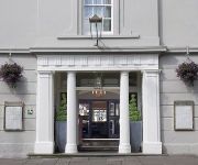
The Angel Hotel Abergavenny
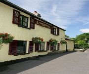
Dragon Inn Crickhowell
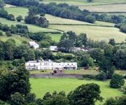
Llanwenarth Hotel
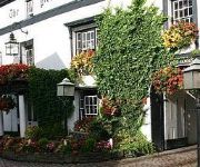
Bear Crickhowell
Manor
Videos from this area
These are videos related to the place based on their proximity to this place.
Abergavenny Livestock market, June 2012
Wednesday's are a busy day in Abergavenny at the Livestock market, located in the heart of the town.
Paragliding above Abergavenny.
Me with friends, Mark and Martin, enjoying a fly after work above Abergavenny South Wales UK. 30/04/2013 Better than being behind that desk!
Starlings over Abergavenny
These starlings were doing their amazing flying display 'murmuration' over Bailey Park as I walked to town.
A Ride Through Abergavenny in Monmouthshire
Subscribe for the love of motorcycles and the great outdoors: http://www.youtube.com/subscription_center?add_user=wiltshirebyways Please click 'S H O W M O R E' for route info: ↓↓↓↓↓↓...
Abergavenny's Best Bits from 2010 Onwards! Part 1
This video celebrates my 4 year anniversary for my youtube account! Most clips were recorded at Abergavenny Station but some were recorded from the Old Station at Penpergwm. This includes best...
Abergavenny fireworks extravaganza clip 2011
A clip from the November 5th Abergavenny Round Table Fireworks extravaganza 2011.
Vintage Steam Fair Abergavenny Wales 2009
The Rotary International Club of Abergavenny organise the annual Vintage Steam Rally. This video looks at the Steam Engines but there are also old and vintage cars, tractors, motor bikes,...
Abergavenny BCC 2010
End of the day and I was going for a top to bottom when I pick up a thermal above the grave yard. No drift, but when I got back up to above launch I went on glide to pick up a few points for...
Club Practice (Abergavenny) - Tai-otoshi_2
Thought we'd have a go at video analysis of a technique. These are our tai-otoshi efforts.
Videos provided by Youtube are under the copyright of their owners.
Attractions and noteworthy things
Distances are based on the centre of the city/town and sightseeing location. This list contains brief abstracts about monuments, holiday activities, national parcs, museums, organisations and more from the area as well as interesting facts about the region itself. Where available, you'll find the corresponding homepage. Otherwise the related wikipedia article.
Sugar Loaf, Monmouthshire
Sugar Loaf, sometimes called The Sugar Loaf (Welsh: Mynydd Pen-y-Fal or Y Fâl), is a mountain situated 2 miles north-west of Abergavenny in Monmouthshire, Wales. It is the southernmost of the summit peaks of the Black Mountains, with a height of 1,955 feet (596 metres).
Gilwern
Gilwern is a village in Monmouthshire, Wales. The name is translated from the Welsh language as "the nook near the alder grove". It is within the Llanelly parish ward of Monmouthshire County Council, 4 miles west of market town of Abergavenny.
Y Graig
Y Graig, three miles west of Abergavenny, is the site of an abandoned settlement, known to have been occupied in the 18th and 19th centuries. It is a Scheduled Ancient Monument in the care of Cadw.
Partrishow
Partrishow, also known as Patricio or Patrishow, is a small village in the Black Mountains of South Wales, within the Brecon Beacons National Park.
Llangenny
Llangenny is a small hamlet in the Brecon Beacons National Park in southern Powys, Wales. Llangenny has approximately 100 inhabitants and is a village in the Vale of Grwyney, the lower reaches of the Grwyne Fawr, which comprises Llangenny, Glangrwyney and Llanbedr. The two main features of Llangenny are the parish church of St. Cenau or Saint Keyne, a public house (the Dragons Head Inn) and Cwm Barn, an old barn converted into accommodation.
Llanbedr, Crickhowell
Llanbedr is a small village 2 miles northeast of Crickhowell in the county of Powys in south Wales. It lies above the river known as the Grwyne Fechan just above its confluence with the Grwyne Fawr in the southern reaches of the Black Mountains range. The village lies within the shadow of Table Mountain, an outlying spur of Pen Cerrig-calch on which is perched the Iron Age hillfort of Crug Hywel.
Crug Mawr
Crug Mawr is a hill in the Black Mountains in the Brecon Beacons National Park in southern Powys, Wales. Its summit at a height of 550m (1,805ft) is marked by a trig point. The peak sits high above the valleys of the Grwyne Fawr and Grwyne Fechan to the north of the more well-known Sugar Loaf. The views from here across the Black Mountains are wide ranging and also extend eastwards across Monmouthshire.
Coed-y-Cerrig National Nature Reserve
In the shadow of the Black Mountains, Coed-y-Cerrig National Nature Reserve is located at the bottom of a deep valley, about six km north of Abergavenny and three km west of Llanfihangel Crucorney. Despite its small size, the reserve has a variety of wet and dry woodland habitats, making it rich in wildlife. Its moist valley floor is covered by an unusual type of alder woodland, and is alive with fungi in autumn.


